Aylesham elevation
Aylesham (England, Kent), United Kingdom elevation is 77 meters and Aylesham elevation in feet is 253 ft above sea level [src 1]. Aylesham is a populated place (feature code) with elevation that is 5 meters (16 ft) bigger than average city elevation in United Kingdom.
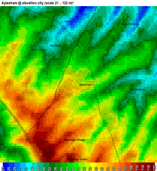
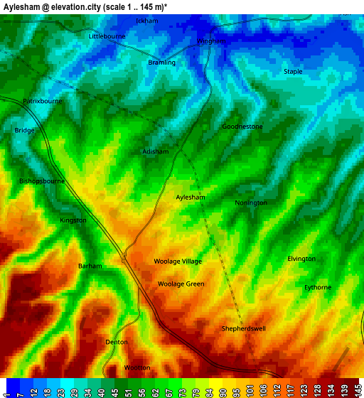
Below is the Elevation map of Aylesham, which displays elevation range with different colors. Scale of the first map is from 21 to 122 m (69 to 400 ft) with average elevation of 69.3 meters (=227 ft) [note 1]
These maps also provides idea of topography and contour of this city, they are displayed at different zoom levels. More info about maps, scale and edge coordinates you can find below images.
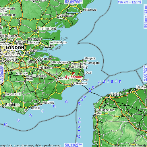
| \ | Map #1 | Map #2 | Topo.Map |
| Scale [m] | 21..122 m | 1..145 m | × |
| Scale [ft] | 69..400 ft | 3..476 ft | × |
| Average | 69.3 m = 227 ft | 66.2 m = 217 ft | × |
| Width | 6.12 km = 3.8 mi | 12.24 km = 7.6 mi | 195.8 km = 121.7 mi |
| Height | 6.12 km = 3.8 mi | 12.24 km = 7.6 mi | 195.8 km = 121.7 mi |
| ↑Max Latitude | 51.252903° | 51.280399° | 52.09766° |
| Latitude at center | 51.22539° | 51.22539° | 51.22539° |
| ↓Min Latitude | 51.197861° | 51.170315° | 50.33627° |
| ← Min Longitude | 1.157625° | 1.113679° | -0.20468° |
| Longitude center | 1.20157° | 1.20157° | 1.20157° |
| →Max Longitude | 1.245515° | 1.289461° | 2.60782° |
Nearby cities:
Cities around Aylesham sort by population:
• Canterbury elevation 19 m
10.4 km,  305°
305°
• Sturry 13 m
10.1 km,  326°
326°
• Sandwich 3 m
10.8 km,  61°
61°
• Wootton 132 m
5.9 km,  195°
195°
• Ash 22 m
8.1 km,  42°
42°
• Eastry 26 m
7.8 km,  72°
72°
• Shepherdswell 93 m
4.7 km,  154°
154°
• Bridge 27 m
5.7 km,  292°
292°
• Littlebourne 14 m
6 km,  336°
336°
• Eythorne 73 m
5.5 km,  124°
124°
• Wingham 11 m
5.2 km,  10°
10°
• Barham 53 m
3.8 km,  234°
234°
Multilingual:
 En español:
Aylesham elevación 77 m.
 En France:
Aylesham élévation 77 m.


Sources and notes:
- [note 1] Map square and city borders are not equal. Map elevation data is calculated only from area inside that square.
- [src 1] Elevation data from geonames database provided with same terms of usage.
- [src 2] The elevation map of Aylesham is generated using elevation data from NASA's 3 arcsec (90m) resolution SRTM data.
- [src 3] Base (background) map © OpenStreetMap contributors tiles are generated by Geofabrik and OpenTopoMap.
Copyright & License:
This Aylesham Elevation Map is licensed under CC BY-SA. You may reuse any part from this page, if you give a proper credit by linking to this URL:
 More info on terms of use page.