Blackheath elevation
Blackheath (England, Greater London), United Kingdom elevation is 33 meters and Blackheath elevation in feet is 108 ft above sea level [src 1]. Blackheath is a populated place (feature code) with elevation that is 39 meters (128 ft) smaller than average city elevation in United Kingdom.
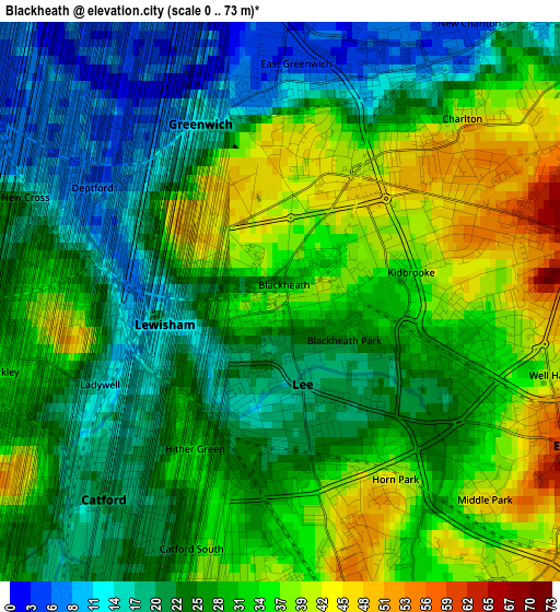
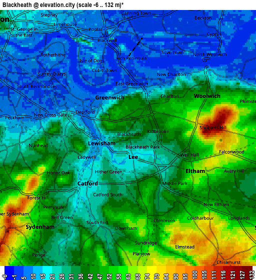
Below is the Elevation map of Blackheath, which displays elevation range with different colors. Scale of the first map is from 0 to 73 m (0 to 240 ft) with average elevation of 27.8 meters (=91 ft) [note 1]
These maps also provides idea of topography and contour of this city, they are displayed at different zoom levels. More info about maps, scale and edge coordinates you can find below images.
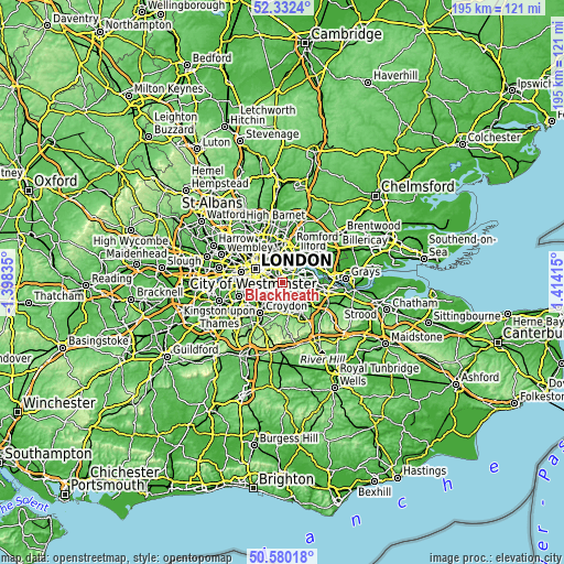
| \ | Map #1 | Map #2 | Topo.Map |
| Scale [m] | 0..73 m | -6..132 m | × |
| Scale [ft] | 0..240 ft | -20..433 ft | × |
| Average | 27.8 m = 91 ft | 33.3 m = 109 ft | × |
| Width | 6.09 km = 3.8 mi | 12.18 km = 7.6 mi | 194.8 km = 121 mi |
| Height | 6.09 km = 3.8 mi | 12.18 km = 7.6 mi | 194.8 km = 121 mi |
| ↑Max Latitude | 51.49207° | 51.519423° | 52.3324° |
| Latitude at center | 51.4647° | 51.4647° | 51.4647° |
| ↓Min Latitude | 51.437314° | 51.409912° | 50.58018° |
| ← Min Longitude | -0.036045° | -0.079991° | -1.39835° |
| Longitude center | 0.0079° | 0.0079° | 0.0079° |
| →Max Longitude | 0.051845° | 0.095791° | 1.41415° |
Nearby cities:
Cities around Blackheath sort by population:
• Beckenham elevation 45 m
6.6 km,  200°
200°
• Canary Wharf 32 m
4.9 km,  336°
336°
• Peckham 9 m
5.5 km,  280°
280°
• Welling 47 m
6.9 km,  92°
92°
• Chislehurst 86 m
6.8 km,  141°
141°
• Abbey Wood 9 m
7.3 km,  70°
70°
• Shortlands 56 m
7.3 km,  181°
181°
• Camberwell 8 m
7.1 km, 278°
• Bromley 72 m
6.5 km, 175°
• Poplar 7 m
5.4 km, 342°
• Woolwich 20 m
4.9 km,  53°
53°
• Catford 22 m
2.9 km,  221°
221°
Multilingual:
 En español:
Blackheath elevación 33 m.
 En France:
Blackheath élévation 33 m.
 Auf Deutsch:
Blackheath höhe über dem Meeresspiegel ist 33 m.

Sources and notes:
- [note 1] Map square and city borders are not equal. Map elevation data is calculated only from area inside that square.
- [src 1] Elevation data from geonames database provided with same terms of usage.
- [src 2] The elevation map of Blackheath is generated using elevation data from NASA's 3 arcsec (90m) resolution SRTM data.
- [src 3] Base (background) map © OpenStreetMap contributors tiles are generated by Geofabrik and OpenTopoMap.
Copyright & License:
This Blackheath Elevation Map is licensed under CC BY-SA. You may reuse any part from this page, if you give a proper credit by linking to this URL:
 More info on terms of use page.