Hainault elevation
Hainault (England, Greater London), United Kingdom elevation is 44 meters and Hainault elevation in feet is 144 ft above sea level [src 1]. Hainault is a section of populated place (feature code) with elevation that is 28 meters (92 ft) smaller than average city elevation in United Kingdom.
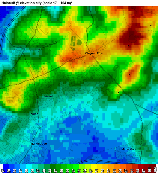
Below is the Elevation map of Hainault, which displays elevation range with different colors. Scale of the first map is from 17 to 104 m (56 to 341 ft) with average elevation of 47.5 meters (=156 ft) [note 1]
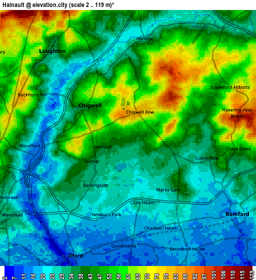
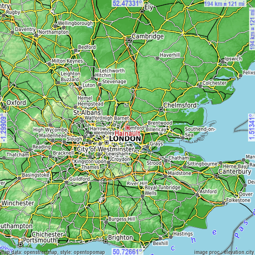
These maps also provides idea of topography and contour of this city, they are displayed at different zoom levels. More info about maps, scale and edge coordinates you can find below images.
| \ | Map #1 | Map #2 | Topo.Map |
| Scale [m] | 17..104 m | 2..119 m | × |
| Scale [ft] | 56..341 ft | 7..390 ft | × |
| Average | 47.5 m = 156 ft | 39.1 m = 128 ft | × |
| Width | 6.07 km = 3.8 mi | 12.14 km = 7.5 mi | 194.2 km = 120.7 mi |
| Height | 6.07 km = 3.8 mi | 12.14 km = 7.5 mi | 194.2 km = 120.7 mi |
| ↑Max Latitude | 51.635643° | 51.66291° | 52.47331° |
| Latitude at center | 51.60836° | 51.60836° | 51.60836° |
| ↓Min Latitude | 51.58106° | 51.553744° | 50.72661° |
| ← Min Longitude | 0.063215° | 0.019269° | -1.29909° |
| Longitude center | 0.10716° | 0.10716° | 0.10716° |
| →Max Longitude | 0.151105° | 0.195051° | 1.51341° |
Nearby cities:
Cities around Hainault sort by population:
• Dagenham elevation 13 m
7.7 km,  147°
147°
• Becontree 11 m
6.3 km,  166°
166°
• Romford 20 m
6.6 km,  124°
124°
• Woodford Green 62 m
5.8 km,  271°
271°
• Grange Hill 70 m
1.5 km,  284°
284°
• Buckhurst Hill 82 m
5.4 km,  288°
288°
• Chigwell 36 m
2.5 km,  300°
300°
• Collier Row 37 m
4.2 km,  104°
104°
• Chadwell Heath 20 m
4.5 km,  156°
156°
• Theydon Bois 60 m
7.4 km,  354°
354°
• Abridge 35 m
4.7 km,  11°
11°
• Ilford 15 m
6.1 km,  202°
202°
Multilingual:
 En español:
Hainault elevación 44 m.
 En France:
Hainault élévation 44 m.


Sources and notes:
- [note 1] Map square and city borders are not equal. Map elevation data is calculated only from area inside that square.
- [src 1] Elevation data from geonames database provided with same terms of usage.
- [src 2] The elevation map of Hainault is generated using elevation data from NASA's 3 arcsec (90m) resolution SRTM data.
- [src 3] Base (background) map © OpenStreetMap contributors tiles are generated by Geofabrik and OpenTopoMap.
Copyright & License:
This Hainault Elevation Map is licensed under CC BY-SA. You may reuse any part from this page, if you give a proper credit by linking to this URL:
 More info on terms of use page.