Didsbury elevation
Didsbury (England, Manchester), United Kingdom elevation is 40 meters and Didsbury elevation in feet is 131 ft above sea level [src 1]. Didsbury is a populated place (feature code) with elevation that is 32 meters (105 ft) smaller than average city elevation in United Kingdom.
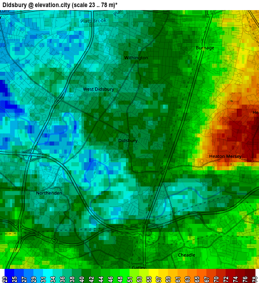
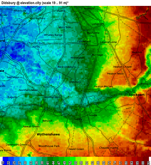
Below is the Elevation map of Didsbury, which displays elevation range with different colors. Scale of the first map is from 23 to 78 m (75 to 256 ft) with average elevation of 41.8 meters (=137 ft) [note 1]
These maps also provides idea of topography and contour of this city, they are displayed at different zoom levels. More info about maps, scale and edge coordinates you can find below images.
| \ | Map #1 | Map #2 | Topo.Map |
| Scale [m] | 23..78 m | 19..91 m | × |
| Scale [ft] | 75..256 ft | 62..299 ft | × |
| Average | 41.8 m = 137 ft | 51.3 m = 168 ft | × |
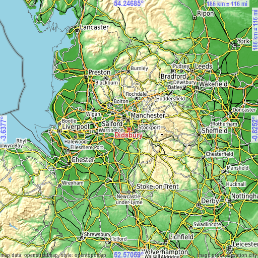
| Width | 5.82 km = 3.6 mi | 11.65 km = 7.2 mi | 186.4 km = 115.8 mi |
| Height | 5.82 km = 3.6 mi | 11.65 km = 7.2 mi | 186.4 km = 115.8 mi |
| ↑Max Latitude | 53.443163° | 53.469329° | 54.24685° |
| Latitude at center | 53.41698° | 53.41698° | 53.41698° |
| ↓Min Latitude | 53.390781° | 53.364566° | 52.57059° |
| ← Min Longitude | -2.275395° | -2.319341° | -3.6377° |
| Longitude center | -2.23145° | -2.23145° | -2.23145° |
| →Max Longitude | -2.187505° | -2.143559° | -0.8252° |
Nearby cities:
Cities around Didsbury sort by population:
• Stockport elevation 59 m
5 km,  99°
99°
• Sale 30 m
6.2 km,  278°
278°
• Stretford 27 m
6.7 km,  303°
303°
• Cheadle Hulme 68 m
5.3 km,  148°
148°
• Longsight 54 m
5 km,  23°
23°
• Fallowfield 44 m
2.7 km, 22°
• Burnage 51 m
2.7 km,  50°
50°
• Timperley 30 m
7 km,  254°
254°
• Hulme 36 m
5.5 km,  347°
347°
• Chorlton cum Hardy 33 m
2.9 km,  313°
313°
• Heaton Chapel 67 m
4 km,  68°
68°
• Cheadle Heath 49 m
3.2 km,  122°
122°
Multilingual:
 En español:
Didsbury elevación 40 m.
 En France:
Didsbury élévation 40 m.


Sources and notes:
- [note 1] Map square and city borders are not equal. Map elevation data is calculated only from area inside that square.
- [src 1] Elevation data from geonames database provided with same terms of usage.
- [src 2] The elevation map of Didsbury is generated using elevation data from NASA's 3 arcsec (90m) resolution SRTM data.
- [src 3] Base (background) map © OpenStreetMap contributors tiles are generated by Geofabrik and OpenTopoMap.
Copyright & License:
This Didsbury Elevation Map is licensed under CC BY-SA. You may reuse any part from this page, if you give a proper credit by linking to this URL:
 More info on terms of use page.