Blackmoorfoot elevation
Blackmoorfoot (England, Kirklees), United Kingdom elevation is 249 meters and Blackmoorfoot elevation in feet is 817 ft above sea level [src 1]. Blackmoorfoot is a populated place (feature code) with elevation that is 177 meters (581 ft) bigger than average city elevation in United Kingdom.
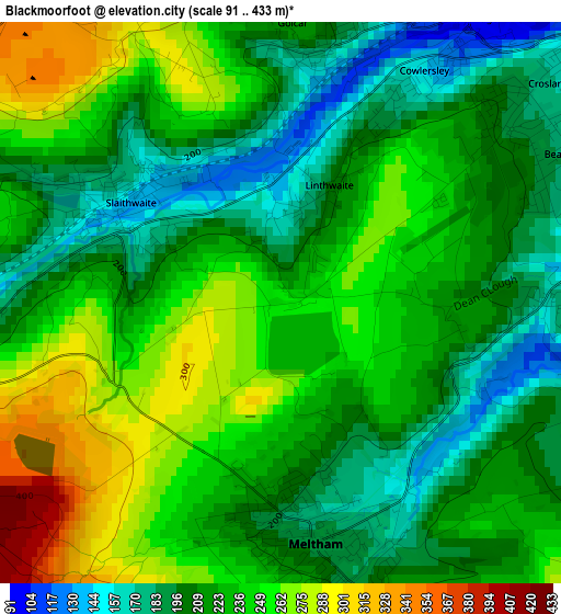
Below is the Elevation map of Blackmoorfoot, which displays elevation range with different colors. Scale of the first map is from 91 to 433 m (299 to 1421 ft) with average elevation of 225.8 meters (=741 ft) [note 1]
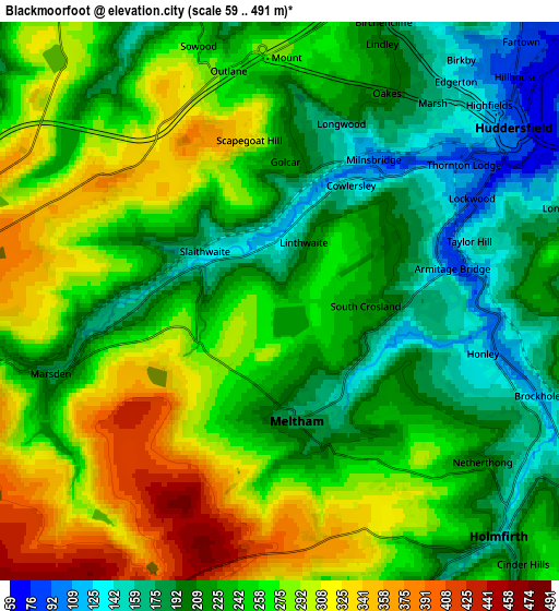
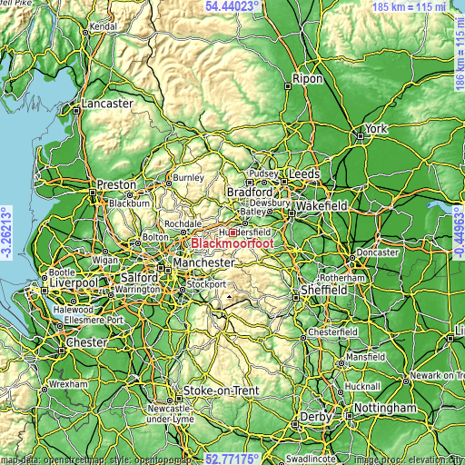
These maps also provides idea of topography and contour of this city, they are displayed at different zoom levels. More info about maps, scale and edge coordinates you can find below images.
| \ | Map #1 | Map #2 | Topo.Map |
| Scale [m] | 91..433 m | 59..491 m | × |
| Scale [ft] | 299..1421 ft | 194..1611 ft | × |
| Average | 225.8 m = 741 ft | 246 m = 807 ft | × |
| Width | 5.8 km = 3.6 mi | 11.59 km = 7.2 mi | 185.5 km = 115.3 mi |
| Height | 5.8 km = 3.6 mi | 11.59 km = 7.2 mi | 185.5 km = 115.3 mi |
| ↑Max Latitude | 53.640291° | 53.666336° | 54.44023° |
| Latitude at center | 53.61423° | 53.61423° | 53.61423° |
| ↓Min Latitude | 53.588153° | 53.562059° | 52.77175° |
| ← Min Longitude | -1.899825° | -1.943771° | -3.26213° |
| Longitude center | -1.85588° | -1.85588° | -1.85588° |
| →Max Longitude | -1.811935° | -1.767989° | -0.44963° |
Nearby cities:
Cities around Blackmoorfoot sort by population:
• Huddersfield elevation 90 m
6.1 km,  50°
50°
• Elland 105 m
8 km,  8°
8°
• Rastrick 73 m
9.7 km,  27°
27°
• Meltham Mills 171 m
2.5 km,  155°
155°
• Meltham 177 m
2.4 km,  168°
168°
• Shepley 232 m
9.8 km,  110°
110°
• Ripponden 135 m
8.8 km,  319°
319°
• Marsden 251 m
4.3 km,  248°
248°
• Linthwaite 190 m
1.2 km,  18°
18°
• Holywell Green 147 m
6.7 km,  353°
353°
• Holmfirth 150 m
6.7 km,  137°
137°
• Barkisland 230 m
8 km,  329°
329°
Multilingual:
 En español:
Blackmoorfoot elevación 249 m.
 En France:
Blackmoorfoot élévation 249 m.
 Auf Deutsch:
Blackmoorfoot höhe über dem Meeresspiegel ist 249 m.

Sources and notes:
- [note 1] Map square and city borders are not equal. Map elevation data is calculated only from area inside that square.
- [src 1] Elevation data from geonames database provided with same terms of usage.
- [src 2] The elevation map of Blackmoorfoot is generated using elevation data from NASA's 3 arcsec (90m) resolution SRTM data.
- [src 3] Base (background) map © OpenStreetMap contributors tiles are generated by Geofabrik and OpenTopoMap.
Copyright & License:
This Blackmoorfoot Elevation Map is licensed under CC BY-SA. You may reuse any part from this page, if you give a proper credit by linking to this URL:
 More info on terms of use page.