Looe elevation
Looe (England, Cornwall), United Kingdom elevation is 40 meters and Looe elevation in feet is 131 ft above sea level [src 1]. Looe is a populated place (feature code) with elevation that is 32 meters (105 ft) smaller than average city elevation in United Kingdom.
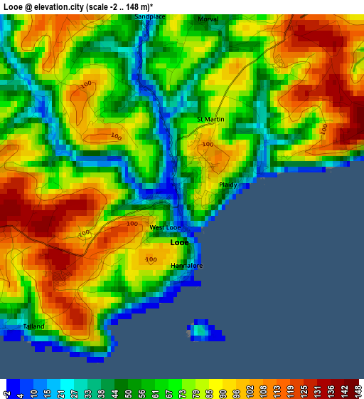
Below is the Elevation map of Looe, which displays elevation range with different colors. Scale of the first map is from -2 to 148 m (-7 to 486 ft) with average elevation of 75.1 meters (=246 ft) [note 1]
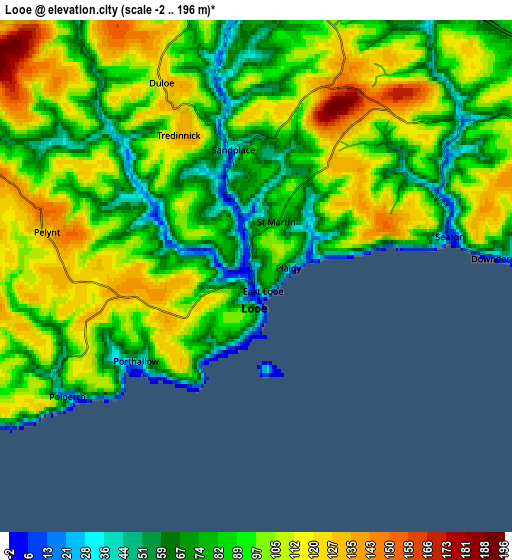
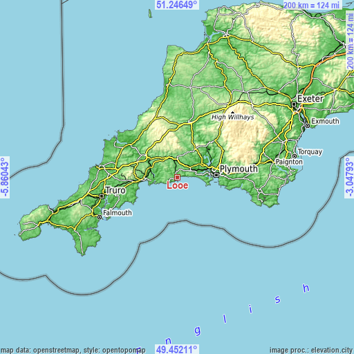
These maps also provides idea of topography and contour of this city, they are displayed at different zoom levels. More info about maps, scale and edge coordinates you can find below images.
| \ | Map #1 | Map #2 | Topo.Map |
| Scale [m] | -2..148 m | -2..196 m | × |
| Scale [ft] | -7..486 ft | -7..643 ft | × |
| Average | 75.1 m = 246 ft | 92.5 m = 303 ft | × |
| Width | 6.23 km = 3.9 mi | 12.47 km = 7.7 mi | 199.5 km = 124 mi |
| Height | 6.23 km = 3.9 mi | 12.47 km = 7.7 mi | 199.5 km = 124 mi |
| ↑Max Latitude | 50.385808° | 50.41382° | 51.24649° |
| Latitude at center | 50.35778° | 50.35778° | 50.35778° |
| ↓Min Latitude | 50.329735° | 50.301673° | 49.45211° |
| ← Min Longitude | -4.498125° | -4.542071° | -5.86043° |
| Longitude center | -4.45418° | -4.45418° | -4.45418° |
| →Max Longitude | -4.410235° | -4.366289° | -3.04793° |
Nearby cities:
Cities around Looe sort by population:
• Saltash elevation 64 m
17.2 km,  70°
70°
• Par 3 m
17.7 km,  267°
267°
• Liskeard 129 m
10.8 km,  355°
355°
• Lostwithiel 11 m
16.3 km,  289°
289°
• Fowey 46 m
13.3 km,  259°
259°
• Pensilva 232 m
16.4 km,  9°
9°
• Dobwalls 137 m
12 km,  338°
338°
• Polperro 38 m
5.7 km,  238°
238°
• Landrake 91 m
13.7 km,  58°
58°
• Millbrook 7 m
17 km,  93°
93°
• Pillaton 43 m
15 km,  46°
46°
• Duloe 116 m
3.5 km,  323°
323°
Multilingual:
 En español:
Looe elevación 40 m.
 En France:
Looe élévation 40 m.


Sources and notes:
- [note 1] Map square and city borders are not equal. Map elevation data is calculated only from area inside that square.
- [src 1] Elevation data from geonames database provided with same terms of usage.
- [src 2] The elevation map of Looe is generated using elevation data from NASA's 3 arcsec (90m) resolution SRTM data.
- [src 3] Base (background) map © OpenStreetMap contributors tiles are generated by Geofabrik and OpenTopoMap.
Copyright & License:
This Looe Elevation Map is licensed under CC BY-SA. You may reuse any part from this page, if you give a proper credit by linking to this URL:
 More info on terms of use page.