Hadston elevation
Hadston (England, Northumberland), United Kingdom elevation is 18 meters and Hadston elevation in feet is 59 ft above sea level [src 1]. Hadston is a populated place (feature code) with elevation that is 54 meters (177 ft) smaller than average city elevation in United Kingdom.
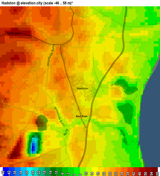
Below is the Elevation map of Hadston, which displays elevation range with different colors. Scale of the first map is from -46 to 58 m (-151 to 190 ft) with average elevation of 20.8 meters (=68 ft) [note 1]
These maps also provides idea of topography and contour of this city, they are displayed at different zoom levels. More info about maps, scale and edge coordinates you can find below images.
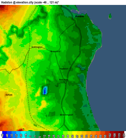
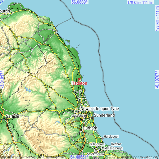
| \ | Map #1 | Map #2 | Topo.Map |
| Scale [m] | -46..58 m | -46..121 m | × |
| Scale [ft] | -151..190 ft | -151..397 ft | × |
| Average | 20.8 m = 68 ft | 31.7 m = 104 ft | × |
| Width | 5.56 km = 3.5 mi | 11.13 km = 6.9 mi | 178.1 km = 110.7 mi |
| Height | 5.56 km = 3.5 mi | 11.13 km = 6.9 mi | 178 km = 110.6 mi |
| ↑Max Latitude | 55.319293° | 55.34429° | 56.0869° |
| Latitude at center | 55.29428° | 55.29428° | 55.29428° |
| ↓Min Latitude | 55.269251° | 55.244207° | 54.48551° |
| ← Min Longitude | -1.647865° | -1.691811° | -3.01017° |
| Longitude center | -1.60392° | -1.60392° | -1.60392° |
| →Max Longitude | -1.559975° | -1.516029° | -0.19767° |
Nearby cities:
Cities around Hadston sort by population:
• Amble elevation 8 m
4.5 km,  16°
16°
• Pegswood 58 m
13.1 km,  191°
191°
• Lynemouth 20 m
9.8 km,  156°
156°
• Shilbottle 126 m
10.1 km,  327°
327°
• East Chevington 14 m
1.8 km,  133°
133°
• Warkworth 27 m
6.2 km,  352°
352°
• Felton 41 m
6.8 km,  273°
273°
• Lesbury 12 m
11.7 km, 352°
• Longhorsley 122 m
11.8 km,  242°
242°
• Alnmouth 22 m
11.8 km,  1°
1°
• Cresswell 18 m
9.3 km, 158°
• Acklington 33 m
2 km,  288°
288°
Multilingual:
 En español:
Hadston elevación 18 m.
 En France:
Hadston élévation 18 m.


Sources and notes:
- [note 1] Map square and city borders are not equal. Map elevation data is calculated only from area inside that square.
- [src 1] Elevation data from geonames database provided with same terms of usage.
- [src 2] The elevation map of Hadston is generated using elevation data from NASA's 3 arcsec (90m) resolution SRTM data.
- [src 3] Base (background) map © OpenStreetMap contributors tiles are generated by Geofabrik and OpenTopoMap.
Copyright & License:
This Hadston Elevation Map is licensed under CC BY-SA. You may reuse any part from this page, if you give a proper credit by linking to this URL:
 More info on terms of use page.