Abertillery elevation
Abertillery (Wales, Blaenau Gwent), United Kingdom elevation is 228 meters and Abertillery elevation in feet is 748 ft above sea level [src 1]. Abertillery is a populated place (feature code) with elevation that is 156 meters (512 ft) bigger than average city elevation in United Kingdom.
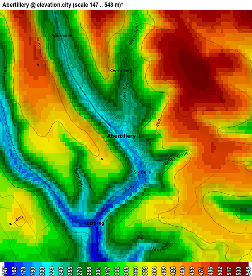
Below is the Elevation map of Abertillery, which displays elevation range with different colors. Scale of the first map is from 147 to 548 m (482 to 1798 ft) with average elevation of 364.8 meters (=1197 ft) [note 1]
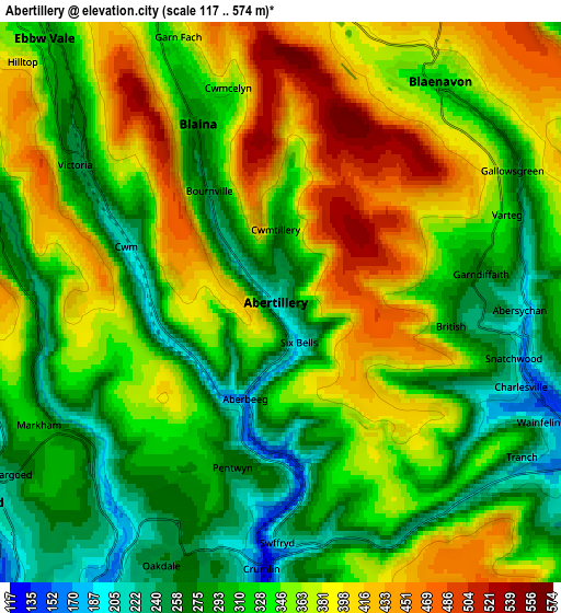
These maps also provides idea of topography and contour of this city, they are displayed at different zoom levels. More info about maps, scale and edge coordinates you can find below images.
| \ | Map #1 | Map #2 | Topo.Map |
| Scale [m] | 147..548 m | 117..574 m | × |
| Scale [ft] | 482..1798 ft | 384..1883 ft | × |
| Average | 364.8 m = 1197 ft | 340.4 m = 1117 ft | × |
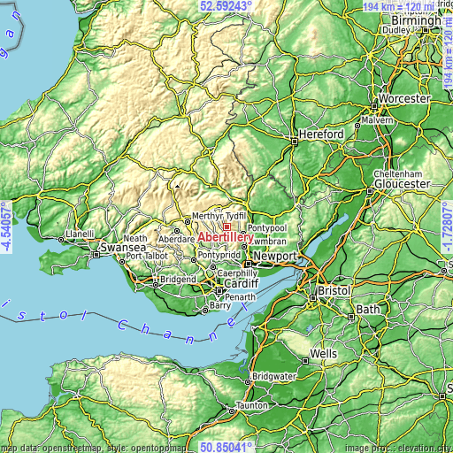
| Width | 6.05 km = 3.8 mi | 12.11 km = 7.5 mi | 193.7 km = 120.4 mi |
| Height | 6.05 km = 3.8 mi | 12.11 km = 7.5 mi | 193.7 km = 120.4 mi |
| ↑Max Latitude | 51.75702° | 51.784214° | 52.59243° |
| Latitude at center | 51.72981° | 51.72981° | 51.72981° |
| ↓Min Latitude | 51.702583° | 51.67534° | 50.85041° |
| ← Min Longitude | -3.178265° | -3.222211° | -4.54057° |
| Longitude center | -3.13432° | -3.13432° | -3.13432° |
| →Max Longitude | -3.090375° | -3.046429° | -1.72807° |
Nearby cities:
Cities around Abertillery sort by population:
• Pontypool elevation 173 m
7 km,  117°
117°
• Ebbw Vale 311 m
7.3 km,  316°
316°
• Blackwood 227 m
8.5 km,  216°
216°
• Brynmawr 382 m
8.5 km,  336°
336°
• Tredegar 321 m
9.1 km,  301°
301°
• Bargoed 231 m
8.6 km,  232°
232°
• Victoria 301 m
5 km, 296°
• Newbridge 164 m
7 km,  179°
179°
• Crumlin 215 m
5.8 km, 180°
• Blaenavon 334 m
6 km,  34°
34°
• New Tredegar 217 m
7.4 km,  262°
262°
• Cwm 219 m
3.4 km,  289°
289°
Multilingual:
 En español:
Abertillery elevación 228 m.
 En France:
Abertillery élévation 228 m.
 Auf Deutsch:
Abertillery höhe über dem Meeresspiegel ist 228 m.

Sources and notes:
- [note 1] Map square and city borders are not equal. Map elevation data is calculated only from area inside that square.
- [src 1] Elevation data from geonames database provided with same terms of usage.
- [src 2] The elevation map of Abertillery is generated using elevation data from NASA's 3 arcsec (90m) resolution SRTM data.
- [src 3] Base (background) map © OpenStreetMap contributors tiles are generated by Geofabrik and OpenTopoMap.
Copyright & License:
This Abertillery Elevation Map is licensed under CC BY-SA. You may reuse any part from this page, if you give a proper credit by linking to this URL:
 More info on terms of use page.