Ballynahinch elevation
Ballynahinch (Northern Ireland, Newry Mourne and Down), United Kingdom elevation is 74 meters and Ballynahinch elevation in feet is 243 ft above sea level [src 1]. Ballynahinch is a populated place (feature code) with elevation that is 2 meters (7 ft) bigger than average city elevation in United Kingdom.
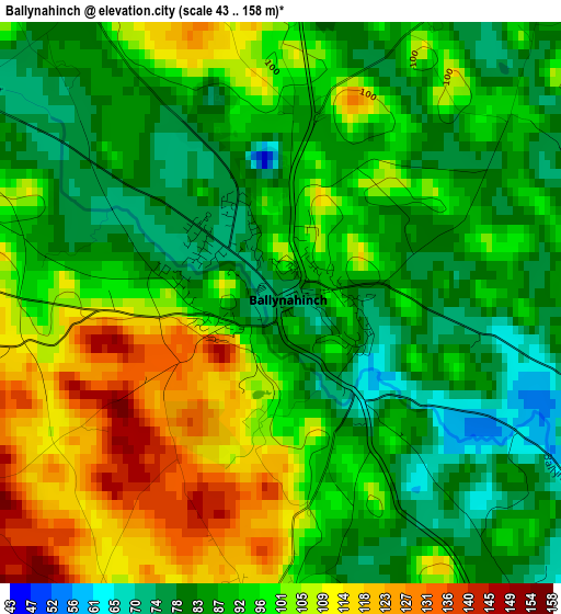
Below is the Elevation map of Ballynahinch, which displays elevation range with different colors. Scale of the first map is from 43 to 158 m (141 to 518 ft) with average elevation of 94.6 meters (=310 ft) [note 1]
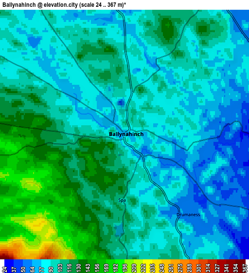
These maps also provides idea of topography and contour of this city, they are displayed at different zoom levels. More info about maps, scale and edge coordinates you can find below images.
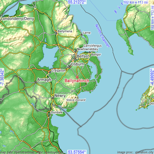
| \ | Map #1 | Map #2 | Topo.Map |
| Scale [m] | 43..158 m | 24..367 m | × |
| Scale [ft] | 141..518 ft | 79..1204 ft | × |
| Average | 94.6 m = 310 ft | 103.2 m = 339 ft | × |
| Width | 5.69 km = 3.5 mi | 11.38 km = 7.1 mi | 182 km = 113.1 mi |
| Height | 5.69 km = 3.5 mi | 11.38 km = 7.1 mi | 182 km = 113.1 mi |
| ↑Max Latitude | 54.427872° | 54.453428° | 55.21272° |
| Latitude at center | 54.4023° | 54.4023° | 54.4023° |
| ↓Min Latitude | 54.376712° | 54.351108° | 53.57554° |
| ← Min Longitude | -5.941115° | -5.985061° | -7.30342° |
| Longitude center | -5.89717° | -5.89717° | -5.89717° |
| →Max Longitude | -5.853225° | -5.809279° | -4.49092° |
Nearby cities:
Cities around Ballynahinch sort by population:
• Lisburn elevation 53 m
16.2 km,  326°
326°
• Castlereagh 29 m
19.1 km,  2°
2°
• Downpatrick 11 m
14.4 km,  124°
124°
• Carryduff 118 m
12.9 km, 2°
• Hillsborough 113 m
13.5 km,  300°
300°
• Saintfield 74 m
7.8 km,  33°
33°
• Ballygowan 58 m
13 km, 31°
• Killyleagh 11 m
16.1 km,  90°
90°
• Castlewellan 113 m
16.5 km,  190°
190°
• Crossgar 22 m
8.9 km, 93°
• Annahilt 92 m
7.5 km, 297°
• Dundrum 6 m
16.5 km,  168°
168°
Multilingual:
 En español:
Ballynahinch elevación 74 m.
 En France:
Ballynahinch élévation 74 m.
 Auf Deutsch:
Ballynahinch höhe über dem Meeresspiegel ist 74 m.

Sources and notes:
- [note 1] Map square and city borders are not equal. Map elevation data is calculated only from area inside that square.
- [src 1] Elevation data from geonames database provided with same terms of usage.
- [src 2] The elevation map of Ballynahinch is generated using elevation data from NASA's 3 arcsec (90m) resolution SRTM data.
- [src 3] Base (background) map © OpenStreetMap contributors tiles are generated by Geofabrik and OpenTopoMap.
Copyright & License:
This Ballynahinch Elevation Map is licensed under CC BY-SA. You may reuse any part from this page, if you give a proper credit by linking to this URL:
 More info on terms of use page.