Barnard Castle elevation
Barnard Castle (England, County Durham), United Kingdom elevation is 164 meters and Barnard Castle elevation in feet is 538 ft above sea level [src 1]. Barnard Castle is a seat of a third-order administrative division (feature code) with elevation that is 92 meters (302 ft) bigger than average city elevation in United Kingdom.
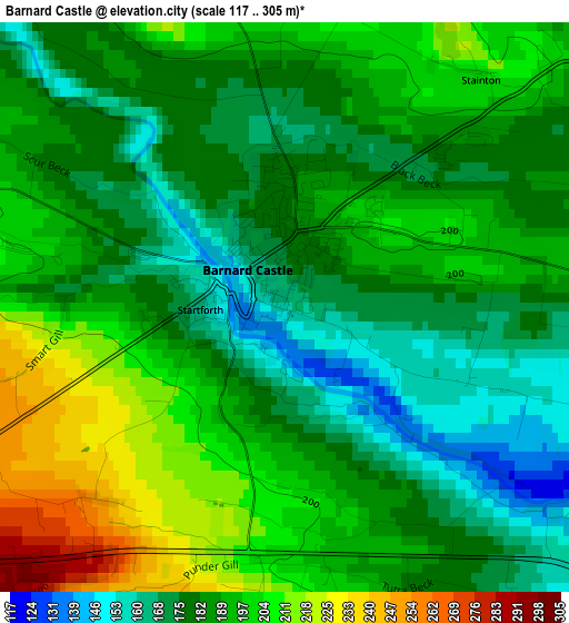
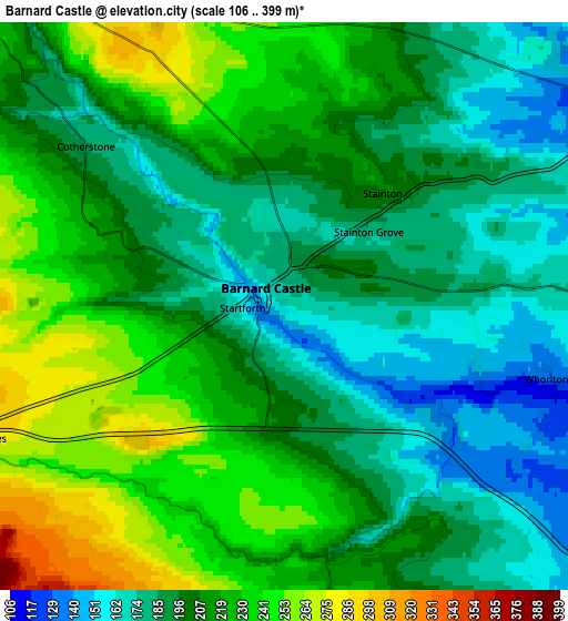
Below is the Elevation map of Barnard Castle, which displays elevation range with different colors. Scale of the first map is from 117 to 305 m (384 to 1001 ft) with average elevation of 187.3 meters (=615 ft) [note 1]
These maps also provides idea of topography and contour of this city, they are displayed at different zoom levels. More info about maps, scale and edge coordinates you can find below images.
| \ | Map #1 | Map #2 | Topo.Map |
| Scale [m] | 117..305 m | 106..399 m | × |
| Scale [ft] | 384..1001 ft | 348..1309 ft | × |
| Average | 187.3 m = 615 ft | 206.4 m = 677 ft | × |
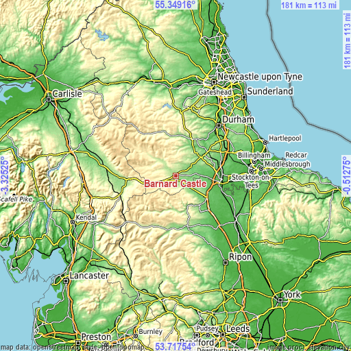
| Width | 5.67 km = 3.5 mi | 11.34 km = 7 mi | 181.4 km = 112.7 mi |
| Height | 5.67 km = 3.5 mi | 11.34 km = 7 mi | 181.4 km = 112.7 mi |
| ↑Max Latitude | 54.566985° | 54.592455° | 55.34916° |
| Latitude at center | 54.5415° | 54.5415° | 54.5415° |
| ↓Min Latitude | 54.515999° | 54.490482° | 53.71754° |
| ← Min Longitude | -1.962945° | -2.006891° | -3.32525° |
| Longitude center | -1.919° | -1.919° | -1.919° |
| →Max Longitude | -1.875055° | -1.831109° | -0.51275° |
Nearby cities:
Cities around Barnard Castle sort by population:
• Staindrop elevation 114 m
8.4 km,  58°
58°
• Eggleston 248 m
9.3 km,  324°
324°
• Winston 137 m
8.4 km,  87°
87°
• Romaldkirk 228 m
8.3 km,  314°
314°
• Hutton Magna 132 m
8.1 km,  115°
115°
• Ovington 135 m
7.9 km,  100°
100°
• Bowes 292 m
6.9 km,  245°
245°
• Barningham 217 m
6.7 km,  152°
152°
• Brignall 199 m
4.5 km, 154°
• Rokeby 128 m
4.4 km,  129°
129°
• Lartington 213 m
3.7 km,  292°
292°
• Startforth 163 m
0.8 km, 245°
Multilingual:
 En español:
Barnard Castle elevación 164 m.
 En France:
Barnard Castle élévation 164 m.
 Auf Deutsch:
Barnard Castle höhe über dem Meeresspiegel ist 164 m.

Sources and notes:
- [note 1] Map square and city borders are not equal. Map elevation data is calculated only from area inside that square.
- [src 1] Elevation data from geonames database provided with same terms of usage.
- [src 2] The elevation map of Barnard Castle is generated using elevation data from NASA's 3 arcsec (90m) resolution SRTM data.
- [src 3] Base (background) map © OpenStreetMap contributors tiles are generated by Geofabrik and OpenTopoMap.
Copyright & License:
This Barnard Castle Elevation Map is licensed under CC BY-SA. You may reuse any part from this page, if you give a proper credit by linking to this URL:
 More info on terms of use page.