Barton-le-Clay elevation
Barton-le-Clay (England, Central Bedfordshire), United Kingdom elevation is 70 meters and Barton-le-Clay elevation in feet is 230 ft above sea level [src 1]. Barton-le-Clay is a seat of a third-order administrative division (feature code) with elevation that is 2 meters (7 ft) smaller than average city elevation in United Kingdom.
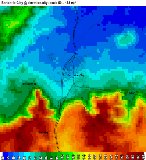
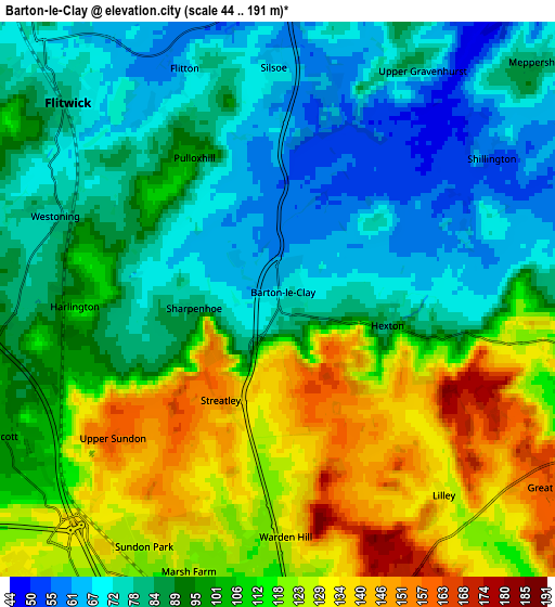
Below is the Elevation map of Barton-le-Clay, which displays elevation range with different colors. Scale of the first map is from 50 to 168 m (164 to 551 ft) with average elevation of 94.6 meters (=310 ft) [note 1]
These maps also provides idea of topography and contour of this city, they are displayed at different zoom levels. More info about maps, scale and edge coordinates you can find below images.
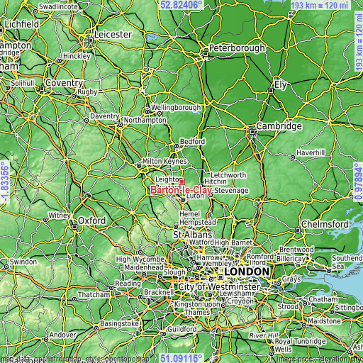
| \ | Map #1 | Map #2 | Topo.Map |
| Scale [m] | 50..168 m | 44..191 m | × |
| Scale [ft] | 164..551 ft | 144..627 ft | × |
| Average | 94.6 m = 310 ft | 98.7 m = 324 ft | × |
| Width | 6.02 km = 3.7 mi | 12.04 km = 7.5 mi | 192.7 km = 119.7 mi |
| Height | 6.02 km = 3.7 mi | 12.04 km = 7.5 mi | 192.7 km = 119.7 mi |
| ↑Max Latitude | 51.993048° | 52.020099° | 52.82406° |
| Latitude at center | 51.96598° | 51.96598° | 51.96598° |
| ↓Min Latitude | 51.938896° | 51.911795° | 51.09115° |
| ← Min Longitude | -0.471255° | -0.515201° | -1.83356° |
| Longitude center | -0.42731° | -0.42731° | -0.42731° |
| →Max Longitude | -0.383365° | -0.339419° | 0.97894° |
Nearby cities:
Cities around Barton-le-Clay sort by population:
• Flitwick elevation 78 m
6.2 km,  312°
312°
• Clophill 56 m
6.8 km,  2°
2°
• Harlington 107 m
4.5 km,  265°
265°
• Westoning 78 m
5.1 km,  289°
289°
• Greenfield 66 m
4.9 km,  327°
327°
• Silsoe 68 m
4.7 km, 2°
• Shillington 54 m
5.5 km,  56°
56°
• Pirton 79 m
6.4 km,  84°
84°
• Pulloxhill 94 m
3.7 km, 331°
• Streatley 151 m
2.5 km,  207°
207°
• Chalton 108 m
6.6 km,  230°
230°
• Gravenhurst 49 m
6.2 km,  39°
39°
Multilingual:
 En español:
Barton-le-Clay elevación 70 m.
 En France:
Barton-le-Clay élévation 70 m.
 Auf Deutsch:
Barton-le-Clay höhe über dem Meeresspiegel ist 70 m.

Sources and notes:
- [note 1] Map square and city borders are not equal. Map elevation data is calculated only from area inside that square.
- [src 1] Elevation data from geonames database provided with same terms of usage.
- [src 2] The elevation map of Barton-le-Clay is generated using elevation data from NASA's 3 arcsec (90m) resolution SRTM data.
- [src 3] Base (background) map © OpenStreetMap contributors tiles are generated by Geofabrik and OpenTopoMap.
Copyright & License:
This Barton-le-Clay Elevation Map is licensed under CC BY-SA. You may reuse any part from this page, if you give a proper credit by linking to this URL:
 More info on terms of use page.