Biggin Hill elevation
Biggin Hill (England, Greater London), United Kingdom elevation is 188 meters and Biggin Hill elevation in feet is 617 ft above sea level [src 1]. Biggin Hill is a populated place (feature code) with elevation that is 116 meters (381 ft) bigger than average city elevation in United Kingdom.
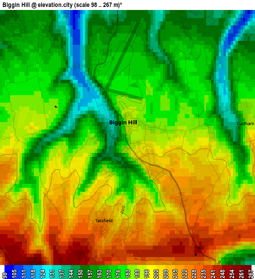
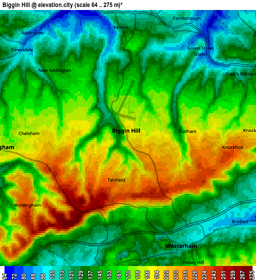
Below is the Elevation map of Biggin Hill, which displays elevation range with different colors. Scale of the first map is from 98 to 267 m (322 to 876 ft) with average elevation of 185.8 meters (=610 ft) [note 1]
These maps also provides idea of topography and contour of this city, they are displayed at different zoom levels. More info about maps, scale and edge coordinates you can find below images.
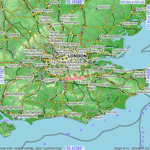
| \ | Map #1 | Map #2 | Topo.Map |
| Scale [m] | 98..267 m | 64..275 m | × |
| Scale [ft] | 322..876 ft | 210..902 ft | × |
| Average | 185.8 m = 610 ft | 156.5 m = 513 ft | × |
| Width | 6.11 km = 3.8 mi | 12.22 km = 7.6 mi | 195.5 km = 121.5 mi |
| Height | 6.11 km = 3.8 mi | 12.22 km = 7.6 mi | 195.5 km = 121.5 mi |
| ↑Max Latitude | 51.34075° | 51.368194° | 52.18388° |
| Latitude at center | 51.31329° | 51.31329° | 51.31329° |
| ↓Min Latitude | 51.285813° | 51.25832° | 50.42586° |
| ← Min Longitude | -0.009615° | -0.053561° | -1.37192° |
| Longitude center | 0.03433° | 0.03433° | 0.03433° |
| →Max Longitude | 0.078275° | 0.122221° | 1.44058° |
Nearby cities:
Cities around Biggin Hill sort by population:
• Caterham elevation 140 m
8.6 km,  246°
246°
• Orpington 62 m
8.1 km,  32°
32°
• West Wickham 88 m
6.9 km,  329°
329°
• Oxted 108 m
6.9 km,  204°
204°
• Shortlands 56 m
9.8 km,  347°
347°
• Farnborough 110 m
5.7 km, 25°
• Warlingham 186 m
6.4 km,  266°
266°
• Whyteleafe 113 m
8.3 km, 265°
• Westerham 116 m
5.7 km,  155°
155°
• Godstone 104 m
10.2 km,  224°
224°
• Woldingham 230 m
5.7 km,  236°
236°
• Sundridge 84 m
7.3 km,  122°
122°
Multilingual:
 En español:
Biggin Hill elevación 188 m.
 En France:
Biggin Hill élévation 188 m.
 Auf Deutsch:
Biggin Hill höhe über dem Meeresspiegel ist 188 m.

Sources and notes:
- [note 1] Map square and city borders are not equal. Map elevation data is calculated only from area inside that square.
- [src 1] Elevation data from geonames database provided with same terms of usage.
- [src 2] The elevation map of Biggin Hill is generated using elevation data from NASA's 3 arcsec (90m) resolution SRTM data.
- [src 3] Base (background) map © OpenStreetMap contributors tiles are generated by Geofabrik and OpenTopoMap.
Copyright & License:
This Biggin Hill Elevation Map is licensed under CC BY-SA. You may reuse any part from this page, if you give a proper credit by linking to this URL:
 More info on terms of use page.