Bisham elevation
Bisham (England, Royal Borough of Windsor and Maidenhead), United Kingdom elevation is 31 meters and Bisham elevation in feet is 102 ft above sea level [src 1]. Bisham is a seat of a third-order administrative division (feature code) with elevation that is 41 meters (135 ft) smaller than average city elevation in United Kingdom.
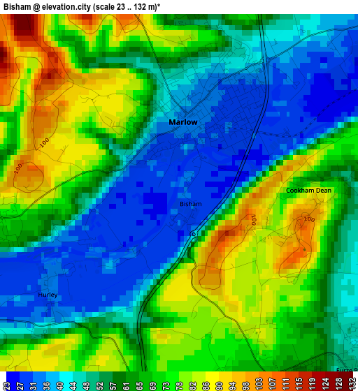
Below is the Elevation map of Bisham, which displays elevation range with different colors. Scale of the first map is from 23 to 132 m (75 to 433 ft) with average elevation of 60.8 meters (=199 ft) [note 1]
These maps also provides idea of topography and contour of this city, they are displayed at different zoom levels. More info about maps, scale and edge coordinates you can find below images.
| \ | Map #1 | Topo.Map |
| Scale [m] | 23..132 m | × |
| Scale [ft] | 75..433 ft | × |
| Average | 60.8 m = 199 ft | × |
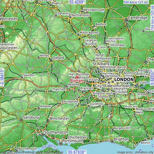
| Width | 6.08 km = 3.8 mi | 194.4 km = 120.8 mi |
| Height | 6.08 km = 3.8 mi | 194.4 km = 120.8 mi |
| ↑Max Latitude | 51.588352° | 52.4269° |
| Latitude at center | 51.56104° | 51.56104° |
| ↓Min Latitude | 51.533712° | 50.67838° |
| ← Min Longitude | -0.821825° | -2.18413° |
| Longitude center | -0.77788° | -0.77788° |
| →Max Longitude | -0.733935° | 0.62837° |
Nearby cities:
Cities around Bisham sort by population:
• High Wycombe elevation 76 m
7.8 km,  14°
14°
• Maidenhead 32 m
5.8 km,  136°
136°
• Marlow 32 m
1 km,  15°
15°
• Beaconsfield 106 m
10.7 km,  57°
57°
• Henley-on-Thames 34 m
9 km,  249°
249°
• Cookham 29 m
4.8 km,  92°
92°
• Bourne End 31 m
4.8 km,  69°
69°
• Wargrave 49 m
9.1 km,  222°
222°
• White Waltham 33 m
7.7 km,  177°
177°
• Bray 23 m
8.9 km, 135°
• Remenham 34 m
7.9 km,  262°
262°
• Hurley 34 m
2.7 km,  233°
233°
Multilingual:
 En español:
Bisham elevación 31 m.
 En France:
Bisham élévation 31 m.


Sources and notes:
- [note 1] Map square and city borders are not equal. Map elevation data is calculated only from area inside that square.
- [src 1] Elevation data from geonames database provided with same terms of usage.
- [src 2] The elevation map of Bisham is generated using elevation data from NASA's 3 arcsec (90m) resolution SRTM data.
- [src 3] Base (background) map © OpenStreetMap contributors tiles are generated by Geofabrik and OpenTopoMap.
Copyright & License:
This Bisham Elevation Map is licensed under CC BY-SA. You may reuse any part from this page, if you give a proper credit by linking to this URL:
 More info on terms of use page.