Branston elevation
Branston (England, Lincolnshire), United Kingdom elevation is 40 meters and Branston elevation in feet is 131 ft above sea level [src 1]. Branston is a populated place (feature code) with elevation that is 32 meters (105 ft) smaller than average city elevation in United Kingdom.
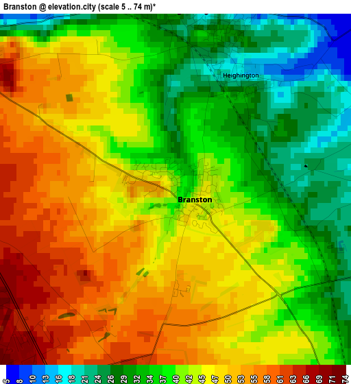
Below is the Elevation map of Branston, which displays elevation range with different colors. Scale of the first map is from 5 to 74 m (16 to 243 ft) with average elevation of 42.4 meters (=139 ft) [note 1]
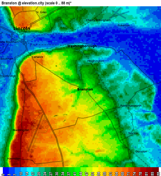
These maps also provides idea of topography and contour of this city, they are displayed at different zoom levels. More info about maps, scale and edge coordinates you can find below images.
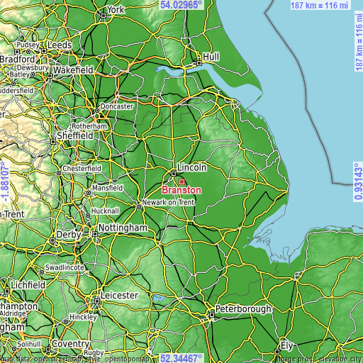
| \ | Map #1 | Map #2 | Topo.Map |
| Scale [m] | 5..74 m | 0..88 m | × |
| Scale [ft] | 16..243 ft | 0..289 ft | × |
| Average | 42.4 m = 139 ft | 33.8 m = 111 ft | × |
| Width | 5.85 km = 3.6 mi | 11.71 km = 7.3 mi | 187.4 km = 116.4 mi |
| Height | 5.85 km = 3.6 mi | 11.71 km = 7.3 mi | 187.3 km = 116.4 mi |
| ↑Max Latitude | 53.221759° | 53.248062° | 54.02965° |
| Latitude at center | 53.19544° | 53.19544° | 53.19544° |
| ↓Min Latitude | 53.169105° | 53.142753° | 52.34467° |
| ← Min Longitude | -0.518765° | -0.562711° | -1.88107° |
| Longitude center | -0.47482° | -0.47482° | -0.47482° |
| →Max Longitude | -0.430875° | -0.386929° | 0.93143° |
Nearby cities:
Cities around Branston sort by population:
• Lincoln elevation 9 m
5.5 km,  309°
309°
• Washingborough 10 m
3.2 km,  359°
359°
• Heighington 16 m
2.2 km,  29°
29°
• Bracebridge Heath 76 m
4 km,  271°
271°
• Burton 37 m
10 km,  322°
322°
• Waddington 78 m
5 km,  230°
230°
• Metheringham 20 m
7.8 km,  142°
142°
• Nettleham 27 m
7.9 km,  353°
353°
• Navenby 67 m
10.4 km,  198°
198°
• Reepham 6 m
5 km, 33°
• Sudbrooke 19 m
8.1 km,  11°
11°
• Bardney 16 m
10.2 km,  80°
80°
Multilingual:
 En español:
Branston elevación 40 m.
 En France:
Branston élévation 40 m.


Sources and notes:
- [note 1] Map square and city borders are not equal. Map elevation data is calculated only from area inside that square.
- [src 1] Elevation data from geonames database provided with same terms of usage.
- [src 2] The elevation map of Branston is generated using elevation data from NASA's 3 arcsec (90m) resolution SRTM data.
- [src 3] Base (background) map © OpenStreetMap contributors tiles are generated by Geofabrik and OpenTopoMap.
Copyright & License:
This Branston Elevation Map is licensed under CC BY-SA. You may reuse any part from this page, if you give a proper credit by linking to this URL:
 More info on terms of use page.