Carcroft elevation
Carcroft (England, Doncaster), United Kingdom elevation is 8 meters and Carcroft elevation in feet is 26 ft above sea level [src 1]. Carcroft is a populated place (feature code) with elevation that is 64 meters (210 ft) smaller than average city elevation in United Kingdom.
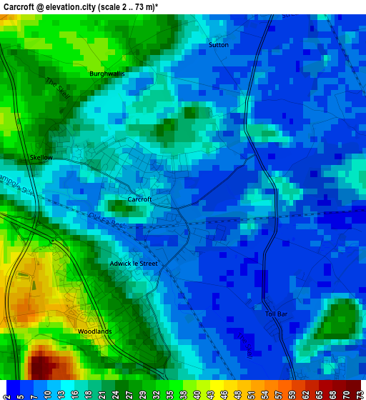
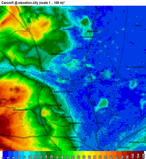
Below is the Elevation map of Carcroft, which displays elevation range with different colors. Scale of the first map is from 2 to 73 m (7 to 240 ft) with average elevation of 17.4 meters (=57 ft) [note 1]
These maps also provides idea of topography and contour of this city, they are displayed at different zoom levels. More info about maps, scale and edge coordinates you can find below images.
| \ | Map #1 | Map #2 | Topo.Map |
| Scale [m] | 2..73 m | 1..108 m | × |
| Scale [ft] | 7..240 ft | 3..354 ft | × |
| Average | 17.4 m = 57 ft | 28.3 m = 93 ft | × |
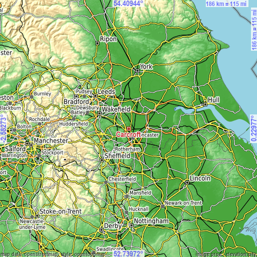
| Width | 5.8 km = 3.6 mi | 11.6 km = 7.2 mi | 185.7 km = 115.4 mi |
| Height | 5.8 km = 3.6 mi | 11.6 km = 7.2 mi | 185.6 km = 115.3 mi |
| ↑Max Latitude | 53.608901° | 53.634965° | 54.40944° |
| Latitude at center | 53.58282° | 53.58282° | 53.58282° |
| ↓Min Latitude | 53.556723° | 53.530611° | 52.73972° |
| ← Min Longitude | -1.220425° | -1.264371° | -2.58273° |
| Longitude center | -1.17648° | -1.17648° | -1.17648° |
| →Max Longitude | -1.132535° | -1.088589° | 0.22977° |
Nearby cities:
Cities around Carcroft sort by population:
• Doncaster elevation 19 m
7.3 km,  155°
155°
• Bentley 11 m
5.8 km, 162°
• Adwick le Street 12 m
1.4 km,  201°
201°
• South Elmsall 67 m
7 km,  283°
283°
• Kirk Sandall 12 m
7.5 km,  107°
107°
• Askern 13 m
4.1 km,  23°
23°
• Norton 21 m
5.6 km,  355°
355°
• Campsall 15 m
4 km, 356°
• Moss 8 m
6.3 km,  53°
53°
• Marr 53 m
5.3 km,  213°
213°
• Fenwick 9 m
8.1 km,  39°
39°
• North Elmsall 59 m
7.5 km,  292°
292°
Multilingual:
 En español:
Carcroft elevación 8 m.
 En France:
Carcroft élévation 8 m.


Sources and notes:
- [note 1] Map square and city borders are not equal. Map elevation data is calculated only from area inside that square.
- [src 1] Elevation data from geonames database provided with same terms of usage.
- [src 2] The elevation map of Carcroft is generated using elevation data from NASA's 3 arcsec (90m) resolution SRTM data.
- [src 3] Base (background) map © OpenStreetMap contributors tiles are generated by Geofabrik and OpenTopoMap.
Copyright & License:
This Carcroft Elevation Map is licensed under CC BY-SA. You may reuse any part from this page, if you give a proper credit by linking to this URL:
 More info on terms of use page.