Carterton elevation
Carterton (England, Oxfordshire), United Kingdom elevation is 93 meters and Carterton elevation in feet is 305 ft above sea level [src 1]. Carterton is a populated place (feature code) with elevation that is 21 meters (69 ft) bigger than average city elevation in United Kingdom.
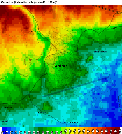
Below is the Elevation map of Carterton, which displays elevation range with different colors. Scale of the first map is from 69 to 126 m (226 to 413 ft) with average elevation of 92.9 meters (=305 ft) [note 1]
These maps also provides idea of topography and contour of this city, they are displayed at different zoom levels. More info about maps, scale and edge coordinates you can find below images.
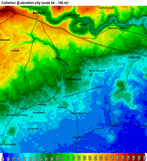
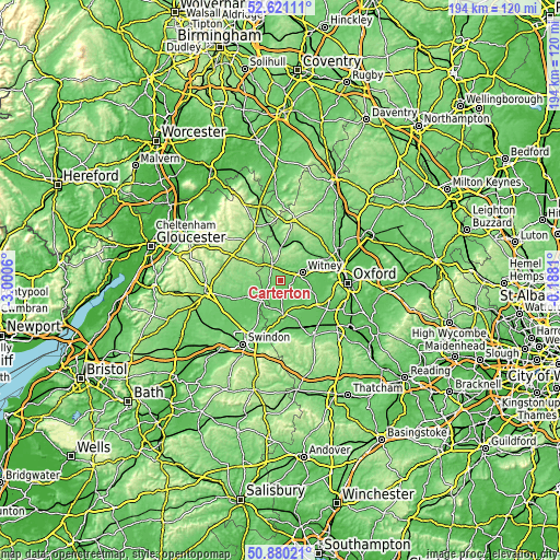
| \ | Map #1 | Map #2 | Topo.Map |
| Scale [m] | 69..126 m | 64..166 m | × |
| Scale [ft] | 226..413 ft | 210..545 ft | × |
| Average | 92.9 m = 305 ft | 95.6 m = 314 ft | × |
| Width | 6.05 km = 3.8 mi | 12.1 km = 7.5 mi | 193.6 km = 120.3 mi |
| Height | 6.05 km = 3.8 mi | 12.1 km = 7.5 mi | 193.6 km = 120.3 mi |
| ↑Max Latitude | 51.786243° | 51.813419° | 52.62111° |
| Latitude at center | 51.75905° | 51.75905° | 51.75905° |
| ↓Min Latitude | 51.731841° | 51.704616° | 50.88021° |
| ← Min Longitude | -1.638295° | -1.682241° | -3.0006° |
| Longitude center | -1.59435° | -1.59435° | -1.59435° |
| →Max Longitude | -1.550405° | -1.506459° | -0.1881° |
Nearby cities:
Cities around Carterton sort by population:
• Witney elevation 87 m
8 km,  69°
69°
• Faringdon 109 m
11.4 km,  177°
177°
• Fairford 92 m
14.1 km,  246°
246°
• Shipton under Wychwood 104 m
11.3 km,  358°
358°
• Bampton 73 m
5 km,  137°
137°
• Lechlade 79 m
9.8 km,  222°
222°
• Stanford in the Vale 77 m
14.6 km,  155°
155°
• Ducklington 80 m
7.6 km,  82°
82°
• North Leigh 139 m
12.2 km,  59°
59°
• Minster Lovell 120 m
4.9 km,  40°
40°
• Burford 107 m
6.3 km,  332°
332°
• Standlake 68 m
12.2 km,  106°
106°
Multilingual:
 En español:
Carterton elevación 93 m.
 En France:
Carterton élévation 93 m.
 Auf Deutsch:
Carterton höhe über dem Meeresspiegel ist 93 m.

Sources and notes:
- [note 1] Map square and city borders are not equal. Map elevation data is calculated only from area inside that square.
- [src 1] Elevation data from geonames database provided with same terms of usage.
- [src 2] The elevation map of Carterton is generated using elevation data from NASA's 3 arcsec (90m) resolution SRTM data.
- [src 3] Base (background) map © OpenStreetMap contributors tiles are generated by Geofabrik and OpenTopoMap.
Copyright & License:
This Carterton Elevation Map is licensed under CC BY-SA. You may reuse any part from this page, if you give a proper credit by linking to this URL:
 More info on terms of use page.