Conwy elevation
Conwy (Wales), United Kingdom elevation is 18 meters and Conwy elevation in feet is 59 ft above sea level [src 1]. Conwy is a seat of a second-order administrative division (feature code) with elevation that is 54 meters (177 ft) smaller than average city elevation in United Kingdom.
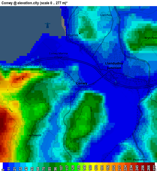
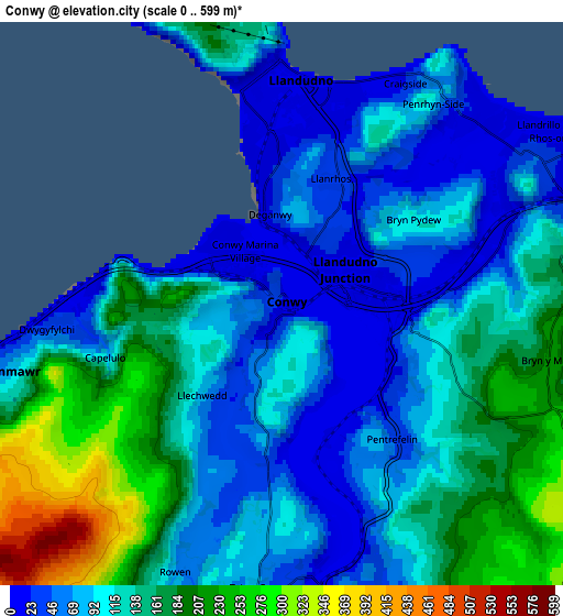
Below is the Elevation map of Conwy, which displays elevation range with different colors. Scale of the first map is from 0 to 277 m (0 to 909 ft) with average elevation of 54.4 meters (=178 ft) [note 1]
These maps also provides idea of topography and contour of this city, they are displayed at different zoom levels. More info about maps, scale and edge coordinates you can find below images.
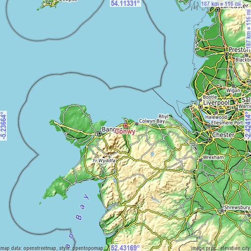
| \ | Map #1 | Map #2 | Topo.Map |
| Scale [m] | 0..277 m | 0..599 m | × |
| Scale [ft] | 0..909 ft | 0..1965 ft | × |
| Average | 54.4 m = 178 ft | 118.6 m = 389 ft | × |
| Width | 5.84 km = 3.6 mi | 11.69 km = 7.3 mi | 187 km = 116.2 mi |
| Height | 5.84 km = 3.6 mi | 11.69 km = 7.3 mi | 187 km = 116.2 mi |
| ↑Max Latitude | 53.307037° | 53.333287° | 54.11331° |
| Latitude at center | 53.28077° | 53.28077° | 53.28077° |
| ↓Min Latitude | 53.254487° | 53.228188° | 52.43169° |
| ← Min Longitude | -3.874335° | -3.918281° | -5.23664° |
| Longitude center | -3.83039° | -3.83039° | -3.83039° |
| →Max Longitude | -3.786445° | -3.742499° | -2.42414° |
Nearby cities:
Cities around Conwy sort by population:
• Colwyn Bay elevation 25 m
7.1 km,  77°
77°
• Abergele 18 m
16.5 km,  88°
88°
• Llandudno 10 m
4.9 km,  359°
359°
• Deganwy 47 m
2.6 km,  4°
4°
• Llanfairfechan 22 m
9.9 km,  255°
255°
• Llanrwst 17 m
15.8 km,  171°
171°
• Penmaenmawr 52 m
7 km, 257°
• Llansantffraid Glan Conwy 1 m
2.6 km,  127°
127°
• Llangoed 33 m
17.2 km,  274°
274°
• Aber 33 m
13.5 km,  246°
246°
• Llysfaen 173 m
10.9 km, 88°
• Mochdre 132 m
5.4 km, 86°
Multilingual:
 En español:
Conwy elevación 18 m.
 En France:
Conwy élévation 18 m.


Sources and notes:
- [note 1] Map square and city borders are not equal. Map elevation data is calculated only from area inside that square.
- [src 1] Elevation data from geonames database provided with same terms of usage.
- [src 2] The elevation map of Conwy is generated using elevation data from NASA's 3 arcsec (90m) resolution SRTM data.
- [src 3] Base (background) map © OpenStreetMap contributors tiles are generated by Geofabrik and OpenTopoMap.
Copyright & License:
This Conwy Elevation Map is licensed under CC BY-SA. You may reuse any part from this page, if you give a proper credit by linking to this URL:
 More info on terms of use page.