Coppull elevation
Coppull (England, Lancashire), United Kingdom elevation is 75 meters and Coppull elevation in feet is 246 ft above sea level [src 1]. Coppull is a populated place (feature code) with elevation that is 3 meters (10 ft) bigger than average city elevation in United Kingdom.
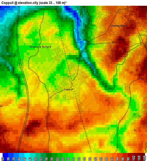
Below is the Elevation map of Coppull, which displays elevation range with different colors. Scale of the first map is from 33 to 108 m (108 to 354 ft) with average elevation of 78.6 meters (=258 ft) [note 1]
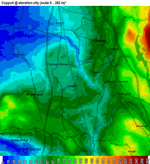
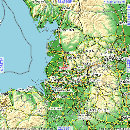
These maps also provides idea of topography and contour of this city, they are displayed at different zoom levels. More info about maps, scale and edge coordinates you can find below images.
| \ | Map #1 | Map #2 | Topo.Map |
| Scale [m] | 33..108 m | 9..262 m | × |
| Scale [ft] | 108..354 ft | 30..860 ft | × |
| Average | 78.6 m = 258 ft | 86.6 m = 284 ft | × |
| Width | 5.8 km = 3.6 mi | 11.59 km = 7.2 mi | 185.5 km = 115.3 mi |
| Height | 5.8 km = 3.6 mi | 11.59 km = 7.2 mi | 185.5 km = 115.3 mi |
| ↑Max Latitude | 53.651324° | 53.677363° | 54.45105° |
| Latitude at center | 53.62527° | 53.62527° | 53.62527° |
| ↓Min Latitude | 53.5992° | 53.573113° | 52.78301° |
| ← Min Longitude | -2.702485° | -2.746431° | -4.06479° |
| Longitude center | -2.65854° | -2.65854° | -2.65854° |
| →Max Longitude | -2.614595° | -2.570649° | -1.25229° |
Nearby cities:
Cities around Coppull sort by population:
• Leyland elevation 39 m
8.3 km,  346°
346°
• Chorley 105 m
3.9 km,  45°
45°
• Horwich 135 m
7.7 km,  110°
110°
• Clayton-le-Woods 63 m
8 km,  355°
355°
• Adlington 94 m
3.7 km, 111°
• Euxton 52 m
5.1 km, 346°
• Appley Bridge 21 m
6.7 km,  217°
217°
• Shevington 61 m
6.3 km,  201°
201°
• Blackrod 155 m
6.3 km,  125°
125°
• Eccleston 34 m
4.6 km,  294°
294°
• Parbold 17 m
8.3 km,  242°
242°
• Haigh 110 m
5.7 km,  119°
119°
Multilingual:
 En español:
Coppull elevación 75 m.
 En France:
Coppull élévation 75 m.


Sources and notes:
- [note 1] Map square and city borders are not equal. Map elevation data is calculated only from area inside that square.
- [src 1] Elevation data from geonames database provided with same terms of usage.
- [src 2] The elevation map of Coppull is generated using elevation data from NASA's 3 arcsec (90m) resolution SRTM data.
- [src 3] Base (background) map © OpenStreetMap contributors tiles are generated by Geofabrik and OpenTopoMap.
Copyright & License:
This Coppull Elevation Map is licensed under CC BY-SA. You may reuse any part from this page, if you give a proper credit by linking to this URL:
 More info on terms of use page.