Crediton elevation
Crediton (England, Devon), United Kingdom elevation is 43 meters and Crediton elevation in feet is 141 ft above sea level [src 1]. Crediton is a populated place (feature code) with elevation that is 29 meters (95 ft) smaller than average city elevation in United Kingdom.
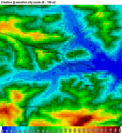
Below is the Elevation map of Crediton, which displays elevation range with different colors. Scale of the first map is from 28 to 190 m (92 to 623 ft) with average elevation of 79.6 meters (=261 ft) [note 1]
These maps also provides idea of topography and contour of this city, they are displayed at different zoom levels. More info about maps, scale and edge coordinates you can find below images.
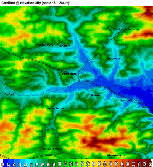
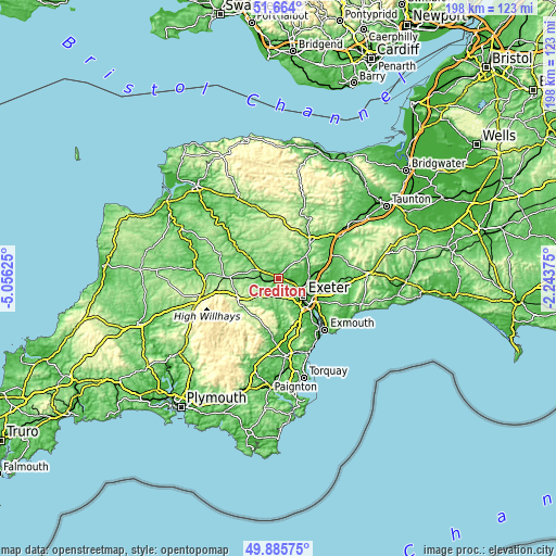
| \ | Map #1 | Map #2 | Topo.Map |
| Scale [m] | 28..190 m | 18..244 m | × |
| Scale [ft] | 92..623 ft | 59..801 ft | × |
| Average | 79.6 m = 261 ft | 104.5 m = 343 ft | × |
| Width | 6.18 km = 3.8 mi | 12.36 km = 7.7 mi | 197.7 km = 122.8 mi |
| Height | 6.18 km = 3.8 mi | 12.36 km = 7.7 mi | 197.7 km = 122.8 mi |
| ↑Max Latitude | 50.811106° | 50.838866° | 51.664° |
| Latitude at center | 50.78333° | 50.78333° | 50.78333° |
| ↓Min Latitude | 50.755537° | 50.727728° | 49.88575° |
| ← Min Longitude | -3.693945° | -3.737891° | -5.05625° |
| Longitude center | -3.65° | -3.65° | -3.65° |
| →Max Longitude | -3.606055° | -3.562109° | -2.24375° |
Nearby cities:
Cities around Crediton sort by population:
• Exeter elevation 46 m
10.9 km,  127°
127°
• Heavitree 36 m
12.9 km,  122°
122°
• Tiverton 63 m
17.3 km,  39°
39°
• Topsham 10 m
16.8 km, 130°
• Exminster 16 m
15.7 km,  136°
136°
• Bradninch 75 m
16.5 km,  73°
73°
• Silverton 84 m
12.3 km, 72°
• Moretonhampstead 202 m
15.8 km,  210°
210°
• Copplestone 110 m
7.4 km,  294°
294°
• Witheridge 186 m
15.4 km,  345°
345°
• Bow 127 m
11.9 km,  278°
278°
• Morchard Bishop 164 m
10.5 km,  318°
318°
Multilingual:
 En español:
Crediton elevación 43 m.
 En France:
Crediton élévation 43 m.


Sources and notes:
- [note 1] Map square and city borders are not equal. Map elevation data is calculated only from area inside that square.
- [src 1] Elevation data from geonames database provided with same terms of usage.
- [src 2] The elevation map of Crediton is generated using elevation data from NASA's 3 arcsec (90m) resolution SRTM data.
- [src 3] Base (background) map © OpenStreetMap contributors tiles are generated by Geofabrik and OpenTopoMap.
Copyright & License:
This Crediton Elevation Map is licensed under CC BY-SA. You may reuse any part from this page, if you give a proper credit by linking to this URL:
 More info on terms of use page.