Crofton elevation
Crofton (England, City and Borough of Wakefield), United Kingdom elevation is 64 meters and Crofton elevation in feet is 210 ft above sea level [src 1]. Crofton is a seat of a third-order administrative division (feature code) with elevation that is 8 meters (26 ft) smaller than average city elevation in United Kingdom.
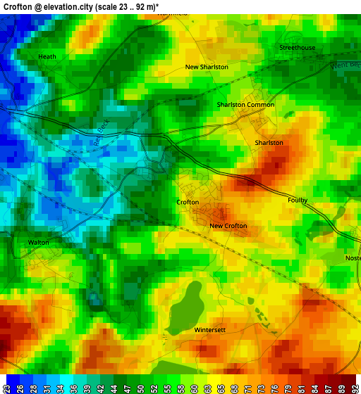
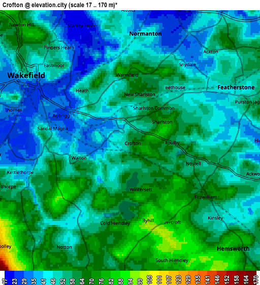
Below is the Elevation map of Crofton, which displays elevation range with different colors. Scale of the first map is from 23 to 92 m (75 to 302 ft) with average elevation of 56.3 meters (=185 ft) [note 1]
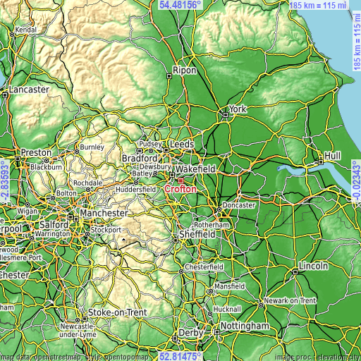
These maps also provides idea of topography and contour of this city, they are displayed at different zoom levels. More info about maps, scale and edge coordinates you can find below images.
| \ | Map #1 | Map #2 | Topo.Map |
| Scale [m] | 23..92 m | 17..170 m | × |
| Scale [ft] | 75..302 ft | 56..558 ft | × |
| Average | 56.3 m = 185 ft | 54.6 m = 179 ft | × |
| Width | 5.79 km = 3.6 mi | 11.58 km = 7.2 mi | 185.3 km = 115.1 mi |
| Height | 5.79 km = 3.6 mi | 11.58 km = 7.2 mi | 185.3 km = 115.1 mi |
| ↑Max Latitude | 53.682425° | 53.708444° | 54.48156° |
| Latitude at center | 53.65639° | 53.65639° | 53.65639° |
| ↓Min Latitude | 53.630339° | 53.604272° | 52.81475° |
| ← Min Longitude | -1.473625° | -1.517571° | -2.83593° |
| Longitude center | -1.42968° | -1.42968° | -1.42968° |
| →Max Longitude | -1.385735° | -1.341789° | -0.02343° |
Nearby cities:
Cities around Crofton sort by population:
• Wakefield elevation 50 m
5.4 km,  303°
303°
• Featherstone 48 m
5.3 km,  64°
64°
• Royston 69 m
6.4 km,  192°
192°
• Hemsworth 62 m
7 km,  134°
134°
• Ryhill 99 m
4 km,  161°
161°
• Fitzwilliam 65 m
4.4 km, 126°
• Sharlston 65 m
1.8 km,  36°
36°
• Low Ackworth 28 m
7 km,  95°
95°
• Notton 55 m
5.6 km,  210°
210°
• Crigglestone 71 m
6.7 km,  256°
256°
• Normanton 46 m
4.9 km,  10°
10°
• Walton 50 m
2.5 km,  250°
250°
Multilingual:
 En español:
Crofton elevación 64 m.
 En France:
Crofton élévation 64 m.


Sources and notes:
- [note 1] Map square and city borders are not equal. Map elevation data is calculated only from area inside that square.
- [src 1] Elevation data from geonames database provided with same terms of usage.
- [src 2] The elevation map of Crofton is generated using elevation data from NASA's 3 arcsec (90m) resolution SRTM data.
- [src 3] Base (background) map © OpenStreetMap contributors tiles are generated by Geofabrik and OpenTopoMap.
Copyright & License:
This Crofton Elevation Map is licensed under CC BY-SA. You may reuse any part from this page, if you give a proper credit by linking to this URL:
 More info on terms of use page.