Dorking elevation
Dorking (England, Surrey), United Kingdom elevation is 59 meters and Dorking elevation in feet is 194 ft above sea level [src 1]. Dorking is a populated place (feature code) with elevation that is 13 meters (43 ft) smaller than average city elevation in United Kingdom.
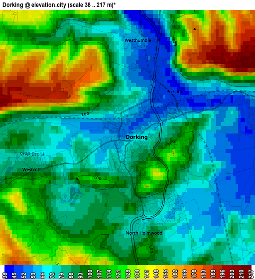
Below is the Elevation map of Dorking, which displays elevation range with different colors. Scale of the first map is from 38 to 217 m (125 to 712 ft) with average elevation of 97.4 meters (=320 ft) [note 1]
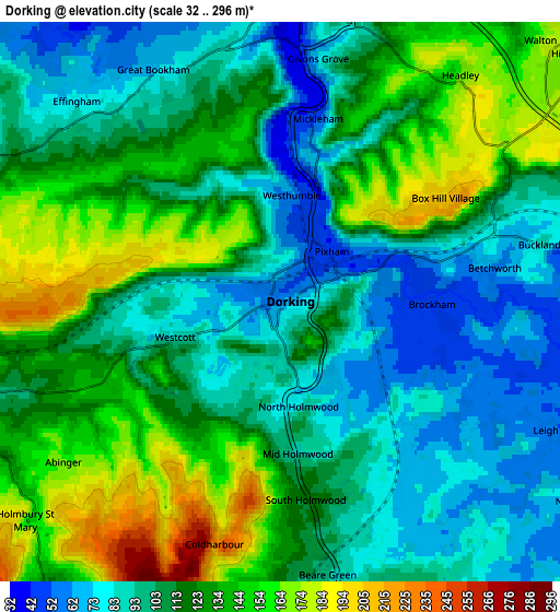
These maps also provides idea of topography and contour of this city, they are displayed at different zoom levels. More info about maps, scale and edge coordinates you can find below images.
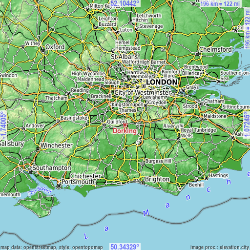
| \ | Map #1 | Map #2 | Topo.Map |
| Scale [m] | 38..217 m | 32..296 m | × |
| Scale [ft] | 125..712 ft | 105..971 ft | × |
| Average | 97.4 m = 320 ft | 115.6 m = 379 ft | × |
| Width | 6.12 km = 3.8 mi | 12.24 km = 7.6 mi | 195.8 km = 121.7 mi |
| Height | 6.12 km = 3.8 mi | 12.24 km = 7.6 mi | 195.8 km = 121.7 mi |
| ↑Max Latitude | 51.259789° | 51.287281° | 52.10442° |
| Latitude at center | 51.23228° | 51.23228° | 51.23228° |
| ↓Min Latitude | 51.204755° | 51.177213° | 50.34329° |
| ← Min Longitude | -0.377745° | -0.421691° | -1.74005° |
| Longitude center | -0.3338° | -0.3338° | -0.3338° |
| →Max Longitude | -0.289855° | -0.245909° | 1.07245° |
Nearby cities:
Cities around Dorking sort by population:
• Reigate elevation 85 m
8.9 km,  86°
86°
• Leatherhead 41 m
7.1 km,  0°
0°
• Ashtead 75 m
8.8 km,  15°
15°
• Great Bookham 68 m
5.9 km,  331°
331°
• Tadworth 171 m
9.5 km,  45°
45°
• East Horsley 72 m
8.2 km,  303°
303°
• Peaslake 130 m
9.1 km,  240°
240°
• Westcott 95 m
2.8 km,  251°
251°
• Lower Kingswood 178 m
9.4 km,  63°
63°
• West Horsley 90 m
9 km,  290°
290°
• Capel 89 m
9.2 km,  175°
175°
• Holmwood 100 m
5.8 km,  171°
171°
Multilingual:
 En español:
Dorking elevación 59 m.
 En France:
Dorking élévation 59 m.


Sources and notes:
- [note 1] Map square and city borders are not equal. Map elevation data is calculated only from area inside that square.
- [src 1] Elevation data from geonames database provided with same terms of usage.
- [src 2] The elevation map of Dorking is generated using elevation data from NASA's 3 arcsec (90m) resolution SRTM data.
- [src 3] Base (background) map © OpenStreetMap contributors tiles are generated by Geofabrik and OpenTopoMap.
Copyright & License:
This Dorking Elevation Map is licensed under CC BY-SA. You may reuse any part from this page, if you give a proper credit by linking to this URL:
 More info on terms of use page.