Dungannon elevation
Dungannon (Northern Ireland, Mid Ulster), United Kingdom elevation is 105 meters and Dungannon elevation in feet is 344 ft above sea level [src 1]. Dungannon is a seat of a second-order administrative division (feature code) with elevation that is 33 meters (108 ft) bigger than average city elevation in United Kingdom.
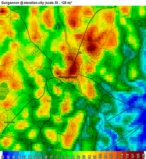
Below is the Elevation map of Dungannon, which displays elevation range with different colors. Scale of the first map is from 39 to 128 m (128 to 420 ft) with average elevation of 81.2 meters (=266 ft) [note 1]
These maps also provides idea of topography and contour of this city, they are displayed at different zoom levels. More info about maps, scale and edge coordinates you can find below images.
| \ | Map #1 | Map #2 | Topo.Map |
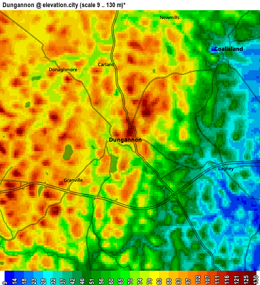
| Scale [m] | 39..128 m | 9..130 m | × |
| Scale [ft] | 128..420 ft | 30..427 ft | × |
| Average | 81.2 m = 266 ft | 70.3 m = 231 ft | × |
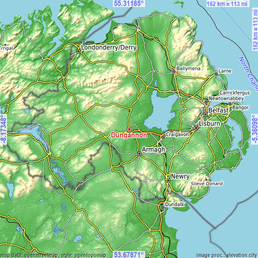
| Width | 5.67 km = 3.5 mi | 11.35 km = 7.1 mi | 181.6 km = 112.8 mi |
| Height | 5.67 km = 3.5 mi | 11.35 km = 7.1 mi | 181.6 km = 112.8 mi |
| ↑Max Latitude | 54.528949° | 54.554442° | 55.31185° |
| Latitude at center | 54.50344° | 54.50344° | 54.50344° |
| ↓Min Latitude | 54.477915° | 54.452374° | 53.67871° |
| ← Min Longitude | -6.811175° | -6.855121° | -8.17348° |
| Longitude center | -6.76723° | -6.76723° | -6.76723° |
| →Max Longitude | -6.723285° | -6.679339° | -5.36098° |
Nearby cities:
Cities around Dungannon sort by population:
• Craigavon elevation 34 m
25.4 km,  104°
104°
• Portadown 22 m
22.7 km,  113°
113°
• Armagh 37 m
18.3 km,  159°
159°
• Cookstown 78 m
15.6 km,  5°
5°
• Magherafelt 76 m
29.7 km,  20°
20°
• Coalisland 34 m
6 km,  44°
44°
• Keady 148 m
28.5 km,  171°
171°
• Tandragee 63 m
28.2 km,  125°
125°
• Waringstown 50 m
31.2 km, 104°
• Gilford 28 m
30 km,  119°
119°
• Moneymore 48 m
21.9 km, 16°
• Moy 19 m
8.8 km, 132°
Multilingual:
 En español:
Dungannon elevación 105 m.
 En France:
Dungannon élévation 105 m.
 Auf Deutsch:
Dungannon höhe über dem Meeresspiegel ist 105 m.

Sources and notes:
- [note 1] Map square and city borders are not equal. Map elevation data is calculated only from area inside that square.
- [src 1] Elevation data from geonames database provided with same terms of usage.
- [src 2] The elevation map of Dungannon is generated using elevation data from NASA's 3 arcsec (90m) resolution SRTM data.
- [src 3] Base (background) map © OpenStreetMap contributors tiles are generated by Geofabrik and OpenTopoMap.
Copyright & License:
This Dungannon Elevation Map is licensed under CC BY-SA. You may reuse any part from this page, if you give a proper credit by linking to this URL:
 More info on terms of use page.