Garforth elevation
Garforth (England, City and Borough of Leeds), United Kingdom elevation is 77 meters and Garforth elevation in feet is 253 ft above sea level [src 1]. Garforth is a populated place (feature code) with elevation that is 5 meters (16 ft) bigger than average city elevation in United Kingdom.
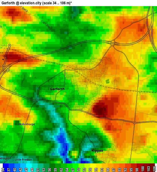
Below is the Elevation map of Garforth, which displays elevation range with different colors. Scale of the first map is from 34 to 106 m (112 to 348 ft) with average elevation of 72.8 meters (=239 ft) [note 1]
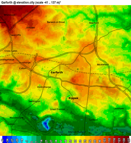
These maps also provides idea of topography and contour of this city, they are displayed at different zoom levels. More info about maps, scale and edge coordinates you can find below images.
| \ | Map #1 | Map #2 | Topo.Map |
| Scale [m] | 34..106 m | -41..137 m | × |
| Scale [ft] | 112..348 ft | -135..449 ft | × |
| Average | 72.8 m = 239 ft | 61.6 m = 202 ft | × |
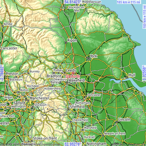
| Width | 5.77 km = 3.6 mi | 11.55 km = 7.2 mi | 184.7 km = 114.8 mi |
| Height | 5.77 km = 3.6 mi | 11.55 km = 7.2 mi | 184.7 km = 114.8 mi |
| ↑Max Latitude | 53.817681° | 53.843617° | 54.61423° |
| Latitude at center | 53.79173° | 53.79173° | 53.79173° |
| ↓Min Latitude | 53.765762° | 53.739779° | 52.95278° |
| ← Min Longitude | -1.424615° | -1.468561° | -2.78692° |
| Longitude center | -1.38067° | -1.38067° | -1.38067° |
| →Max Longitude | -1.336725° | -1.292779° | 0.02558° |
Nearby cities:
Cities around Garforth sort by population:
• Castleford elevation 15 m
7.4 km,  170°
170°
• Kippax 71 m
2.8 km, 167°
• Sherburn in Elmet 12 m
8.8 km,  87°
87°
• Swillington 59 m
3.5 km,  223°
223°
• Scholes 101 m
4.7 km,  318°
318°
• South Milford 13 m
9 km,  100°
100°
• Aberford 47 m
4.6 km,  33°
33°
• Thorner 87 m
8.3 km,  338°
338°
• Shadwell 127 m
9.2 km, 319°
• Methley 21 m
7.1 km,  191°
191°
• Ledsham 50 m
5.7 km,  123°
123°
• Ledston 26 m
5 km,  150°
150°
Multilingual:
 En español:
Garforth elevación 77 m.
 En France:
Garforth élévation 77 m.


Sources and notes:
- [note 1] Map square and city borders are not equal. Map elevation data is calculated only from area inside that square.
- [src 1] Elevation data from geonames database provided with same terms of usage.
- [src 2] The elevation map of Garforth is generated using elevation data from NASA's 3 arcsec (90m) resolution SRTM data.
- [src 3] Base (background) map © OpenStreetMap contributors tiles are generated by Geofabrik and OpenTopoMap.
Copyright & License:
This Garforth Elevation Map is licensed under CC BY-SA. You may reuse any part from this page, if you give a proper credit by linking to this URL:
 More info on terms of use page.