Grantham elevation
Grantham (England, Lincolnshire), United Kingdom elevation is 64 meters and Grantham elevation in feet is 210 ft above sea level [src 1]. Grantham is a populated place (feature code) with elevation that is 8 meters (26 ft) smaller than average city elevation in United Kingdom.
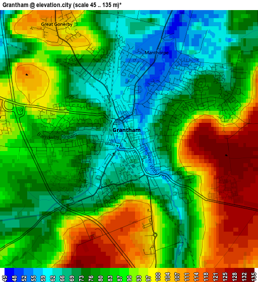
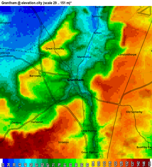
Below is the Elevation map of Grantham, which displays elevation range with different colors. Scale of the first map is from 45 to 135 m (148 to 443 ft) with average elevation of 85.1 meters (=279 ft) [note 1]
These maps also provides idea of topography and contour of this city, they are displayed at different zoom levels. More info about maps, scale and edge coordinates you can find below images.
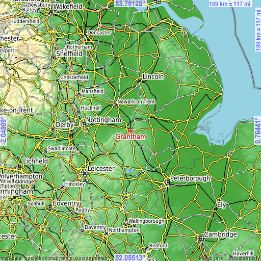
| \ | Map #1 | Map #2 | Topo.Map |
| Scale [m] | 45..135 m | 29..151 m | × |
| Scale [ft] | 148..443 ft | 95..495 ft | × |
| Average | 85.1 m = 279 ft | 90.4 m = 297 ft | × |
| Width | 5.89 km = 3.7 mi | 11.79 km = 7.3 mi | 188.6 km = 117.2 mi |
| Height | 5.89 km = 3.7 mi | 11.79 km = 7.3 mi | 188.6 km = 117.2 mi |
| ↑Max Latitude | 52.937983° | 52.96446° | 53.75125° |
| Latitude at center | 52.91149° | 52.91149° | 52.91149° |
| ↓Min Latitude | 52.884981° | 52.858455° | 52.05513° |
| ← Min Longitude | -0.685785° | -0.729731° | -2.04809° |
| Longitude center | -0.64184° | -0.64184° | -0.64184° |
| →Max Longitude | -0.597895° | -0.553949° | 0.76441° |
Nearby cities:
Cities around Grantham sort by population:
• Sleaford elevation 17 m
18.3 km,  58°
58°
• Great Gonerby 106 m
3.1 km,  327°
327°
• Bottesford 35 m
11.1 km,  287°
287°
• Long Bennington 32 m
12 km,  319°
319°
• Barrowby 107 m
3.3 km,  279°
279°
• Aslockton 26 m
17.7 km, 285°
• South Witham 107 m
16.3 km,  176°
176°
• Claypole 25 m
14.7 km,  335°
335°
• Caythorpe 55 m
12 km,  13°
13°
• Ancaster 46 m
10.6 km,  41°
41°
• Colsterworth 105 m
11.7 km,  173°
173°
• Corby Glen 77 m
13.8 km,  142°
142°
Multilingual:
 En español:
Grantham elevación 64 m.
 En France:
Grantham élévation 64 m.


Sources and notes:
- [note 1] Map square and city borders are not equal. Map elevation data is calculated only from area inside that square.
- [src 1] Elevation data from geonames database provided with same terms of usage.
- [src 2] The elevation map of Grantham is generated using elevation data from NASA's 3 arcsec (90m) resolution SRTM data.
- [src 3] Base (background) map © OpenStreetMap contributors tiles are generated by Geofabrik and OpenTopoMap.
Copyright & License:
This Grantham Elevation Map is licensed under CC BY-SA. You may reuse any part from this page, if you give a proper credit by linking to this URL:
 More info on terms of use page.