Hinton elevation
Hinton (England, South Gloucestershire), United Kingdom elevation is 110 meters and Hinton elevation in feet is 361 ft above sea level [src 1]. Hinton is a populated place (feature code) with elevation that is 38 meters (125 ft) bigger than average city elevation in United Kingdom.
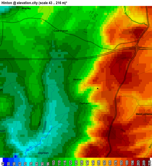
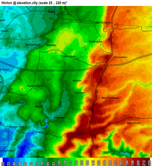
Below is the Elevation map of Hinton, which displays elevation range with different colors. Scale of the first map is from 43 to 216 m (141 to 709 ft) with average elevation of 133.2 meters (=437 ft) [note 1]
These maps also provides idea of topography and contour of this city, they are displayed at different zoom levels. More info about maps, scale and edge coordinates you can find below images.
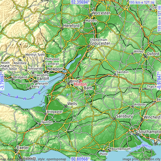
| \ | Map #1 | Map #2 | Topo.Map |
| Scale [m] | 43..216 m | 25..220 m | × |
| Scale [ft] | 141..709 ft | 82..722 ft | × |
| Average | 133.2 m = 437 ft | 124.8 m = 409 ft | × |
| Width | 6.08 km = 3.8 mi | 12.17 km = 7.6 mi | 194.7 km = 121 mi |
| Height | 6.08 km = 3.8 mi | 12.17 km = 7.6 mi | 194.7 km = 121 mi |
| ↑Max Latitude | 51.517075° | 51.544413° | 52.35694° |
| Latitude at center | 51.48972° | 51.48972° | 51.48972° |
| ↓Min Latitude | 51.462349° | 51.434962° | 50.60568° |
| ← Min Longitude | -2.428665° | -2.472611° | -3.79097° |
| Longitude center | -2.38472° | -2.38472° | -2.38472° |
| →Max Longitude | -2.340775° | -2.296829° | -0.97847° |
Nearby cities:
Cities around Hinton sort by population:
• Mangotsfield elevation 74 m
8.3 km,  268°
268°
• Chipping Sodbury 99 m
5.4 km,  353°
353°
• Yate 80 m
6.1 km,  337°
337°
• Pucklechurch 113 m
3.4 km,  262°
262°
• Wick 74 m
4.9 km,  213°
213°
• Marshfield 186 m
5.4 km,  124°
124°
• Bitton 19 m
8.9 km,  215°
215°
• Horton 110 m
7.9 km,  16°
16°
• North Wraxall 130 m
8.6 km,  102°
102°
• Nettleton 130 m
8.6 km,  80°
80°
• Siston 79 m
4.8 km,  249°
249°
• Cold Ashton 201 m
4.6 km,  159°
159°
Multilingual:
 En español:
Hinton elevación 110 m.
 En France:
Hinton élévation 110 m.


Sources and notes:
- [note 1] Map square and city borders are not equal. Map elevation data is calculated only from area inside that square.
- [src 1] Elevation data from geonames database provided with same terms of usage.
- [src 2] The elevation map of Hinton is generated using elevation data from NASA's 3 arcsec (90m) resolution SRTM data.
- [src 3] Base (background) map © OpenStreetMap contributors tiles are generated by Geofabrik and OpenTopoMap.
Copyright & License:
This Hinton Elevation Map is licensed under CC BY-SA. You may reuse any part from this page, if you give a proper credit by linking to this URL:
 More info on terms of use page.