Horbury elevation
Horbury (England, City and Borough of Wakefield), United Kingdom elevation is 77 meters and Horbury elevation in feet is 253 ft above sea level [src 1]. Horbury is a populated place (feature code) with elevation that is 5 meters (16 ft) bigger than average city elevation in United Kingdom.
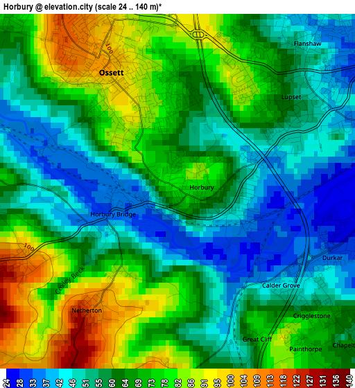
Below is the Elevation map of Horbury, which displays elevation range with different colors. Scale of the first map is from 24 to 140 m (79 to 459 ft) with average elevation of 64.3 meters (=211 ft) [note 1]
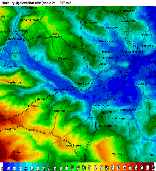
These maps also provides idea of topography and contour of this city, they are displayed at different zoom levels. More info about maps, scale and edge coordinates you can find below images.
| \ | Map #1 | Map #2 | Topo.Map |
| Scale [m] | 24..140 m | 21..217 m | × |
| Scale [ft] | 79..459 ft | 69..712 ft | × |
| Average | 64.3 m = 211 ft | 82.3 m = 270 ft | × |
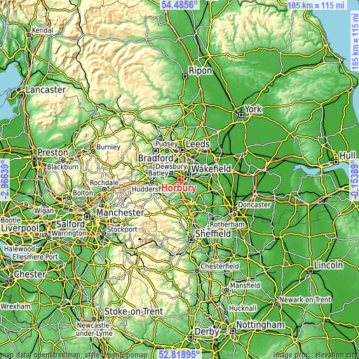
| Width | 5.79 km = 3.6 mi | 11.58 km = 7.2 mi | 185.3 km = 115.1 mi |
| Height | 5.79 km = 3.6 mi | 11.58 km = 7.2 mi | 185.3 km = 115.1 mi |
| ↑Max Latitude | 53.686543° | 53.712559° | 54.4856° |
| Latitude at center | 53.66051° | 53.66051° | 53.66051° |
| ↓Min Latitude | 53.634461° | 53.608397° | 52.81895° |
| ← Min Longitude | -1.604085° | -1.648031° | -2.96639° |
| Longitude center | -1.56014° | -1.56014° | -1.56014° |
| →Max Longitude | -1.516195° | -1.472249° | -0.15389° |
Nearby cities:
Cities around Horbury sort by population:
• Wakefield elevation 50 m
4.8 km,  58°
58°
• Dewsbury 44 m
5.7 km,  306°
306°
• Batley 58 m
6.8 km, 314°
• Ossett 105 m
2.5 km,  328°
328°
• Clayton West 127 m
8 km,  204°
204°
• Middlestown 109 m
2.7 km,  246°
246°
• Emley 192 m
7 km,  222°
222°
• Flockton 154 m
6.2 km,  237°
237°
• Notton 55 m
7.9 km,  132°
132°
• Woolley 117 m
6 km,  150°
150°
• Walton 50 m
6.3 km,  101°
101°
• Crigglestone 71 m
2.9 km, 134°
Multilingual:
 En español:
Horbury elevación 77 m.
 En France:
Horbury élévation 77 m.


Sources and notes:
- [note 1] Map square and city borders are not equal. Map elevation data is calculated only from area inside that square.
- [src 1] Elevation data from geonames database provided with same terms of usage.
- [src 2] The elevation map of Horbury is generated using elevation data from NASA's 3 arcsec (90m) resolution SRTM data.
- [src 3] Base (background) map © OpenStreetMap contributors tiles are generated by Geofabrik and OpenTopoMap.
Copyright & License:
This Horbury Elevation Map is licensed under CC BY-SA. You may reuse any part from this page, if you give a proper credit by linking to this URL:
 More info on terms of use page.