Kiveton Park elevation
Kiveton Park (England, Rotherham), United Kingdom elevation is 103 meters and Kiveton Park elevation in feet is 338 ft above sea level [src 1]. Kiveton Park is a populated place (feature code) with elevation that is 31 meters (102 ft) bigger than average city elevation in United Kingdom.
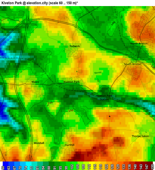
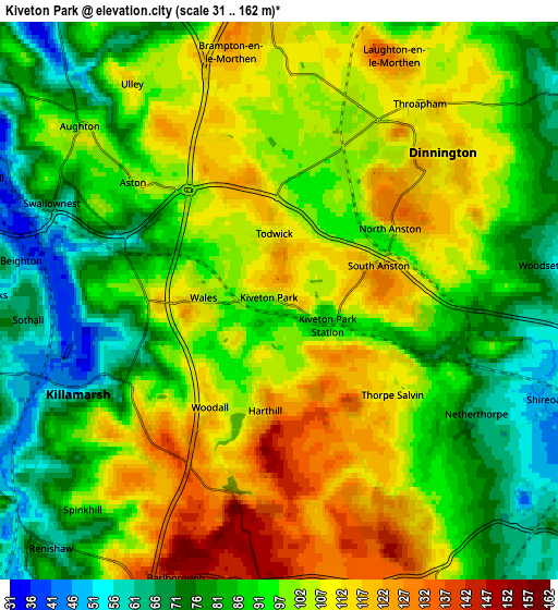
Below is the Elevation map of Kiveton Park, which displays elevation range with different colors. Scale of the first map is from 60 to 150 m (197 to 492 ft) with average elevation of 106.6 meters (=350 ft) [note 1]
These maps also provides idea of topography and contour of this city, they are displayed at different zoom levels. More info about maps, scale and edge coordinates you can find below images.
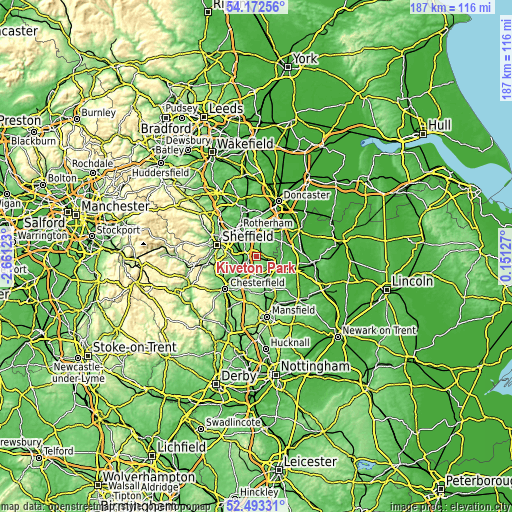
| \ | Map #1 | Map #2 | Topo.Map |
| Scale [m] | 60..150 m | 31..162 m | × |
| Scale [ft] | 197..492 ft | 102..531 ft | × |
| Average | 106.6 m = 350 ft | 95.8 m = 314 ft | × |
| Width | 5.83 km = 3.6 mi | 11.67 km = 7.3 mi | 186.7 km = 116 mi |
| Height | 5.83 km = 3.6 mi | 11.67 km = 7.3 mi | 186.7 km = 116 mi |
| ↑Max Latitude | 53.367429° | 53.393643° | 54.17256° |
| Latitude at center | 53.3412° | 53.3412° | 53.3412° |
| ↓Min Latitude | 53.314954° | 53.288693° | 52.49331° |
| ← Min Longitude | -1.298925° | -1.342871° | -2.66123° |
| Longitude center | -1.25498° | -1.25498° | -1.25498° |
| →Max Longitude | -1.211035° | -1.167089° | 0.15127° |
Nearby cities:
Cities around Kiveton Park sort by population:
• Dinnington elevation 116 m
4.6 km,  52°
52°
• Beighton 52 m
5.3 km,  260°
260°
• Killamarsh 50 m
4.5 km,  244°
244°
• Clowne 134 m
7.4 km,  184°
184°
• Wales 110 m
1.8 km,  267°
267°
• Whitwell 106 m
6.9 km,  158°
158°
• Treeton 59 m
8.1 km,  307°
307°
• Barlborough 141 m
6.3 km,  200°
200°
• Woodsetts 62 m
5.6 km,  82°
82°
• Harthill 107 m
2.8 km, 195°
• Todwick 108 m
1.4 km,  355°
355°
• Ulley 112 m
5.5 km,  325°
325°
Multilingual:
 En español:
Kiveton Park elevación 103 m.
 En France:
Kiveton Park élévation 103 m.
 Auf Deutsch:
Kiveton Park höhe über dem Meeresspiegel ist 103 m.

Sources and notes:
- [note 1] Map square and city borders are not equal. Map elevation data is calculated only from area inside that square.
- [src 1] Elevation data from geonames database provided with same terms of usage.
- [src 2] The elevation map of Kiveton Park is generated using elevation data from NASA's 3 arcsec (90m) resolution SRTM data.
- [src 3] Base (background) map © OpenStreetMap contributors tiles are generated by Geofabrik and OpenTopoMap.
Copyright & License:
This Kiveton Park Elevation Map is licensed under CC BY-SA. You may reuse any part from this page, if you give a proper credit by linking to this URL:
 More info on terms of use page.