Launceston elevation
Launceston (England, Cornwall), United Kingdom elevation is 135 meters and Launceston elevation in feet is 443 ft above sea level [src 1]. Launceston is a seat of a third-order administrative division (feature code) with elevation that is 63 meters (207 ft) bigger than average city elevation in United Kingdom.
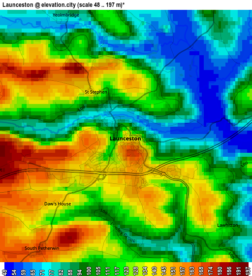
Below is the Elevation map of Launceston, which displays elevation range with different colors. Scale of the first map is from 48 to 197 m (157 to 646 ft) with average elevation of 111.9 meters (=367 ft) [note 1]
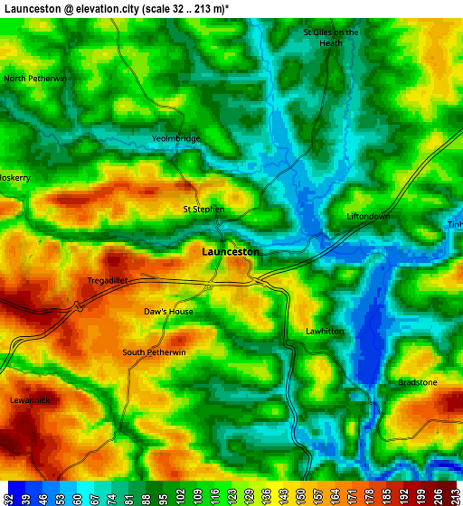
These maps also provides idea of topography and contour of this city, they are displayed at different zoom levels. More info about maps, scale and edge coordinates you can find below images.
| \ | Map #1 | Map #2 | Topo.Map |
| Scale [m] | 48..197 m | 32..213 m | × |
| Scale [ft] | 157..646 ft | 105..699 ft | × |
| Average | 111.9 m = 367 ft | 113.6 m = 373 ft | × |
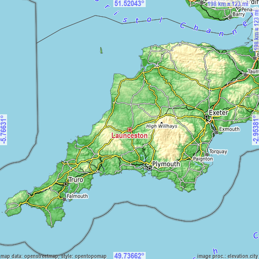
| Width | 6.2 km = 3.9 mi | 12.4 km = 7.7 mi | 198.3 km = 123.2 mi |
| Height | 6.2 km = 3.9 mi | 12.4 km = 7.7 mi | 198.3 km = 123.2 mi |
| ↑Max Latitude | 50.664853° | 50.6927° | 51.52043° |
| Latitude at center | 50.63699° | 50.63699° | 50.63699° |
| ↓Min Latitude | 50.60911° | 50.581214° | 49.73662° |
| ← Min Longitude | -4.404005° | -4.447951° | -5.76631° |
| Longitude center | -4.36006° | -4.36006° | -4.36006° |
| →Max Longitude | -4.316115° | -4.272169° | -2.95381° |
Nearby cities:
Cities around Launceston sort by population:
• Tavistock elevation 85 m
18.1 km,  122°
122°
• Callington 161 m
15.4 km,  167°
167°
• Gunnislake 53 m
16.2 km,  140°
140°
• Holsworthy 138 m
19.5 km,  1°
1°
• Pensilva 232 m
15.4 km,  194°
194°
• Lifton 75 m
5.5 km,  82°
82°
• Jacobstow 99 m
17.1 km,  308°
308°
• South Hill 137 m
11.5 km,  176°
176°
• North Hill 123 m
11 km,  208°
208°
• Trewen 191 m
7.9 km,  253°
253°
• Boyton 133 m
7.2 km,  346°
346°
• Werrington 102 m
3.3 km, 351°
Multilingual:
 En español:
Launceston elevación 135 m.
 En France:
Launceston élévation 135 m.
 Auf Deutsch:
Launceston höhe über dem Meeresspiegel ist 135 m.

Sources and notes:
- [note 1] Map square and city borders are not equal. Map elevation data is calculated only from area inside that square.
- [src 1] Elevation data from geonames database provided with same terms of usage.
- [src 2] The elevation map of Launceston is generated using elevation data from NASA's 3 arcsec (90m) resolution SRTM data.
- [src 3] Base (background) map © OpenStreetMap contributors tiles are generated by Geofabrik and OpenTopoMap.
Copyright & License:
This Launceston Elevation Map is licensed under CC BY-SA. You may reuse any part from this page, if you give a proper credit by linking to this URL:
 More info on terms of use page.