Lingfield elevation
Lingfield (England, Surrey), United Kingdom elevation is 67 meters and Lingfield elevation in feet is 220 ft above sea level [src 1]. Lingfield is a populated place (feature code) with elevation that is 5 meters (16 ft) smaller than average city elevation in United Kingdom.
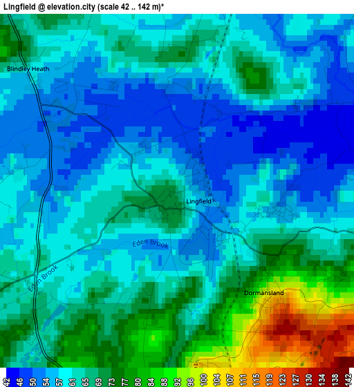
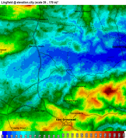
Below is the Elevation map of Lingfield, which displays elevation range with different colors. Scale of the first map is from 42 to 142 m (138 to 466 ft) with average elevation of 64 meters (=210 ft) [note 1]
These maps also provides idea of topography and contour of this city, they are displayed at different zoom levels. More info about maps, scale and edge coordinates you can find below images.
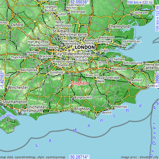
| \ | Map #1 | Map #2 | Topo.Map |
| Scale [m] | 42..142 m | 39..170 m | × |
| Scale [ft] | 138..466 ft | 128..558 ft | × |
| Average | 64 m = 210 ft | 78.6 m = 258 ft | × |
| Width | 6.13 km = 3.8 mi | 12.25 km = 7.6 mi | 196.1 km = 121.9 mi |
| Height | 6.13 km = 3.8 mi | 12.25 km = 7.6 mi | 196 km = 121.8 mi |
| ↑Max Latitude | 51.204732° | 51.232257° | 52.05038° |
| Latitude at center | 51.17719° | 51.17719° | 51.17719° |
| ↓Min Latitude | 51.149632° | 51.122057° | 50.28714° |
| ← Min Longitude | -0.059525° | -0.103471° | -1.42183° |
| Longitude center | -0.01558° | -0.01558° | -0.01558° |
| →Max Longitude | 0.028365° | 0.072311° | 1.39067° |
Nearby cities:
Cities around Lingfield sort by population:
• East Grinstead elevation 137 m
6 km,  173°
173°
• Horley 56 m
10 km,  268°
268°
• Oxted 108 m
8.9 km,  4°
4°
• Edenbridge 46 m
6 km,  74°
74°
• Copthorne 76 m
8.3 km,  239°
239°
• Crawley Down 118 m
7.6 km,  214°
214°
• Forest Row 74 m
9.6 km,  159°
159°
• Godstone 104 m
8.7 km,  334°
334°
• Dormansland 104 m
2.4 km,  141°
141°
• Bletchingley 143 m
9.2 km,  320°
320°
• Blindley Heath 57 m
3.1 km,  306°
306°
• Felbridge 94 m
4.6 km,  202°
202°
Multilingual:
 En español:
Lingfield elevación 67 m.
 En France:
Lingfield élévation 67 m.
 Auf Deutsch:
Lingfield höhe über dem Meeresspiegel ist 67 m.

Sources and notes:
- [note 1] Map square and city borders are not equal. Map elevation data is calculated only from area inside that square.
- [src 1] Elevation data from geonames database provided with same terms of usage.
- [src 2] The elevation map of Lingfield is generated using elevation data from NASA's 3 arcsec (90m) resolution SRTM data.
- [src 3] Base (background) map © OpenStreetMap contributors tiles are generated by Geofabrik and OpenTopoMap.
Copyright & License:
This Lingfield Elevation Map is licensed under CC BY-SA. You may reuse any part from this page, if you give a proper credit by linking to this URL:
 More info on terms of use page.