Maldon elevation
Maldon (England, Essex), United Kingdom elevation is 34 meters and Maldon elevation in feet is 112 ft above sea level [src 1]. Maldon is a populated place (feature code) with elevation that is 38 meters (125 ft) smaller than average city elevation in United Kingdom.
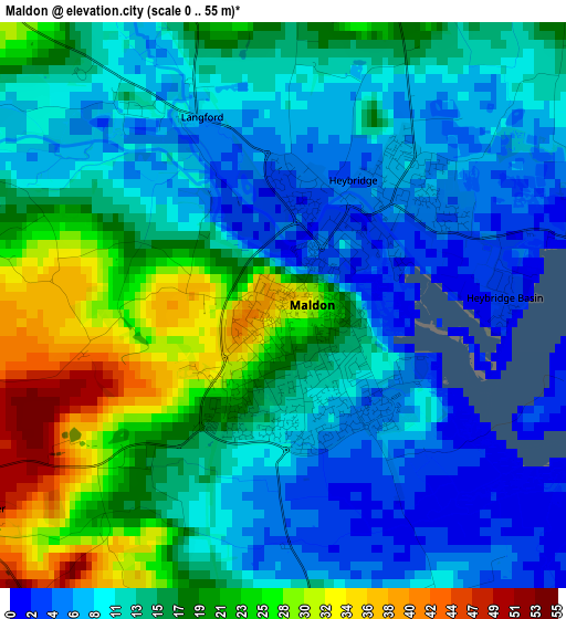
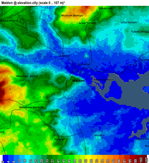
Below is the Elevation map of Maldon, which displays elevation range with different colors. Scale of the first map is from 0 to 55 m (0 to 180 ft) with average elevation of 14.6 meters (=48 ft) [note 1]
These maps also provides idea of topography and contour of this city, they are displayed at different zoom levels. More info about maps, scale and edge coordinates you can find below images.
| \ | Map #1 | Map #2 | Topo.Map |
| Scale [m] | 0..55 m | 0..107 m | × |
| Scale [ft] | 0..180 ft | 0..351 ft | × |
| Average | 14.6 m = 48 ft | 26 m = 85 ft | × |
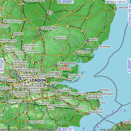
| Width | 6.05 km = 3.8 mi | 12.11 km = 7.5 mi | 193.7 km = 120.4 mi |
| Height | 6.05 km = 3.8 mi | 12.11 km = 7.5 mi | 193.7 km = 120.4 mi |
| ↑Max Latitude | 51.758309° | 51.785503° | 52.59369° |
| Latitude at center | 51.7311° | 51.7311° | 51.7311° |
| ↓Min Latitude | 51.703874° | 51.676632° | 50.85172° |
| ← Min Longitude | 0.630685° | 0.586739° | -0.73162° |
| Longitude center | 0.67463° | 0.67463° | 0.67463° |
| →Max Longitude | 0.718575° | 0.762521° | 2.08088° |
Nearby cities:
Cities around Maldon sort by population:
• Witham elevation 25 m
8 km,  342°
342°
• Tiptree 56 m
10.3 km,  28°
28°
• Danbury 106 m
6.6 km,  255°
255°
• Hatfield Peverel 46 m
7.4 km,  312°
312°
• Wickham Bishops 75 m
5.3 km,  355°
355°
• Mayland 8 m
8.5 km,  131°
131°
• Boreham 37 m
9.7 km,  288°
288°
• Bicknacre 51 m
7.4 km,  236°
236°
• Latchingdon and Snoreham 11 m
7.5 km,  151°
151°
• Cold Norton 46 m
6.6 km,  182°
182°
• Althorne 48 m
10.1 km,  144°
144°
• Tolleshunt Knights 52 m
10.3 km,  43°
43°
Multilingual:
 En español:
Maldon elevación 34 m.
 En France:
Maldon élévation 34 m.


Sources and notes:
- [note 1] Map square and city borders are not equal. Map elevation data is calculated only from area inside that square.
- [src 1] Elevation data from geonames database provided with same terms of usage.
- [src 2] The elevation map of Maldon is generated using elevation data from NASA's 3 arcsec (90m) resolution SRTM data.
- [src 3] Base (background) map © OpenStreetMap contributors tiles are generated by Geofabrik and OpenTopoMap.
Copyright & License:
This Maldon Elevation Map is licensed under CC BY-SA. You may reuse any part from this page, if you give a proper credit by linking to this URL:
 More info on terms of use page.