Maryport elevation
Maryport (England, Cumbria), United Kingdom elevation is 11 meters and Maryport elevation in feet is 36 ft above sea level [src 1]. Maryport is a populated place (feature code) with elevation that is 61 meters (200 ft) smaller than average city elevation in United Kingdom.
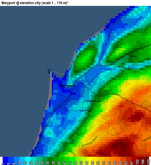
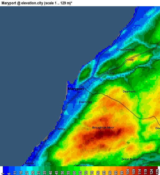
Below is the Elevation map of Maryport, which displays elevation range with different colors. Scale of the first map is from 1 to 110 m (3 to 361 ft) with average elevation of 45 meters (=148 ft) [note 1]
These maps also provides idea of topography and contour of this city, they are displayed at different zoom levels. More info about maps, scale and edge coordinates you can find below images.
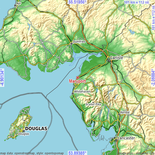
| \ | Map #1 | Map #2 | Topo.Map |
| Scale [m] | 1..110 m | 1..129 m | × |
| Scale [ft] | 3..361 ft | 3..423 ft | × |
| Average | 45 m = 148 ft | 55.8 m = 183 ft | × |
| Width | 5.65 km = 3.5 mi | 11.29 km = 7 mi | 180.7 km = 112.3 mi |
| Height | 5.65 km = 3.5 mi | 11.29 km = 7 mi | 180.6 km = 112.2 mi |
| ↑Max Latitude | 54.739717° | 54.765079° | 55.51856° |
| Latitude at center | 54.71434° | 54.71434° | 54.71434° |
| ↓Min Latitude | 54.688947° | 54.663538° | 53.89385° |
| ← Min Longitude | -3.539035° | -3.582981° | -4.90134° |
| Longitude center | -3.49509° | -3.49509° | -3.49509° |
| →Max Longitude | -3.451145° | -3.407199° | -2.08884° |
Nearby cities:
Cities around Maryport sort by population:
• Workington elevation 20 m
8.6 km,  201°
201°
• Whitehaven 19 m
19.3 km, 197°
• Cockermouth 55 m
10.4 km,  123°
123°
• Cleator Moor 92 m
21.5 km,  183°
183°
• Wigton 33 m
24.7 km,  60°
60°
• Silloth 11 m
18.6 km,  22°
22°
• Aspatria 72 m
12.2 km, 61°
• Dearham 61 m
3.3 km,  94°
94°
• Frizington 142 m
19.2 km, 179°
• Flimby 7 m
3.2 km,  211°
211°
• Saint Bees 19 m
25.5 km,  193°
193°
• Distington 76 m
13.3 km, 192°
Multilingual:
 En español:
Maryport elevación 11 m.
 En France:
Maryport élévation 11 m.


Sources and notes:
- [note 1] Map square and city borders are not equal. Map elevation data is calculated only from area inside that square.
- [src 1] Elevation data from geonames database provided with same terms of usage.
- [src 2] The elevation map of Maryport is generated using elevation data from NASA's 3 arcsec (90m) resolution SRTM data.
- [src 3] Base (background) map © OpenStreetMap contributors tiles are generated by Geofabrik and OpenTopoMap.
Copyright & License:
This Maryport Elevation Map is licensed under CC BY-SA. You may reuse any part from this page, if you give a proper credit by linking to this URL:
 More info on terms of use page.