Murton elevation
Murton (England, County Durham), United Kingdom elevation is 133 meters and Murton elevation in feet is 436 ft above sea level [src 1]. Murton is a seat of a third-order administrative division (feature code) with elevation that is 61 meters (200 ft) bigger than average city elevation in United Kingdom.
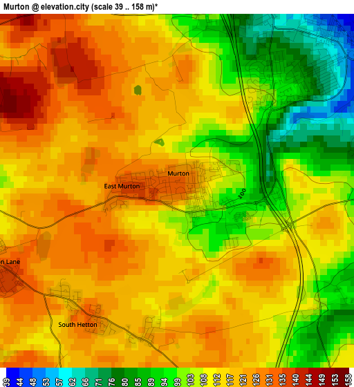
Below is the Elevation map of Murton, which displays elevation range with different colors. Scale of the first map is from 39 to 158 m (128 to 518 ft) with average elevation of 111.8 meters (=367 ft) [note 1]
These maps also provides idea of topography and contour of this city, they are displayed at different zoom levels. More info about maps, scale and edge coordinates you can find below images.
| \ | Map #1 | Map #2 | Topo.Map |
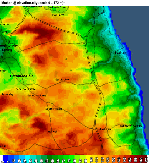
| Scale [m] | 39..158 m | 0..172 m | × |
| Scale [ft] | 128..518 ft | 0..564 ft | × |
| Average | 111.8 m = 367 ft | 104.1 m = 342 ft | × |
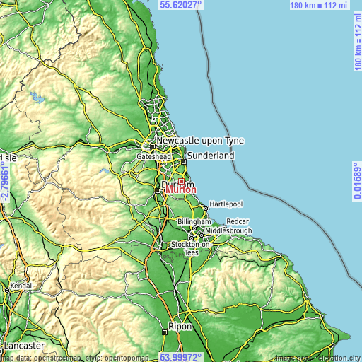
| Width | 5.63 km = 3.5 mi | 11.26 km = 7 mi | 180.2 km = 112 mi |
| Height | 5.63 km = 3.5 mi | 11.26 km = 7 mi | 180.2 km = 112 mi |
| ↑Max Latitude | 54.843432° | 54.868729° | 55.62027° |
| Latitude at center | 54.81812° | 54.81812° | 54.81812° |
| ↓Min Latitude | 54.792792° | 54.767448° | 53.99972° |
| ← Min Longitude | -1.434305° | -1.478251° | -2.79661° |
| Longitude center | -1.39036° | -1.39036° | -1.39036° |
| →Max Longitude | -1.346415° | -1.302469° | 0.01589° |
Nearby cities:
Cities around Murton sort by population:
• Houghton-Le-Spring elevation 79 m
5.3 km,  297°
297°
• Seaham 43 m
3.7 km,  50°
50°
• Ryhope 49 m
6.1 km,  12°
12°
• Hetton-Le-Hole 91 m
3.8 km,  267°
267°
• Easington 134 m
4.2 km,  151°
151°
• South Hetton 119 m
2.4 km,  206°
206°
• Haswell 141 m
4.2 km,  203°
203°
• East Rainton 96 m
5.8 km,  277°
277°
• Hawthorn 80 m
3.3 km,  127°
127°
• Pittington 129 m
6.3 km,  251°
251°
• Easington Colliery 89 m
5.2 km, 130°
• Shotton 127 m
4.2 km,  158°
158°
Multilingual:
 En español:
Murton elevación 133 m.
 En France:
Murton élévation 133 m.


Sources and notes:
- [note 1] Map square and city borders are not equal. Map elevation data is calculated only from area inside that square.
- [src 1] Elevation data from geonames database provided with same terms of usage.
- [src 2] The elevation map of Murton is generated using elevation data from NASA's 3 arcsec (90m) resolution SRTM data.
- [src 3] Base (background) map © OpenStreetMap contributors tiles are generated by Geofabrik and OpenTopoMap.
Copyright & License:
This Murton Elevation Map is licensed under CC BY-SA. You may reuse any part from this page, if you give a proper credit by linking to this URL:
 More info on terms of use page.