Neyland elevation
Neyland (Wales, Pembrokeshire), United Kingdom elevation is 44 meters and Neyland elevation in feet is 144 ft above sea level [src 1]. Neyland is a populated place (feature code) with elevation that is 28 meters (92 ft) smaller than average city elevation in United Kingdom.
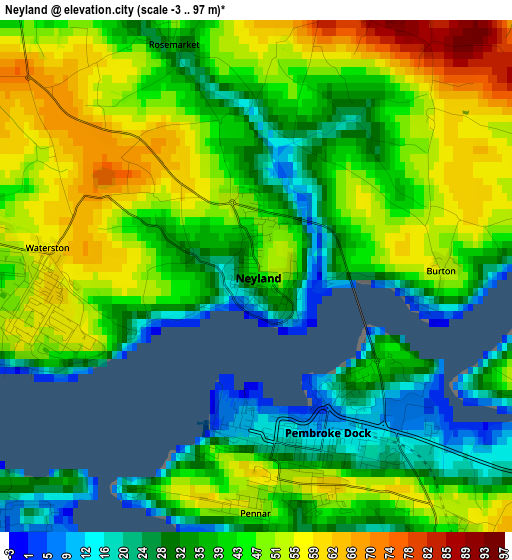
Below is the Elevation map of Neyland, which displays elevation range with different colors. Scale of the first map is from -3 to 97 m (-10 to 318 ft) with average elevation of 42.4 meters (=139 ft) [note 1]
These maps also provides idea of topography and contour of this city, they are displayed at different zoom levels. More info about maps, scale and edge coordinates you can find below images.
| \ | Map #1 | Map #2 | Topo.Map |
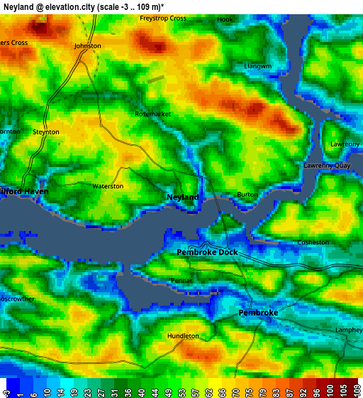
| Scale [m] | -3..97 m | -3..109 m | × |
| Scale [ft] | -10..318 ft | -10..358 ft | × |
| Average | 42.4 m = 139 ft | 44.4 m = 146 ft | × |
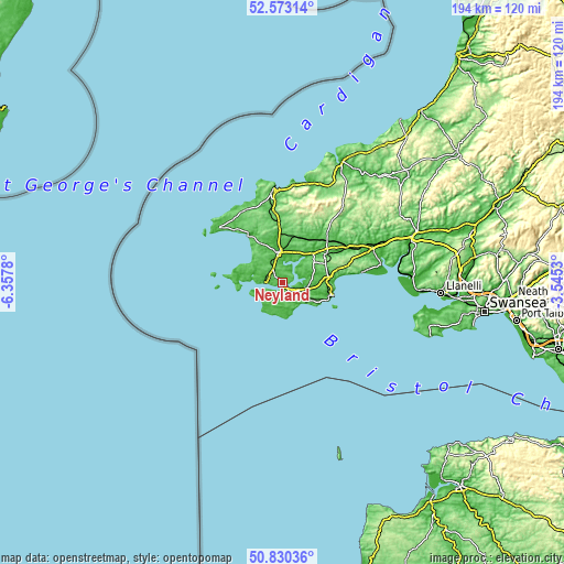
| Width | 6.06 km = 3.8 mi | 12.11 km = 7.5 mi | 193.8 km = 120.4 mi |
| Height | 6.06 km = 3.8 mi | 12.11 km = 7.5 mi | 193.8 km = 120.4 mi |
| ↑Max Latitude | 51.737362° | 51.764568° | 52.57314° |
| Latitude at center | 51.71014° | 51.71014° | 51.71014° |
| ↓Min Latitude | 51.682902° | 51.655647° | 50.83036° |
| ← Min Longitude | -4.995495° | -5.039441° | -6.3578° |
| Longitude center | -4.95155° | -4.95155° | -4.95155° |
| →Max Longitude | -4.907605° | -4.863659° | -3.5453° |
Nearby cities:
Cities around Neyland sort by population:
• Milford Haven elevation 33 m
5.7 km,  272°
272°
• Pembroke Dock 21 m
2.2 km,  159°
159°
• Pembroke 19 m
4.8 km,  145°
145°
• Steynton 64 m
5 km,  295°
295°
• Johnston 69 m
5.9 km,  328°
328°
• Llangwm 27 m
5 km,  31°
31°
• Hook 38 m
6.3 km,  12°
12°
• Hundleton 68 m
4.8 km,  178°
178°
• Herbrandston 58 m
9.5 km,  280°
280°
• Castlemartin 54 m
8.5 km,  212°
212°
• Freystrop 72 m
5.9 km,  354°
354°
• Burton 54 m
2.1 km,  73°
73°
Multilingual:
 En español:
Neyland elevación 44 m.
 En France:
Neyland élévation 44 m.


Sources and notes:
- [note 1] Map square and city borders are not equal. Map elevation data is calculated only from area inside that square.
- [src 1] Elevation data from geonames database provided with same terms of usage.
- [src 2] The elevation map of Neyland is generated using elevation data from NASA's 3 arcsec (90m) resolution SRTM data.
- [src 3] Base (background) map © OpenStreetMap contributors tiles are generated by Geofabrik and OpenTopoMap.
Copyright & License:
This Neyland Elevation Map is licensed under CC BY-SA. You may reuse any part from this page, if you give a proper credit by linking to this URL:
 More info on terms of use page.