Pontycymer elevation
Pontycymer (Wales, Bridgend county borough), United Kingdom elevation is 159 meters and Pontycymer elevation in feet is 522 ft above sea level [src 1]. Pontycymer is a populated place (feature code) with elevation that is 87 meters (285 ft) bigger than average city elevation in United Kingdom.
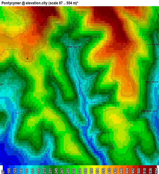
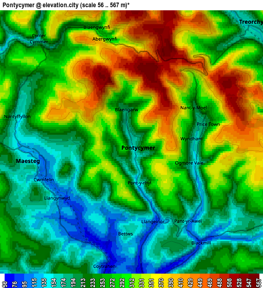
Below is the Elevation map of Pontycymer, which displays elevation range with different colors. Scale of the first map is from 87 to 554 m (285 to 1818 ft) with average elevation of 296 meters (=971 ft) [note 1]
These maps also provides idea of topography and contour of this city, they are displayed at different zoom levels. More info about maps, scale and edge coordinates you can find below images.
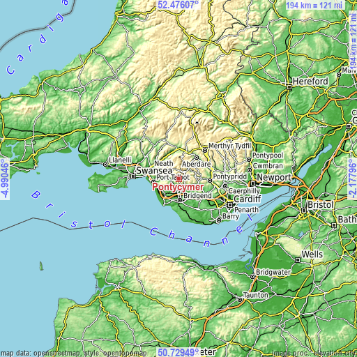
| \ | Map #1 | Map #2 | Topo.Map |
| Scale [m] | 87..554 m | 56..567 m | × |
| Scale [ft] | 285..1818 ft | 184..1860 ft | × |
| Average | 296 m = 971 ft | 271.9 m = 892 ft | × |
| Width | 6.07 km = 3.8 mi | 12.14 km = 7.5 mi | 194.2 km = 120.7 mi |
| Height | 6.07 km = 3.8 mi | 12.14 km = 7.5 mi | 194.2 km = 120.7 mi |
| ↑Max Latitude | 51.638462° | 51.665727° | 52.47607° |
| Latitude at center | 51.61118° | 51.61118° | 51.61118° |
| ↓Min Latitude | 51.583882° | 51.556568° | 50.72949° |
| ← Min Longitude | -3.628155° | -3.672101° | -4.99046° |
| Longitude center | -3.58421° | -3.58421° | -3.58421° |
| →Max Longitude | -3.540265° | -3.496319° | -2.17796° |
Nearby cities:
Cities around Pontycymer sort by population:
• Maesteg elevation 129 m
5.1 km,  267°
267°
• Treorchy 161 m
7.6 km,  45°
45°
• Pentre 165 m
8 km, 53°
• Gilfach Goch 208 m
8 km,  105°
105°
• Ogmore Vale 148 m
3.1 km, 108°
• Price Town 183 m
3.4 km,  76°
76°
• Betws 136 m
4.7 km,  183°
183°
• Croeserw 271 m
5.4 km,  313°
313°
• Pont Rhyd-y-cyff 136 m
4.5 km,  233°
233°
• Blaengwynfi 264 m
5.2 km,  344°
344°
• Treherbert 187 m
7.7 km,  29°
29°
• Clydach Vale 249 m
7.4 km, 76°
Multilingual:
 En español:
Pontycymer elevación 159 m.
 En France:
Pontycymer élévation 159 m.
 Auf Deutsch:
Pontycymer höhe über dem Meeresspiegel ist 159 m.

Sources and notes:
- [note 1] Map square and city borders are not equal. Map elevation data is calculated only from area inside that square.
- [src 1] Elevation data from geonames database provided with same terms of usage.
- [src 2] The elevation map of Pontycymer is generated using elevation data from NASA's 3 arcsec (90m) resolution SRTM data.
- [src 3] Base (background) map © OpenStreetMap contributors tiles are generated by Geofabrik and OpenTopoMap.
Copyright & License:
This Pontycymer Elevation Map is licensed under CC BY-SA. You may reuse any part from this page, if you give a proper credit by linking to this URL:
 More info on terms of use page.