Prestonpans elevation
Prestonpans (Scotland, East Lothian), United Kingdom elevation is 18 meters and Prestonpans elevation in feet is 59 ft above sea level [src 1]. Prestonpans is a populated place (feature code) with elevation that is 54 meters (177 ft) smaller than average city elevation in United Kingdom.
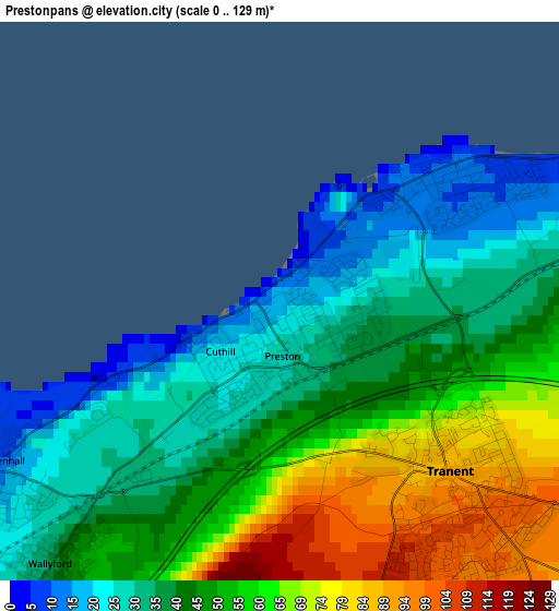
Below is the Elevation map of Prestonpans, which displays elevation range with different colors. Scale of the first map is from 0 to 129 m (0 to 423 ft) with average elevation of 46.9 meters (=154 ft) [note 1]
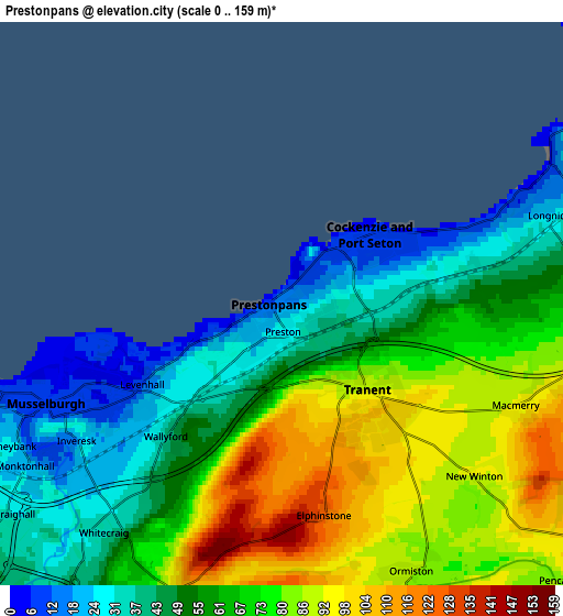
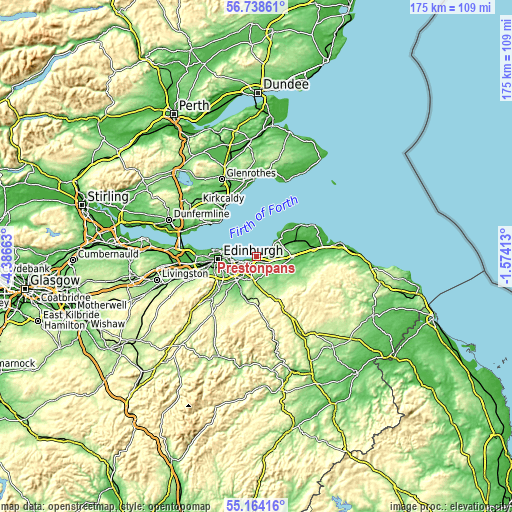
These maps also provides idea of topography and contour of this city, they are displayed at different zoom levels. More info about maps, scale and edge coordinates you can find below images.
| \ | Map #1 | Map #2 | Topo.Map |
| Scale [m] | 0..129 m | 0..159 m | × |
| Scale [ft] | 0..423 ft | 0..522 ft | × |
| Average | 46.9 m = 154 ft | 63.2 m = 207 ft | × |
| Width | 5.47 km = 3.4 mi | 10.94 km = 6.8 mi | 175.1 km = 108.8 mi |
| Height | 5.47 km = 3.4 mi | 10.94 km = 6.8 mi | 175 km = 108.7 mi |
| ↑Max Latitude | 55.983982° | 56.008558° | 56.73861° |
| Latitude at center | 55.95939° | 55.95939° | 55.95939° |
| ↓Min Latitude | 55.934782° | 55.910159° | 55.16416° |
| ← Min Longitude | -3.024325° | -3.068271° | -4.38663° |
| Longitude center | -2.98038° | -2.98038° | -2.98038° |
| →Max Longitude | -2.936435° | -2.892489° | -1.57413° |
Nearby cities:
Cities around Prestonpans sort by population:
• Musselburgh elevation 9 m
4.8 km,  245°
245°
• Mayfield 156 m
10.4 km,  200°
200°
• Dalkeith 58 m
9.2 km,  216°
216°
• Tranent 90 m
2.3 km,  135°
135°
• Cockenzie 7 m
1.3 km,  43°
43°
• Danderhall 83 m
9.5 km,  238°
238°
• Longniddry 22 m
5.5 km,  71°
71°
• Ormiston 88 m
5.7 km,  153°
153°
• Pencaitland 90 m
7.9 km, 137°
• Macmerry 95 m
5.1 km,  114°
114°
• Whitecraig 32 m
5.9 km, 220°
• Aberlady 12 m
9.4 km,  54°
54°
Multilingual:
 En español:
Prestonpans elevación 18 m.
 En France:
Prestonpans élévation 18 m.
 Auf Deutsch:
Prestonpans höhe über dem Meeresspiegel ist 18 m.

Sources and notes:
- [note 1] Map square and city borders are not equal. Map elevation data is calculated only from area inside that square.
- [src 1] Elevation data from geonames database provided with same terms of usage.
- [src 2] The elevation map of Prestonpans is generated using elevation data from NASA's 3 arcsec (90m) resolution SRTM data.
- [src 3] Base (background) map © OpenStreetMap contributors tiles are generated by Geofabrik and OpenTopoMap.
Copyright & License:
This Prestonpans Elevation Map is licensed under CC BY-SA. You may reuse any part from this page, if you give a proper credit by linking to this URL:
 More info on terms of use page.