Radstock elevation
Radstock (England, Bath and North East Somerset), United Kingdom elevation is 110 meters and Radstock elevation in feet is 361 ft above sea level [src 1]. Radstock is a populated place (feature code) with elevation that is 38 meters (125 ft) bigger than average city elevation in United Kingdom.
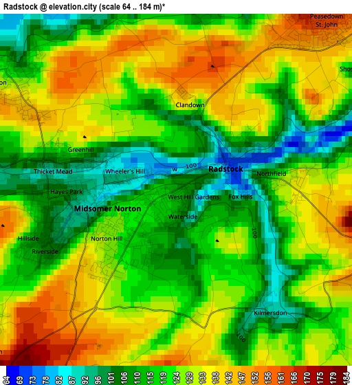
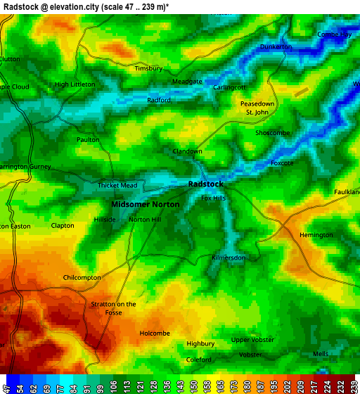
Below is the Elevation map of Radstock, which displays elevation range with different colors. Scale of the first map is from 64 to 184 m (210 to 604 ft) with average elevation of 123.9 meters (=406 ft) [note 1]
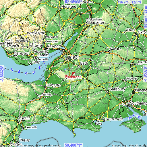
These maps also provides idea of topography and contour of this city, they are displayed at different zoom levels. More info about maps, scale and edge coordinates you can find below images.
| \ | Map #1 | Map #2 | Topo.Map |
| Scale [m] | 64..184 m | 47..239 m | × |
| Scale [ft] | 210..604 ft | 154..784 ft | × |
| Average | 123.9 m = 406 ft | 135.4 m = 444 ft | × |
| Width | 6.11 km = 3.8 mi | 12.22 km = 7.6 mi | 195.6 km = 121.5 mi |
| Height | 6.11 km = 3.8 mi | 12.22 km = 7.6 mi | 195.6 km = 121.5 mi |
| ↑Max Latitude | 51.316095° | 51.343554° | 52.15968° |
| Latitude at center | 51.28862° | 51.28862° | 51.28862° |
| ↓Min Latitude | 51.261128° | 51.233621° | 50.40071° |
| ← Min Longitude | -2.503975° | -2.547921° | -3.86628° |
| Longitude center | -2.46003° | -2.46003° | -2.46003° |
| →Max Longitude | -2.416085° | -2.372139° | -1.05378° |
Nearby cities:
Cities around Radstock sort by population:
• Midsomer Norton elevation 95 m
1.8 km,  259°
259°
• Peasedown Saint John 165 m
4 km,  38°
38°
• Paulton 124 m
3.3 km,  302°
302°
• Clutton 120 m
7.3 km,  308°
308°
• Timsbury 141 m
4.2 km,  341°
341°
• Chilcompton 143 m
4.2 km,  228°
228°
• Cameley 110 m
7.6 km,  293°
293°
• Bishop Sutton 69 m
10.7 km, 298°
• Wellow 84 m
7.2 km,  56°
56°
• Priston 86 m
6.2 km,  13°
13°
• Hinton Charterhouse 140 m
9.9 km,  66°
66°
• Camerton 109 m
3.1 km, 5°
Multilingual:
 En español:
Radstock elevación 110 m.
 En France:
Radstock élévation 110 m.
 Auf Deutsch:
Radstock höhe über dem Meeresspiegel ist 110 m.

Sources and notes:
- [note 1] Map square and city borders are not equal. Map elevation data is calculated only from area inside that square.
- [src 1] Elevation data from geonames database provided with same terms of usage.
- [src 2] The elevation map of Radstock is generated using elevation data from NASA's 3 arcsec (90m) resolution SRTM data.
- [src 3] Base (background) map © OpenStreetMap contributors tiles are generated by Geofabrik and OpenTopoMap.
Copyright & License:
This Radstock Elevation Map is licensed under CC BY-SA. You may reuse any part from this page, if you give a proper credit by linking to this URL:
 More info on terms of use page.