Rottingdean elevation
Rottingdean (England, Brighton and Hove), United Kingdom elevation is 37 meters and Rottingdean elevation in feet is 121 ft above sea level [src 1]. Rottingdean is a seat of a third-order administrative division (feature code) with elevation that is 35 meters (115 ft) smaller than average city elevation in United Kingdom.
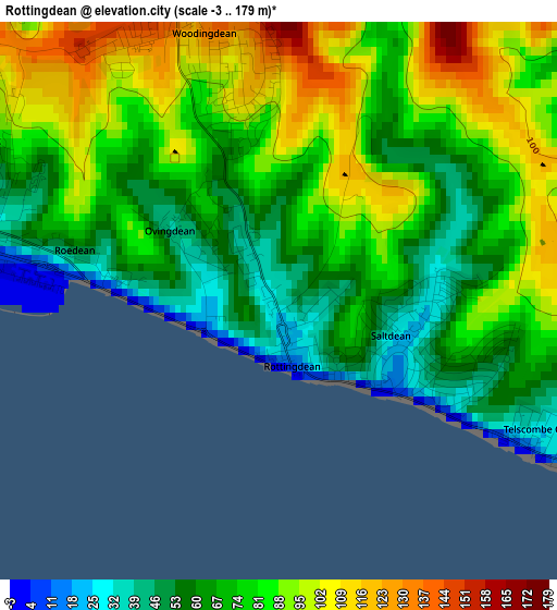
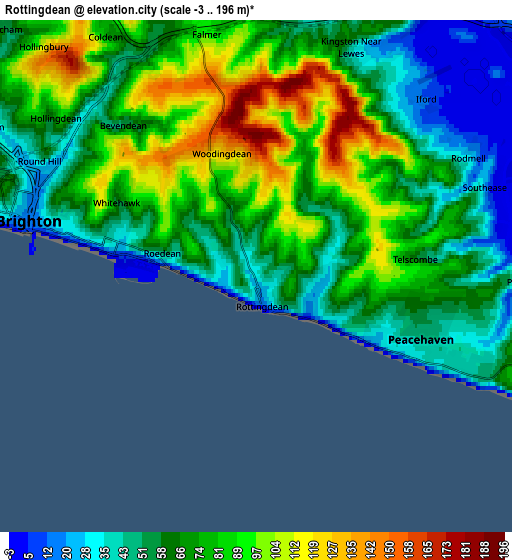
Below is the Elevation map of Rottingdean, which displays elevation range with different colors. Scale of the first map is from -3 to 179 m (-10 to 587 ft) with average elevation of 76.2 meters (=250 ft) [note 1]
These maps also provides idea of topography and contour of this city, they are displayed at different zoom levels. More info about maps, scale and edge coordinates you can find below images.
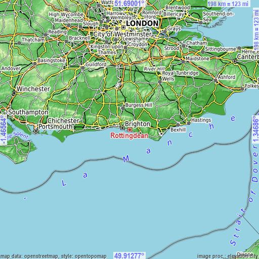
| \ | Map #1 | Map #2 | Topo.Map |
| Scale [m] | -3..179 m | -3..196 m | × |
| Scale [ft] | -10..587 ft | -10..643 ft | × |
| Average | 76.2 m = 250 ft | 70.2 m = 230 ft | × |
| Width | 6.18 km = 3.8 mi | 12.35 km = 7.7 mi | 197.6 km = 122.8 mi |
| Height | 6.18 km = 3.8 mi | 12.35 km = 7.7 mi | 197.6 km = 122.8 mi |
| ↑Max Latitude | 50.837601° | 50.865345° | 51.69001° |
| Latitude at center | 50.80984° | 50.80984° | 50.80984° |
| ↓Min Latitude | 50.782063° | 50.754269° | 49.91277° |
| ← Min Longitude | -0.103335° | -0.147281° | -1.46564° |
| Longitude center | -0.05939° | -0.05939° | -0.05939° |
| →Max Longitude | -0.015445° | 0.028501° | 1.34686° |
Nearby cities:
Cities around Rottingdean sort by population:
• Brighton elevation 29 m
6 km,  290°
290°
• Hove 24 m
7.9 km, 287°
• Seaford 10 m
12.2 km,  110°
110°
• Portslade 40 m
11.6 km, 288°
• Peacehaven 35 m
4.2 km,  117°
117°
• Lewes 27 m
8.6 km,  33°
33°
• Newhaven 2 m
8.2 km,  100°
100°
• Hassocks 55 m
15.1 km,  330°
330°
• Ringmer 28 m
12.2 km,  41°
41°
• Ditchling 63 m
13 km,  342°
342°
• Plumpton Green 36 m
13.8 km,  359°
359°
• South Chailey 38 m
14.5 km,  10°
10°
Multilingual:
 En español:
Rottingdean elevación 37 m.
 En France:
Rottingdean élévation 37 m.
 Auf Deutsch:
Rottingdean höhe über dem Meeresspiegel ist 37 m.

Sources and notes:
- [note 1] Map square and city borders are not equal. Map elevation data is calculated only from area inside that square.
- [src 1] Elevation data from geonames database provided with same terms of usage.
- [src 2] The elevation map of Rottingdean is generated using elevation data from NASA's 3 arcsec (90m) resolution SRTM data.
- [src 3] Base (background) map © OpenStreetMap contributors tiles are generated by Geofabrik and OpenTopoMap.
Copyright & License:
This Rottingdean Elevation Map is licensed under CC BY-SA. You may reuse any part from this page, if you give a proper credit by linking to this URL:
 More info on terms of use page.