Saint Leonards-on-Sea elevation
Saint Leonards-on-Sea (England, East Sussex), United Kingdom elevation is 50 meters and Saint Leonards-on-Sea elevation in feet is 164 ft above sea level [src 1]. Saint Leonards-on-Sea is a populated place (feature code) with elevation that is 22 meters (72 ft) smaller than average city elevation in United Kingdom.
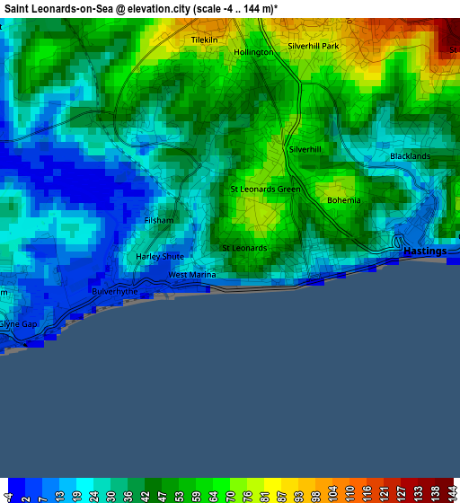
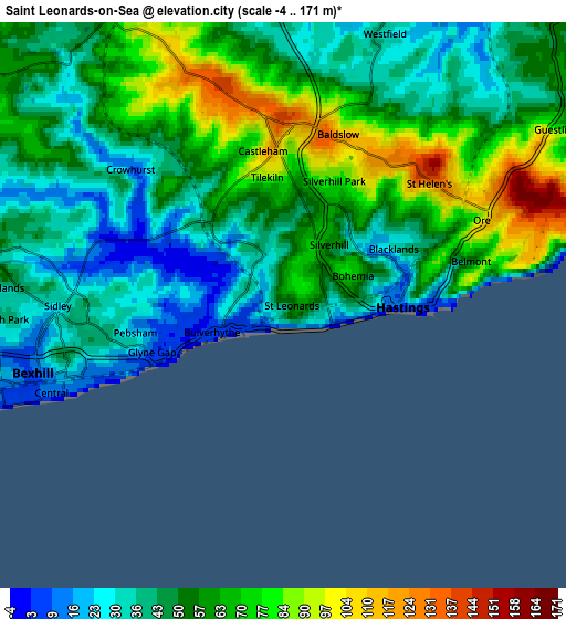
Below is the Elevation map of Saint Leonards-on-Sea, which displays elevation range with different colors. Scale of the first map is from -4 to 144 m (-13 to 472 ft) with average elevation of 40.7 meters (=134 ft) [note 1]
These maps also provides idea of topography and contour of this city, they are displayed at different zoom levels. More info about maps, scale and edge coordinates you can find below images.
| \ | Map #1 | Map #2 | Topo.Map |
| Scale [m] | -4..144 m | -4..171 m | × |
| Scale [ft] | -13..472 ft | -13..561 ft | × |
| Average | 40.7 m = 134 ft | 53.7 m = 176 ft | × |
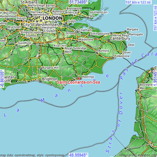
| Width | 6.17 km = 3.8 mi | 12.34 km = 7.7 mi | 197.4 km = 122.7 mi |
| Height | 6.17 km = 3.8 mi | 12.34 km = 7.7 mi | 197.4 km = 122.7 mi |
| ↑Max Latitude | 50.883383° | 50.9111° | 51.73495° |
| Latitude at center | 50.85565° | 50.85565° | 50.85565° |
| ↓Min Latitude | 50.8279° | 50.800134° | 49.95945° |
| ← Min Longitude | 0.501255° | 0.457309° | -0.86105° |
| Longitude center | 0.5452° | 0.5452° | 0.5452° |
| →Max Longitude | 0.589145° | 0.633091° | 1.95145° |
Nearby cities:
Cities around Saint Leonards-on-Sea sort by population:
• Hastings elevation 29 m
1.9 km,  91°
91°
• Bexhill-on-Sea 15 m
5.2 km,  263°
263°
• Battle 83 m
8.1 km,  328°
328°
• Pevensey 3 m
15 km,  254°
254°
• Pevensey Bay 3 m
14.6 km, 250°
• Robertsbridge 11 m
15.3 km,  340°
340°
• Northiam 48 m
15.9 km,  14°
14°
• Fairlight 64 m
8.2 km,  72°
72°
• Winchelsea Beach 2 m
14.1 km,  61°
61°
• Bodle Street 54 m
15.5 km,  294°
294°
• Ninfield 75 m
9.1 km, 292°
• Herstmonceux 50 m
16 km,  283°
283°
Multilingual:
 En español:
Saint Leonards-on-Sea elevación 50 m.
 En France:
Saint Leonards-on-Sea élévation 50 m.
 Auf Deutsch:
Saint Leonards-on-Sea höhe über dem Meeresspiegel ist 50 m.
 На русском:
Saint Leonards-on-Sea высота над уровнем моря 50 м
Sources and notes:
- [note 1] Map square and city borders are not equal. Map elevation data is calculated only from area inside that square.
- [src 1] Elevation data from geonames database provided with same terms of usage.
- [src 2] The elevation map of Saint Leonards-on-Sea is generated using elevation data from NASA's 3 arcsec (90m) resolution SRTM data.
- [src 3] Base (background) map © OpenStreetMap contributors tiles are generated by Geofabrik and OpenTopoMap.
Copyright & License:
This Saint Leonards-on-Sea Elevation Map is licensed under CC BY-SA. You may reuse any part from this page, if you give a proper credit by linking to this URL:
 More info on terms of use page.