Sandy elevation
Sandy (England, Central Bedfordshire), United Kingdom elevation is 30 meters and Sandy elevation in feet is 98 ft above sea level [src 1]. Sandy is a seat of a third-order administrative division (feature code) with elevation that is 42 meters (138 ft) smaller than average city elevation in United Kingdom.
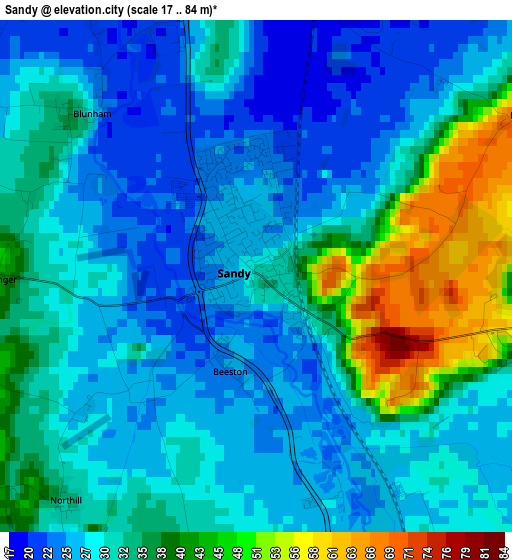
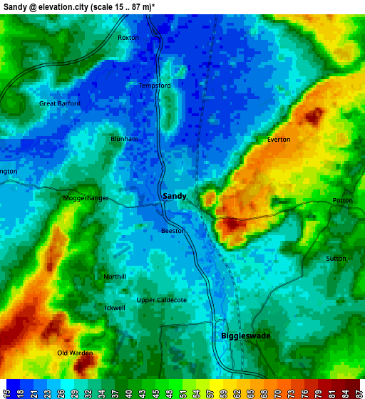
Below is the Elevation map of Sandy, which displays elevation range with different colors. Scale of the first map is from 17 to 84 m (56 to 276 ft) with average elevation of 32 meters (=105 ft) [note 1]
These maps also provides idea of topography and contour of this city, they are displayed at different zoom levels. More info about maps, scale and edge coordinates you can find below images.
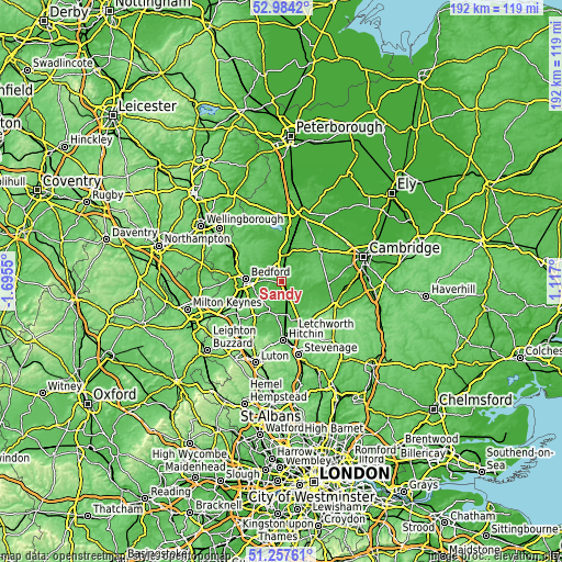
| \ | Map #1 | Map #2 | Topo.Map |
| Scale [m] | 17..84 m | 15..87 m | × |
| Scale [ft] | 56..276 ft | 49..285 ft | × |
| Average | 32 m = 105 ft | 36.5 m = 120 ft | × |
| Width | 6 km = 3.7 mi | 12 km = 7.5 mi | 192 km = 119.3 mi |
| Height | 6 km = 3.7 mi | 12 km = 7.5 mi | 192 km = 119.3 mi |
| ↑Max Latitude | 52.156239° | 52.183192° | 52.9842° |
| Latitude at center | 52.12927° | 52.12927° | 52.12927° |
| ↓Min Latitude | 52.102285° | 52.075283° | 51.25761° |
| ← Min Longitude | -0.333195° | -0.377141° | -1.6955° |
| Longitude center | -0.28925° | -0.28925° | -0.28925° |
| →Max Longitude | -0.245305° | -0.201359° | 1.117° |
Nearby cities:
Cities around Sandy sort by population:
• Biggleswade elevation 32 m
5 km,  160°
160°
• Potton 46 m
5 km,  90°
90°
• Gamlingay 55 m
7.2 km,  65°
65°
• Great Barford 25 m
5.4 km,  306°
306°
• Blunham 36 m
3 km, 311°
• Willington 27 m
5.7 km,  275°
275°
• Cople 28 m
6.9 km,  264°
264°
• Tempsford 22 m
4.6 km,  354°
354°
• Everton 67 m
3.5 km,  57°
57°
• Roxton 26 m
5.7 km,  341°
341°
• Southill 45 m
7.6 km,  197°
197°
• Sutton 40 m
5.5 km,  111°
111°
Multilingual:
 En español:
Sandy elevación 30 m.
 En France:
Sandy élévation 30 m.


Sources and notes:
- [note 1] Map square and city borders are not equal. Map elevation data is calculated only from area inside that square.
- [src 1] Elevation data from geonames database provided with same terms of usage.
- [src 2] The elevation map of Sandy is generated using elevation data from NASA's 3 arcsec (90m) resolution SRTM data.
- [src 3] Base (background) map © OpenStreetMap contributors tiles are generated by Geofabrik and OpenTopoMap.
Copyright & License:
This Sandy Elevation Map is licensed under CC BY-SA. You may reuse any part from this page, if you give a proper credit by linking to this URL:
 More info on terms of use page.