Skelton elevation
Skelton (England, Redcar and Cleveland), United Kingdom elevation is 102 meters and Skelton elevation in feet is 335 ft above sea level [src 1]. Skelton is a populated place (feature code) with elevation that is 30 meters (98 ft) bigger than average city elevation in United Kingdom.
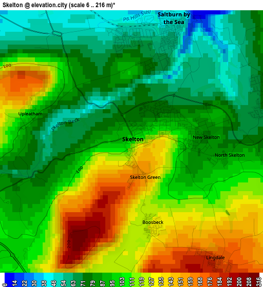
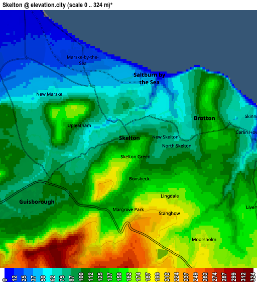
Below is the Elevation map of Skelton, which displays elevation range with different colors. Scale of the first map is from 6 to 216 m (20 to 709 ft) with average elevation of 99.7 meters (=327 ft) [note 1]
These maps also provides idea of topography and contour of this city, they are displayed at different zoom levels. More info about maps, scale and edge coordinates you can find below images.
| \ | Map #1 | Map #2 | Topo.Map |
| Scale [m] | 6..216 m | 0..324 m | × |
| Scale [ft] | 20..709 ft | 0..1063 ft | × |
| Average | 99.7 m = 327 ft | 115.2 m = 378 ft | × |
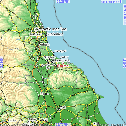
| Width | 5.67 km = 3.5 mi | 11.33 km = 7 mi | 181.3 km = 112.7 mi |
| Height | 5.67 km = 3.5 mi | 11.33 km = 7 mi | 181.3 km = 112.7 mi |
| ↑Max Latitude | 54.586093° | 54.611551° | 55.3679° |
| Latitude at center | 54.56062° | 54.56062° | 54.56062° |
| ↓Min Latitude | 54.535131° | 54.509626° | 53.73704° |
| ← Min Longitude | -1.032195° | -1.076141° | -2.3945° |
| Longitude center | -0.98825° | -0.98825° | -0.98825° |
| →Max Longitude | -0.944305° | -0.900359° | 0.418° |
Nearby cities:
Cities around Skelton sort by population:
• Redcar elevation 9 m
7.8 km,  323°
323°
• Guisborough 95 m
5.2 km,  236°
236°
• Marske-by-the-Sea 22 m
4 km,  329°
329°
• Saltburn-by-the-Sea 52 m
2.6 km,  21°
21°
• Brotton 102 m
3.2 km,  78°
78°
• Loftus 75 m
6.1 km,  95°
95°
• New Marske 59 m
4 km,  299°
299°
• Skinningrove 7 m
5.8 km, 80°
• Danby 128 m
11.6 km,  154°
154°
• Lingdale 175 m
3.2 km,  142°
142°
• Boosbeck 131 m
2 km,  167°
167°
• South Bank 22 m
10.4 km,  273°
273°
Multilingual:
 En español:
Skelton elevación 102 m.
 En France:
Skelton élévation 102 m.


Sources and notes:
- [note 1] Map square and city borders are not equal. Map elevation data is calculated only from area inside that square.
- [src 1] Elevation data from geonames database provided with same terms of usage.
- [src 2] The elevation map of Skelton is generated using elevation data from NASA's 3 arcsec (90m) resolution SRTM data.
- [src 3] Base (background) map © OpenStreetMap contributors tiles are generated by Geofabrik and OpenTopoMap.
Copyright & License:
This Skelton Elevation Map is licensed under CC BY-SA. You may reuse any part from this page, if you give a proper credit by linking to this URL:
 More info on terms of use page.