Snodland elevation
Snodland (England, Kent), United Kingdom elevation is 11 meters and Snodland elevation in feet is 36 ft above sea level [src 1]. Snodland is a populated place (feature code) with elevation that is 61 meters (200 ft) smaller than average city elevation in United Kingdom.
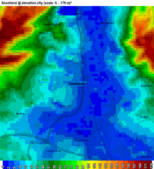
Below is the Elevation map of Snodland, which displays elevation range with different colors. Scale of the first map is from -5 to 178 m (-16 to 584 ft) with average elevation of 38.3 meters (=126 ft) [note 1]
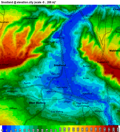
These maps also provides idea of topography and contour of this city, they are displayed at different zoom levels. More info about maps, scale and edge coordinates you can find below images.
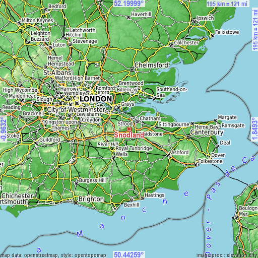
| \ | Map #1 | Map #2 | Topo.Map |
| Scale [m] | -5..178 m | -9..208 m | × |
| Scale [ft] | -16..584 ft | -30..682 ft | × |
| Average | 38.3 m = 126 ft | 68.2 m = 224 ft | × |
| Width | 6.11 km = 3.8 mi | 12.21 km = 7.6 mi | 195.4 km = 121.4 mi |
| Height | 6.11 km = 3.8 mi | 12.21 km = 7.6 mi | 195.4 km = 121.4 mi |
| ↑Max Latitude | 51.35716° | 51.384595° | 52.19999° |
| Latitude at center | 51.32971° | 51.32971° | 51.32971° |
| ↓Min Latitude | 51.302243° | 51.27476° | 50.44259° |
| ← Min Longitude | 0.399105° | 0.355159° | -0.9632° |
| Longitude center | 0.44305° | 0.44305° | 0.44305° |
| →Max Longitude | 0.486995° | 0.530941° | 1.8493° |
Nearby cities:
Cities around Snodland sort by population:
• Strood elevation 32 m
7.4 km,  18°
18°
• Rochester 8 m
7.8 km,  33°
33°
• Larkfield 14 m
3.2 km,  173°
173°
• Aylesford 5 m
3.8 km,  138°
138°
• Cuxton 6 m
5.1 km,  10°
10°
• Meopham 137 m
7.2 km,  306°
306°
• Culverstone Green 178 m
6.8 km,  280°
280°
• Kings Hill 89 m
6.8 km,  204°
204°
• West Malling 49 m
4.7 km,  209°
209°
• Halling 12 m
2.4 km,  3°
3°
• Wouldham 8 m
2.5 km, 25°
• Burham 49 m
2.5 km,  82°
82°
Multilingual:
 En español:
Snodland elevación 11 m.
 En France:
Snodland élévation 11 m.


Sources and notes:
- [note 1] Map square and city borders are not equal. Map elevation data is calculated only from area inside that square.
- [src 1] Elevation data from geonames database provided with same terms of usage.
- [src 2] The elevation map of Snodland is generated using elevation data from NASA's 3 arcsec (90m) resolution SRTM data.
- [src 3] Base (background) map © OpenStreetMap contributors tiles are generated by Geofabrik and OpenTopoMap.
Copyright & License:
This Snodland Elevation Map is licensed under CC BY-SA. You may reuse any part from this page, if you give a proper credit by linking to this URL:
 More info on terms of use page.