Staplehurst elevation
Staplehurst (England, Kent), United Kingdom elevation is 33 meters and Staplehurst elevation in feet is 108 ft above sea level [src 1]. Staplehurst is a populated place (feature code) with elevation that is 39 meters (128 ft) smaller than average city elevation in United Kingdom.
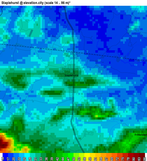
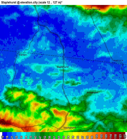
Below is the Elevation map of Staplehurst, which displays elevation range with different colors. Scale of the first map is from 14 to 86 m (46 to 282 ft) with average elevation of 26.2 meters (=86 ft) [note 1]
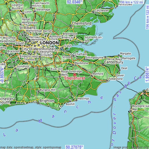
These maps also provides idea of topography and contour of this city, they are displayed at different zoom levels. More info about maps, scale and edge coordinates you can find below images.
| \ | Map #1 | Map #2 | Topo.Map |
| Scale [m] | 14..86 m | 12..127 m | × |
| Scale [ft] | 46..282 ft | 39..417 ft | × |
| Average | 26.2 m = 86 ft | 36.4 m = 119 ft | × |
| Width | 6.13 km = 3.8 mi | 12.26 km = 7.6 mi | 196.1 km = 121.9 mi |
| Height | 6.13 km = 3.8 mi | 12.26 km = 7.6 mi | 196.1 km = 121.9 mi |
| ↑Max Latitude | 51.188651° | 51.216186° | 52.0346° |
| Latitude at center | 51.1611° | 51.1611° | 51.1611° |
| ↓Min Latitude | 51.133532° | 51.105948° | 50.27075° |
| ← Min Longitude | 0.508545° | 0.464599° | -0.85376° |
| Longitude center | 0.55249° | 0.55249° | 0.55249° |
| →Max Longitude | 0.596435° | 0.640381° | 1.95874° |
Nearby cities:
Cities around Staplehurst sort by population:
• Maidstone elevation 9 m
12 km,  348°
348°
• Paddock Wood 16 m
12.1 km,  281°
281°
• Cranbrook 77 m
7.3 km,  189°
189°
• Headcorn 23 m
5.1 km,  79°
79°
• Marden 22 m
4.7 km,  288°
288°
• Horsmonden 61 m
9 km,  254°
254°
• Harrietsham 85 m
12.2 km,  42°
42°
• Yalding 12 m
11.1 km,  309°
309°
• Biddenden 47 m
7.9 km,  130°
130°
• Brenchley 96 m
10.8 km,  264°
264°
• Goudhurst 89 m
8.6 km,  231°
231°
• Sissinghurst 79 m
5.8 km,  174°
174°
Multilingual:
 En español:
Staplehurst elevación 33 m.
 En France:
Staplehurst élévation 33 m.
 Auf Deutsch:
Staplehurst höhe über dem Meeresspiegel ist 33 m.

Sources and notes:
- [note 1] Map square and city borders are not equal. Map elevation data is calculated only from area inside that square.
- [src 1] Elevation data from geonames database provided with same terms of usage.
- [src 2] The elevation map of Staplehurst is generated using elevation data from NASA's 3 arcsec (90m) resolution SRTM data.
- [src 3] Base (background) map © OpenStreetMap contributors tiles are generated by Geofabrik and OpenTopoMap.
Copyright & License:
This Staplehurst Elevation Map is licensed under CC BY-SA. You may reuse any part from this page, if you give a proper credit by linking to this URL:
 More info on terms of use page.