Swanage elevation
Swanage (England, Dorset), United Kingdom elevation is 4 meters and Swanage elevation in feet is 13 ft above sea level [src 1]. Swanage is a populated place (feature code) with elevation that is 68 meters (223 ft) smaller than average city elevation in United Kingdom.
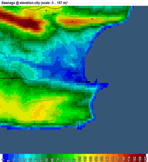
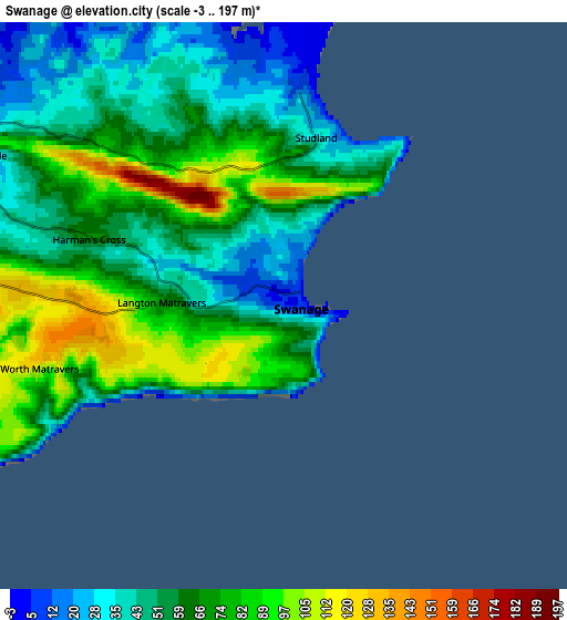
Below is the Elevation map of Swanage, which displays elevation range with different colors. Scale of the first map is from -3 to 197 m (-10 to 646 ft) with average elevation of 67.7 meters (=222 ft) [note 1]
These maps also provides idea of topography and contour of this city, they are displayed at different zoom levels. More info about maps, scale and edge coordinates you can find below images.
| \ | Map #1 | Map #2 | Topo.Map |
| Scale [m] | -3..197 m | -3..197 m | × |
| Scale [ft] | -10..646 ft | -10..646 ft | × |
| Average | 67.7 m = 222 ft | 61.7 m = 202 ft | × |
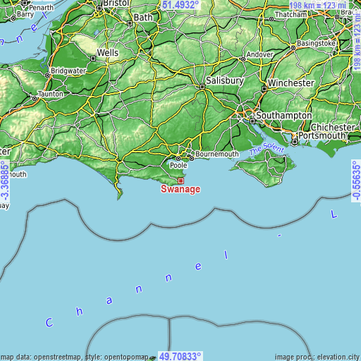
| Width | 6.2 km = 3.9 mi | 12.4 km = 7.7 mi | 198.5 km = 123.3 mi |
| Height | 6.2 km = 3.9 mi | 12.4 km = 7.7 mi | 198.4 km = 123.3 mi |
| ↑Max Latitude | 50.63711° | 50.664973° | 51.4932° |
| Latitude at center | 50.60923° | 50.60923° | 50.60923° |
| ↓Min Latitude | 50.581334° | 50.553421° | 49.70833° |
| ← Min Longitude | -2.006545° | -2.050491° | -3.36885° |
| Longitude center | -1.9626° | -1.9626° | -1.9626° |
| →Max Longitude | -1.918655° | -1.874709° | -0.55635° |
Nearby cities:
Cities around Swanage sort by population:
• Bournemouth elevation 19 m
13.7 km,  25°
25°
• Poole 6 m
11.8 km,  352°
352°
• Christchurch 4 m
19 km,  42°
42°
• Wimborne Minster 47 m
19.4 km,  355°
355°
• Canford Heath 13 m
15.8 km, 358°
• Broadstone 47 m
16.6 km, 352°
• Parkstone 60 m
13.5 km,  5°
5°
• Wareham 11 m
13.6 km,  309°
309°
• Lytchett Matravers 86 m
18.5 km,  333°
333°
• Wool 18 m
19.7 km,  293°
293°
• Bovington Camp 41 m
21.6 km,  297°
297°
• Corfe Castle 20 m
7.4 km, 296°
Multilingual:
 En español:
Swanage elevación 4 m.
 En France:
Swanage élévation 4 m.


Sources and notes:
- [note 1] Map square and city borders are not equal. Map elevation data is calculated only from area inside that square.
- [src 1] Elevation data from geonames database provided with same terms of usage.
- [src 2] The elevation map of Swanage is generated using elevation data from NASA's 3 arcsec (90m) resolution SRTM data.
- [src 3] Base (background) map © OpenStreetMap contributors tiles are generated by Geofabrik and OpenTopoMap.
Copyright & License:
This Swanage Elevation Map is licensed under CC BY-SA. You may reuse any part from this page, if you give a proper credit by linking to this URL:
 More info on terms of use page.