Tenby elevation
Tenby (Wales, Pembrokeshire), United Kingdom elevation is 27 meters and Tenby elevation in feet is 89 ft above sea level [src 1]. Tenby is a seat of a third-order administrative division (feature code) with elevation that is 45 meters (148 ft) smaller than average city elevation in United Kingdom.
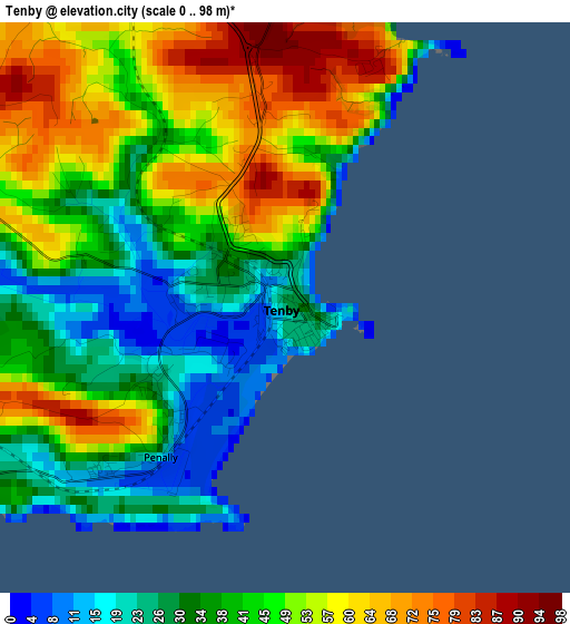
Below is the Elevation map of Tenby, which displays elevation range with different colors. Scale of the first map is from 0 to 98 m (0 to 322 ft) with average elevation of 43.8 meters (=144 ft) [note 1]
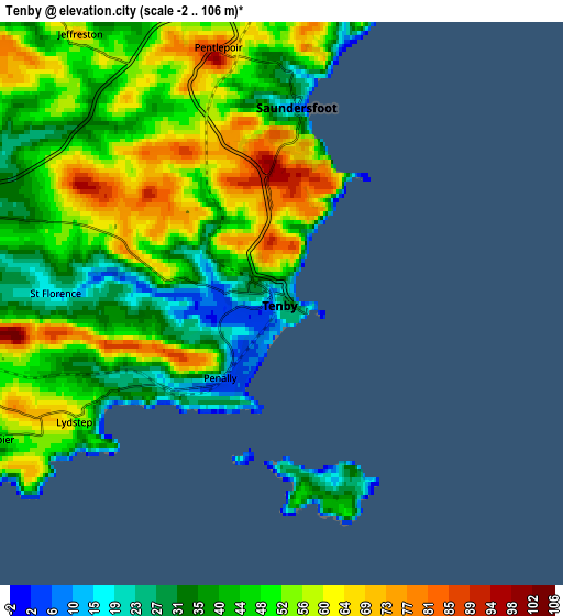
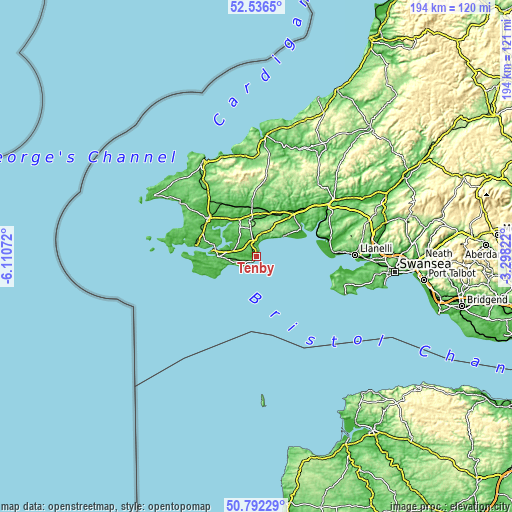
These maps also provides idea of topography and contour of this city, they are displayed at different zoom levels. More info about maps, scale and edge coordinates you can find below images.
| \ | Map #1 | Map #2 | Topo.Map |
| Scale [m] | 0..98 m | -2..106 m | × |
| Scale [ft] | 0..322 ft | -7..348 ft | × |
| Average | 43.8 m = 144 ft | 47.7 m = 156 ft | × |
| Width | 6.06 km = 3.8 mi | 12.12 km = 7.5 mi | 193.9 km = 120.5 mi |
| Height | 6.06 km = 3.8 mi | 12.12 km = 7.5 mi | 193.9 km = 120.5 mi |
| ↑Max Latitude | 51.700035° | 51.727263° | 52.5365° |
| Latitude at center | 51.67279° | 51.67279° | 51.67279° |
| ↓Min Latitude | 51.645529° | 51.618252° | 50.79229° |
| ← Min Longitude | -4.748415° | -4.792361° | -6.11072° |
| Longitude center | -4.70447° | -4.70447° | -4.70447° |
| →Max Longitude | -4.660525° | -4.616579° | -3.29822° |
Nearby cities:
Cities around Tenby sort by population:
• Pembroke Dock elevation 21 m
16.4 km,  277°
277°
• Pembroke 19 m
14.4 km,  270°
270°
• Saundersfoot 19 m
4.1 km,  2°
2°
• Narberth 82 m
14.2 km,  349°
349°
• Kilgetty 57 m
6.7 km, 350°
• Llangwm 27 m
16.7 km,  300°
300°
• Penally 42 m
2 km,  223°
223°
• Templeton 110 m
11.3 km, 348°
• Hundleton 68 m
16.9 km, 267°
• Burton 54 m
15.7 km,  287°
287°
• Jeffreyston 71 m
7.3 km,  323°
323°
• Manorbier 21 m
7.2 km,  245°
245°
Multilingual:
 En español:
Tenby elevación 27 m.
 En France:
Tenby élévation 27 m.


Sources and notes:
- [note 1] Map square and city borders are not equal. Map elevation data is calculated only from area inside that square.
- [src 1] Elevation data from geonames database provided with same terms of usage.
- [src 2] The elevation map of Tenby is generated using elevation data from NASA's 3 arcsec (90m) resolution SRTM data.
- [src 3] Base (background) map © OpenStreetMap contributors tiles are generated by Geofabrik and OpenTopoMap.
Copyright & License:
This Tenby Elevation Map is licensed under CC BY-SA. You may reuse any part from this page, if you give a proper credit by linking to this URL:
 More info on terms of use page.