Tingewick elevation
Tingewick (England, Buckinghamshire), United Kingdom elevation is 109 meters and Tingewick elevation in feet is 358 ft above sea level [src 1]. Tingewick is a populated place (feature code) with elevation that is 37 meters (121 ft) bigger than average city elevation in United Kingdom.
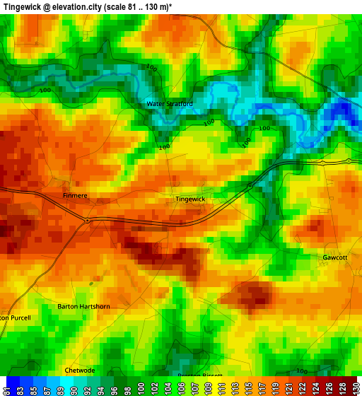
Below is the Elevation map of Tingewick, which displays elevation range with different colors. Scale of the first map is from 81 to 130 m (266 to 427 ft) with average elevation of 108.8 meters (=357 ft) [note 1]
These maps also provides idea of topography and contour of this city, they are displayed at different zoom levels. More info about maps, scale and edge coordinates you can find below images.
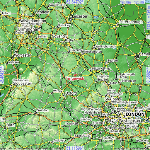
| \ | Map #1 | Topo.Map |
| Scale [m] | 81..130 m | × |
| Scale [ft] | 266..427 ft | × |
| Average | 108.8 m = 357 ft | × |
| Width | 6.02 km = 3.7 mi | 192.6 km = 119.7 mi |
| Height | 6.02 km = 3.7 mi | 192.6 km = 119.7 mi |
| ↑Max Latitude | 52.017363° | 52.84792° |
| Latitude at center | 51.99031° | 51.99031° |
| ↓Min Latitude | 51.963241° | 51.11596° |
| ← Min Longitude | -1.091985° | -2.45429° |
| Longitude center | -1.04804° | -1.04804° |
| →Max Longitude | -1.004095° | 0.35821° |
Nearby cities:
Cities around Tingewick sort by population:
• Bicester elevation 75 m
12.4 km,  215°
215°
• Brackley 145 m
8.5 km,  304°
304°
• Buckingham 89 m
4.3 km,  75°
75°
• Winslow 119 m
12.6 km,  114°
114°
• Deanshanger 73 m
12.9 km,  59°
59°
• Steeple Claydon 101 m
7.5 km,  143°
143°
• Silverstone 119 m
11.4 km,  7°
7°
• Ambrosden 68 m
14.2 km,  200°
200°
• Potterspury 91 m
14.6 km,  45°
45°
• Great Horwood 124 m
11.6 km,  99°
99°
• Stony Stratford 71 m
15.3 km, 61°
• Calverton 73 m
14.7 km,  67°
67°
Multilingual:
 En español:
Tingewick elevación 109 m.
 En France:
Tingewick élévation 109 m.
 Auf Deutsch:
Tingewick höhe über dem Meeresspiegel ist 109 m.

Sources and notes:
- [note 1] Map square and city borders are not equal. Map elevation data is calculated only from area inside that square.
- [src 1] Elevation data from geonames database provided with same terms of usage.
- [src 2] The elevation map of Tingewick is generated using elevation data from NASA's 3 arcsec (90m) resolution SRTM data.
- [src 3] Base (background) map © OpenStreetMap contributors tiles are generated by Geofabrik and OpenTopoMap.
Copyright & License:
This Tingewick Elevation Map is licensed under CC BY-SA. You may reuse any part from this page, if you give a proper credit by linking to this URL:
 More info on terms of use page.