Totnes elevation
Totnes (England, Devon), United Kingdom elevation is 6 meters and Totnes elevation in feet is 20 ft above sea level [src 1]. Totnes is a populated place (feature code) with elevation that is 66 meters (217 ft) smaller than average city elevation in United Kingdom.
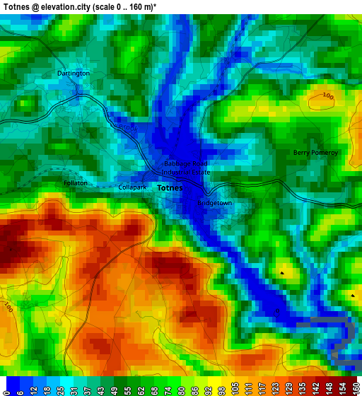
Below is the Elevation map of Totnes, which displays elevation range with different colors. Scale of the first map is from 0 to 160 m (0 to 525 ft) with average elevation of 64.1 meters (=210 ft) [note 1]
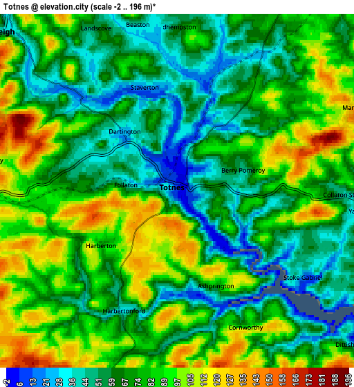
These maps also provides idea of topography and contour of this city, they are displayed at different zoom levels. More info about maps, scale and edge coordinates you can find below images.
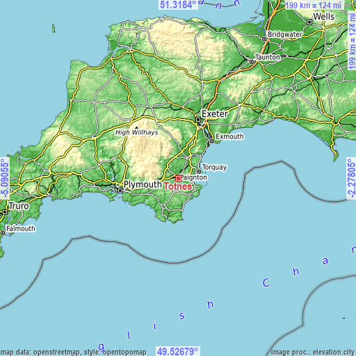
| \ | Map #1 | Map #2 | Topo.Map |
| Scale [m] | 0..160 m | -2..196 m | × |
| Scale [ft] | 0..525 ft | -7..643 ft | × |
| Average | 64.1 m = 210 ft | 74.8 m = 245 ft | × |
| Width | 6.23 km = 3.9 mi | 12.45 km = 7.7 mi | 199.2 km = 123.8 mi |
| Height | 6.23 km = 3.9 mi | 12.45 km = 7.7 mi | 199.2 km = 123.8 mi |
| ↑Max Latitude | 50.459055° | 50.487024° | 51.3184° |
| Latitude at center | 50.43107° | 50.43107° | 50.43107° |
| ↓Min Latitude | 50.403068° | 50.37505° | 49.52679° |
| ← Min Longitude | -3.728245° | -3.772191° | -5.09055° |
| Longitude center | -3.6843° | -3.6843° | -3.6843° |
| →Max Longitude | -3.640355° | -3.596409° | -2.27805° |
Nearby cities:
Cities around Totnes sort by population:
• Torquay elevation 8 m
11.8 km,  73°
73°
• Paignton 8 m
8.3 km,  86°
86°
• Cockington 48 m
9.7 km, 68°
• Dartmouth 6 m
11.5 km,  139°
139°
• Kingskerswell 34 m
10.5 km,  43°
43°
• Buckfastleigh 42 m
8.7 km,  309°
309°
• Ashburton 76 m
10.7 km,  331°
331°
• South Brent 124 m
10.6 km,  267°
267°
• Ipplepen 62 m
7.2 km,  26°
26°
• Marldon 149 m
6.7 km, 66°
• Abbotskerswell 34 m
9.9 km, 30°
• Stoke Gabriel 13 m
5.4 km,  124°
124°
Multilingual:
 En español:
Totnes elevación 6 m.
 En France:
Totnes élévation 6 m.


Sources and notes:
- [note 1] Map square and city borders are not equal. Map elevation data is calculated only from area inside that square.
- [src 1] Elevation data from geonames database provided with same terms of usage.
- [src 2] The elevation map of Totnes is generated using elevation data from NASA's 3 arcsec (90m) resolution SRTM data.
- [src 3] Base (background) map © OpenStreetMap contributors tiles are generated by Geofabrik and OpenTopoMap.
Copyright & License:
This Totnes Elevation Map is licensed under CC BY-SA. You may reuse any part from this page, if you give a proper credit by linking to this URL:
 More info on terms of use page.