Wadhurst elevation
Wadhurst (England, East Sussex), United Kingdom elevation is 152 meters and Wadhurst elevation in feet is 499 ft above sea level [src 1]. Wadhurst is a populated place (feature code) with elevation that is 80 meters (262 ft) bigger than average city elevation in United Kingdom.
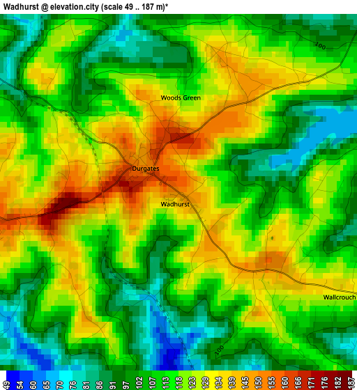
Below is the Elevation map of Wadhurst, which displays elevation range with different colors. Scale of the first map is from 49 to 187 m (161 to 614 ft) with average elevation of 114.8 meters (=377 ft) [note 1]
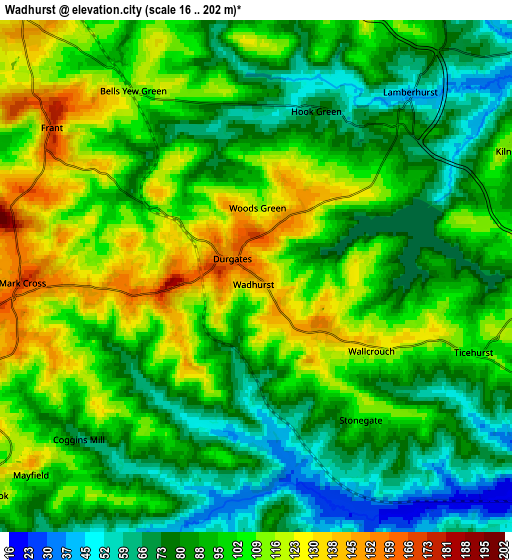
These maps also provides idea of topography and contour of this city, they are displayed at different zoom levels. More info about maps, scale and edge coordinates you can find below images.
| \ | Map #1 | Map #2 | Topo.Map |
| Scale [m] | 49..187 m | 16..202 m | × |
| Scale [ft] | 161..614 ft | 52..663 ft | × |
| Average | 114.8 m = 377 ft | 94.9 m = 311 ft | × |
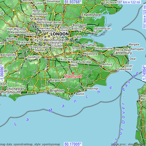
| Width | 6.14 km = 3.8 mi | 12.28 km = 7.6 mi | 196.5 km = 122.1 mi |
| Height | 6.14 km = 3.8 mi | 12.28 km = 7.6 mi | 196.5 km = 122.1 mi |
| ↑Max Latitude | 51.08991° | 51.117504° | 51.93768° |
| Latitude at center | 51.0623° | 51.0623° | 51.0623° |
| ↓Min Latitude | 51.034673° | 51.00703° | 50.17005° |
| ← Min Longitude | 0.295345° | 0.251399° | -1.06696° |
| Longitude center | 0.33929° | 0.33929° | 0.33929° |
| →Max Longitude | 0.383235° | 0.427181° | 1.74554° |
Nearby cities:
Cities around Wadhurst sort by population:
• Royal Tunbridge Wells elevation 118 m
9.5 km,  325°
325°
• Pembury 132 m
9.1 km,  352°
352°
• Rusthall 110 m
11.3 km,  317°
317°
• Hawkhurst 77 m
12.1 km,  97°
97°
• Town Row 129 m
7.6 km,  262°
262°
• Ticehurst 111 m
5.2 km,  109°
109°
• Horsmonden 61 m
10.6 km,  36°
36°
• Burwash 92 m
7.9 km,  156°
156°
• Brenchley 96 m
10.7 km,  22°
22°
• Lamberhurst 41 m
5.5 km, 39°
• Goudhurst 89 m
9.9 km,  55°
55°
• Flimwell 134 m
7.5 km, 96°
Multilingual:
 En español:
Wadhurst elevación 152 m.
 En France:
Wadhurst élévation 152 m.
 Auf Deutsch:
Wadhurst höhe über dem Meeresspiegel ist 152 m.

Sources and notes:
- [note 1] Map square and city borders are not equal. Map elevation data is calculated only from area inside that square.
- [src 1] Elevation data from geonames database provided with same terms of usage.
- [src 2] The elevation map of Wadhurst is generated using elevation data from NASA's 3 arcsec (90m) resolution SRTM data.
- [src 3] Base (background) map © OpenStreetMap contributors tiles are generated by Geofabrik and OpenTopoMap.
Copyright & License:
This Wadhurst Elevation Map is licensed under CC BY-SA. You may reuse any part from this page, if you give a proper credit by linking to this URL:
 More info on terms of use page.