West Clandon elevation
West Clandon (England, Surrey), United Kingdom elevation is 64 meters and West Clandon elevation in feet is 210 ft above sea level [src 1]. West Clandon is a populated place (feature code) with elevation that is 8 meters (26 ft) smaller than average city elevation in United Kingdom.
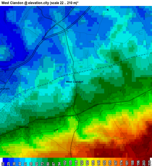
Below is the Elevation map of West Clandon, which displays elevation range with different colors. Scale of the first map is from 22 to 210 m (72 to 689 ft) with average elevation of 78.8 meters (=259 ft) [note 1]
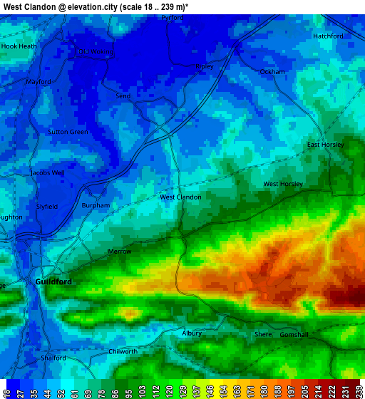
These maps also provides idea of topography and contour of this city, they are displayed at different zoom levels. More info about maps, scale and edge coordinates you can find below images.
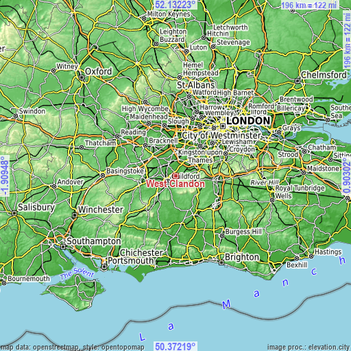
| \ | Map #1 | Map #2 | Topo.Map |
| Scale [m] | 22..210 m | 18..239 m | × |
| Scale [ft] | 72..689 ft | 59..784 ft | × |
| Average | 78.8 m = 259 ft | 72.9 m = 239 ft | × |
| Width | 6.12 km = 3.8 mi | 12.23 km = 7.6 mi | 195.7 km = 121.6 mi |
| Height | 6.12 km = 3.8 mi | 12.23 km = 7.6 mi | 195.7 km = 121.6 mi |
| ↑Max Latitude | 51.288122° | 51.315597° | 52.13223° |
| Latitude at center | 51.26063° | 51.26063° | 51.26063° |
| ↓Min Latitude | 51.233122° | 51.205597° | 50.37219° |
| ← Min Longitude | -0.547175° | -0.591121° | -1.90948° |
| Longitude center | -0.50323° | -0.50323° | -0.50323° |
| →Max Longitude | -0.459285° | -0.415339° | 0.90302° |
Nearby cities:
Cities around West Clandon sort by population:
• Woking elevation 39 m
7.6 km,  329°
329°
• Guildford 46 m
5.7 km,  240°
240°
• Great Bookham 68 m
9.2 km,  77°
77°
• Send 32 m
3.5 km, 332°
• East Horsley 72 m
5.2 km,  73°
73°
• West Byfleet 27 m
8.6 km,  358°
358°
• Bramley 46 m
8.3 km,  207°
207°
• Peaslake 130 m
8.6 km,  152°
152°
• Chilworth 50 m
5.3 km,  201°
201°
• Fairlands 39 m
8.2 km,  270°
270°
• Ripley 27 m
4.3 km,  10°
10°
• West Horsley 90 m
3.3 km,  90°
90°
Multilingual:
 En español:
West Clandon elevación 64 m.
 En France:
West Clandon élévation 64 m.
 Auf Deutsch:
West Clandon höhe über dem Meeresspiegel ist 64 m.

Sources and notes:
- [note 1] Map square and city borders are not equal. Map elevation data is calculated only from area inside that square.
- [src 1] Elevation data from geonames database provided with same terms of usage.
- [src 2] The elevation map of West Clandon is generated using elevation data from NASA's 3 arcsec (90m) resolution SRTM data.
- [src 3] Base (background) map © OpenStreetMap contributors tiles are generated by Geofabrik and OpenTopoMap.
Copyright & License:
This West Clandon Elevation Map is licensed under CC BY-SA. You may reuse any part from this page, if you give a proper credit by linking to this URL:
 More info on terms of use page.