Whalley elevation
Whalley (England, Lancashire), United Kingdom elevation is 51 meters and Whalley elevation in feet is 167 ft above sea level [src 1]. Whalley is a populated place (feature code) with elevation that is 21 meters (69 ft) smaller than average city elevation in United Kingdom.
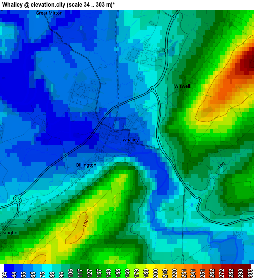
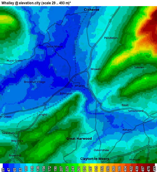
Below is the Elevation map of Whalley, which displays elevation range with different colors. Scale of the first map is from 34 to 303 m (112 to 994 ft) with average elevation of 99 meters (=325 ft) [note 1]
These maps also provides idea of topography and contour of this city, they are displayed at different zoom levels. More info about maps, scale and edge coordinates you can find below images.
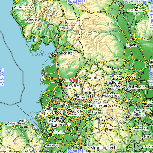
| \ | Map #1 | Map #2 | Topo.Map |
| Scale [m] | 34..303 m | 29..493 m | × |
| Scale [ft] | 112..994 ft | 95..1617 ft | × |
| Average | 99 m = 325 ft | 129.1 m = 424 ft | × |
| Width | 5.77 km = 3.6 mi | 11.54 km = 7.2 mi | 184.6 km = 114.7 mi |
| Height | 5.77 km = 3.6 mi | 11.54 km = 7.2 mi | 184.6 km = 114.7 mi |
| ↑Max Latitude | 53.848023° | 53.873939° | 54.64399° |
| Latitude at center | 53.82209° | 53.82209° | 53.82209° |
| ↓Min Latitude | 53.796141° | 53.770177° | 52.98374° |
| ← Min Longitude | -2.451065° | -2.495011° | -3.81337° |
| Longitude center | -2.40712° | -2.40712° | -2.40712° |
| →Max Longitude | -2.363175° | -2.319229° | -1.00087° |
Nearby cities:
Cities around Whalley sort by population:
• Accrington elevation 148 m
8.2 km,  157°
157°
• Clitheroe 76 m
5 km,  5°
5°
• Great Harwood 125 m
4.1 km,  181°
181°
• Padiham 88 m
6.4 km,  110°
110°
• Clayton le Moors 133 m
6.4 km,  165°
165°
• Rishton 137 m
6 km, 184°
• Church 130 m
7.9 km, 172°
• Langho 110 m
3.6 km,  232°
232°
• Hapton 137 m
7.3 km,  125°
125°
• Billington 62 m
1.3 km,  236°
236°
• Sabden 154 m
4.8 km,  74°
74°
• Waddington 82 m
7.5 km,  356°
356°
Multilingual:
 En español:
Whalley elevación 51 m.
 En France:
Whalley élévation 51 m.


Sources and notes:
- [note 1] Map square and city borders are not equal. Map elevation data is calculated only from area inside that square.
- [src 1] Elevation data from geonames database provided with same terms of usage.
- [src 2] The elevation map of Whalley is generated using elevation data from NASA's 3 arcsec (90m) resolution SRTM data.
- [src 3] Base (background) map © OpenStreetMap contributors tiles are generated by Geofabrik and OpenTopoMap.
Copyright & License:
This Whalley Elevation Map is licensed under CC BY-SA. You may reuse any part from this page, if you give a proper credit by linking to this URL:
 More info on terms of use page.