Agen elevation
Agen (Nouvelle-Aquitaine, Département du Lot-et-Garonne), France elevation is 47 meters and Agen elevation in feet is 154 ft above sea level [src 1]. Agen is a seat of a second-order administrative division (feature code) with elevation that is 127 meters (417 ft) smaller than average city elevation in France.
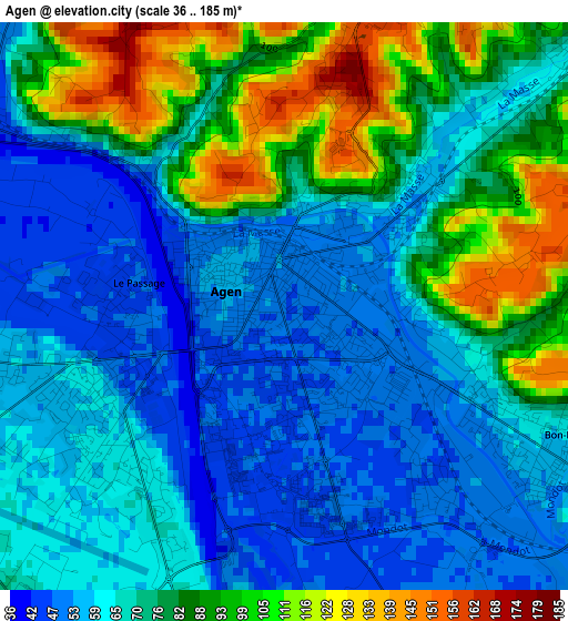
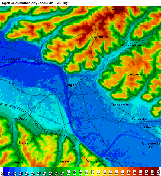
Below is the Elevation map of Agen, which displays elevation range with different colors. Scale of the first map is from 36 to 185 m (118 to 607 ft) with average elevation of 73.3 meters (=240 ft) [note 1]
These maps also provides idea of topography and contour of this city, they are displayed at different zoom levels. More info about maps, scale and edge coordinates you can find below images.
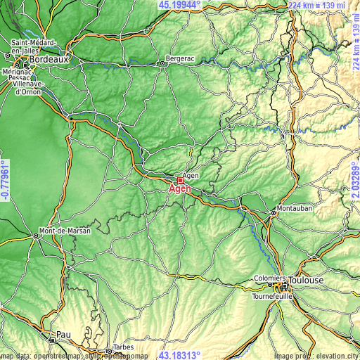
| \ | Map #1 | Map #2 | Topo.Map |
| Scale [m] | 36..185 m | 32..205 m | × |
| Scale [ft] | 118..607 ft | 105..673 ft | × |
| Average | 73.3 m = 240 ft | 90 m = 295 ft | × |
| Width | 7.01 km = 4.4 mi | 14.01 km = 8.7 mi | 224.2 km = 139.3 mi |
| Height | 7.01 km = 4.4 mi | 14.01 km = 8.7 mi | 224.2 km = 139.3 mi |
| ↑Max Latitude | 44.231406° | 44.262886° | 45.19944° |
| Latitude at center | 44.19991° | 44.19991° | 44.19991° |
| ↓Min Latitude | 44.168397° | 44.136866° | 43.18313° |
| ← Min Longitude | 0.582695° | 0.538749° | -0.77961° |
| Longitude center | 0.62664° | 0.62664° | 0.62664° |
| →Max Longitude | 0.670585° | 0.714531° | 2.03289° |
Nearby cities:
Cities around Agen sort by population:
• Le Passage elevation 47 m
1.9 km,  275°
275°
• Bon-Encontre 58 m
3.7 km,  116°
116°
• Foulayronnes 157 m
4.7 km,  18°
18°
• Boé 45 m
4.4 km,  177°
177°
• Pont-du-Casse 82 m
5.3 km,  52°
52°
• Layrac 68 m
7.8 km,  158°
158°
• Colayrac-Saint-Cirq 41 m
6.5 km,  291°
291°
• Castelculier 58 m
5.9 km, 118°
• Brax 53 m
6 km,  273°
273°
• Sainte-Colombe-en-Bruilhois 161 m
9.2 km,  254°
254°
• Estillac 159 m
6.9 km,  226°
226°
• Roquefort 72 m
5.9 km,  242°
242°
Multilingual:
 En español:
Agén elevación 47 m.
 En France:
Agen élévation 47 m.


Sources and notes:
- [note 1] Map square and city borders are not equal. Map elevation data is calculated only from area inside that square.
- [src 1] Elevation data from geonames database provided with same terms of usage.
- [src 2] The elevation map of Agen is generated using elevation data from NASA's 3 arcsec (90m) resolution SRTM data.
- [src 3] Base (background) map © OpenStreetMap contributors tiles are generated by Geofabrik and OpenTopoMap.
Copyright & License:
This Agen Elevation Map is licensed under CC BY-SA. You may reuse any part from this page, if you give a proper credit by linking to this URL:
 More info on terms of use page.